Results


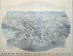
- 1891 Town of Waterloo Map

 The printed date in the right hand corner of the second version of the map is incorrect. The map can be dated to ca. 1891 based on other copies and the presence of St. Louis Roman Catholic Church on Allen St.
 The printed date in the right hand corner of the second version of the map is incorrect. The map can be dated to ca. 1891 based on other copies and …Waterloo Public Library
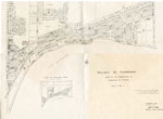
 - Village of Sundridge Map, Lots 21 - 25 Con. 10, Township of Strong
 Map of the village of Sundridge 1957. It includes all the main streets and secondary streets of Sundridge. The map shows the deed numbers of all the properties in the village.
  Map of the village of Sundridge 1957. It includes all the main streets and secondary streets of Sundridge. The map shows the deed numbers of all the properties in the …Sundridge - Strong Union PL
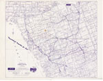
 - The District of Parry Sound Map, "Vacationland Properties for Sale"
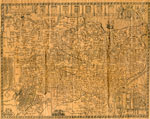
 Map of the district of Parry Sound by A. H. McKee Land & Resort Sales Co. The map was created to show vacation property in the area for sale. The ink on the map is purple.
  Map of the district of Parry Sound by A. H. McKee Land & Resort Sales Co. The map was created to show vacation property in the area for sale. The …Sundridge - Strong Union PL
 - Newspaper Clipping of a Map of Many Townships in the Sundridge Area
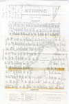
 There's a small rip on the right side of the clipping.
  There's a small rip on the right side of the clipping.Sundridge - Strong Union PL
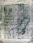
 - Map of Strong Township, Machar


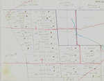
 Photocopy of an early concession map for Strong Township. The township is divided into 14 x 30 plots. Lake Bernard is still Stony Lake at this time. Pool Lake and Lake Wallace are also shown. The main road Distress Road is in the middle of the map. The townships on …

 Photocopy of an early concession map for Strong Township. The township is divided into 14 x 30 plots. Lake Bernard is still Stony Lake at this time. Pool Lake and …Sundridge - Strong Union PL
 - Hand Drawn Map of Sundridge, circa 1880 - 1890, with Typed Legend
 The maps were on two pieces of 8.5" x 11" paper which were stitched together with Photoshop Elements
  The maps were on two pieces of 8.5" x 11" paper which were stitched together with Photoshop ElementsSundridge - Strong Union PL
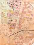
 - Fire Insurance Map 1920 - 1929
 1920 map updated in 1929. Queen Street later became Regina Street. Weaver Street was a small lane approximately where Willis Way is today. On the east side of King Street and south it continued as Weaver and later became Herbert Street. Park Avenue later became Alexandra Avenue. Morley Street no …
  1920 map updated in 1929. Queen Street later became Regina Street. Weaver Street was a small lane approximately where Willis Way is today. On the east side of King Street …Waterloo Public Library
 - The Village of Sundridge, Kent, England

 A replica map of Sundridge, Kent England in 1640. The map is accompanied by a two page history of Sundridge, Kent, England. The history goes into the origins of the British Sundridge, what the area is like today, the history of the church in the area, and the impact of …
 A replica map of Sundridge, Kent England in 1640. The map is accompanied by a two page history of Sundridge, Kent, England. The history goes into the origins of the …Sundridge - Strong Union PL
 - Map of Strong Township, 1942

 A map of Strong Township, produced in 1942. It shows the division of property in Strong Township and names of the land owners. Lake Bernard is near the center of the township. There is a legend at the bottom of the map. Machar Township borders on the north, Chapman on …
 A map of Strong Township, produced in 1942. It shows the division of property in Strong Township and names of the land owners. Lake Bernard is near the center of …Sundridge - Strong Union PL
 - Map of Kitchener, Waterloo, Bridgeport and Centreville, 1956
 Folded inside a booklet.
  Folded inside a booklet.Waterloo Public Library
 - Waterloo Township map with names of early property owners
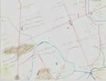
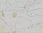
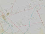
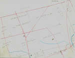
 These maps are hand drawn by Ellis Little and outline over 90000 acres of land granted (Block 2, Waterloo Township) to the Six Nations Indians by the British Crown in 1784 and sold in 1798 to Richard Beasley, James Wilson and John Baptist Rousseaux who looked to resell the land …
  These maps are hand drawn by Ellis Little and outline over 90000 acres of land granted (Block 2, Waterloo Township) to the Six Nations Indians by the British Crown in …Waterloo Public Library
 - Map of Block Number 2, German Company Tract, Waterloo Township, Ontario, 1805
 Block 2 became the basis of Waterloo Township, and it was here that the German Company Tract was located. For a clearer version of the map, please see Waterloo Historical Society Volume 22, 1934. See link in the sidebar.
  Block 2 became the basis of Waterloo Township, and it was here that the German Company Tract was located. For a clearer version of the map, please see Waterloo Historical …Waterloo Public Library
 - Waterloo Township map with names of early property owners
 These maps are hand drawn by Ellis Little and outline over 90000 acres of land granted (Block 2, Waterloo Township) to the Six Nations Indians by the British Crown in 1784 and sold in 1798 to Richard Beasley, James Wilson and John Baptist Rousseaux who looked to resell the land …
  These maps are hand drawn by Ellis Little and outline over 90000 acres of land granted (Block 2, Waterloo Township) to the Six Nations Indians by the British Crown in …Waterloo Public Library
 - Waterloo Township map with names of early property owners
 These maps are hand drawn by Ellis Little and outline over 90000 acres of land granted (Block 2, Waterloo Township) to the Six Nations Indians by the British Crown in 1784 and sold in 1798 to Richard Beasley, James Wilson and John Baptist Rousseaux who looked to resell the land …
  These maps are hand drawn by Ellis Little and outline over 90000 acres of land granted (Block 2, Waterloo Township) to the Six Nations Indians by the British Crown in …Waterloo Public Library
 - Waterloo Township map with names of early property owners
 These maps are hand drawn by Ellis Little and outline over 90000 acres of land granted (Block 2, Waterloo Township) to the Six Nations Indians by the British Crown in 1784 and sold in 1798 to Richard Beasley, James Wilson and John Baptist Rousseaux who looked to resell the land …
  These maps are hand drawn by Ellis Little and outline over 90000 acres of land granted (Block 2, Waterloo Township) to the Six Nations Indians by the British Crown in …Waterloo Public Library
 - Waterloo Township map with names of early property owners
 These maps are hand drawn by Ellis Little and outline over 90000 acres of land granted (Block 2, Waterloo Township) to the Six Nations Indians by the British Crown in 1784 and sold in 1798 to Richard Beasley, James Wilson and John Baptist Rousseaux who looked to resell the land …
  These maps are hand drawn by Ellis Little and outline over 90000 acres of land granted (Block 2, Waterloo Township) to the Six Nations Indians by the British Crown in …Waterloo Public Library
 - Waterloo Township map with names of early property owners
 These maps are hand drawn by Ellis Little and outline over 90000 acres of land granted (Block 2, Waterloo Township) to the Six Nations Indians by the British Crown in 1784 and sold in 1798 to Richard Beasley, James Wilson and John Baptist Rousseaux who looked to resell the land …
  These maps are hand drawn by Ellis Little and outline over 90000 acres of land granted (Block 2, Waterloo Township) to the Six Nations Indians by the British Crown in …Waterloo Public Library
 - Waterloo Township map with names of early property owners
 These maps are hand drawn by Ellis Little and outline over 90000 acres of land granted (Block 2, Waterloo Township) to the Six Nations Indians by the British Crown in 1784 and sold in 1798 to Richard Beasley, James Wilson and John Baptist Rousseaux who looked to resell the land …
  These maps are hand drawn by Ellis Little and outline over 90000 acres of land granted (Block 2, Waterloo Township) to the Six Nations Indians by the British Crown in …Waterloo Public Library
 - Waterloo Township map with names of early property owners
 These maps are hand drawn by Ellis Little and outline over 90000 acres of land granted (Block 2, Waterloo Township) to the Six Nations Indians by the British Crown in 1784 and sold in 1798 to Richard Beasley, James Wilson and John Baptist Rousseaux who looked to resell the land …
  These maps are hand drawn by Ellis Little and outline over 90000 acres of land granted (Block 2, Waterloo Township) to the Six Nations Indians by the British Crown in …Waterloo Public Library
 - Waterloo Township map with names of early property owners
 These maps are hand drawn by Ellis Little and outline over 90000 acres of land granted (Block 2, Waterloo Township) to the Six Nations Indians by the British Crown in 1784 and sold in 1798 to Richard Beasley, James Wilson and John Baptist Rousseaux who looked to resell the land …
  These maps are hand drawn by Ellis Little and outline over 90000 acres of land granted (Block 2, Waterloo Township) to the Six Nations Indians by the British Crown in …Waterloo Public Library

