Results
We found 19 matching items.


Page 1 of 1
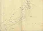
- Second Welland Canal - Book 1, Survey Map 10 - St. Catharines


 Survey map of the Second Welland Canal created by the Welland Canal Company along the western edge of the Town of St. Catharines. Although not labelled, the Second Welland Canal can be seen running through the map along with its tow path, which is located on the southwestern edge of …

 Survey map of the Second Welland Canal created by the Welland Canal Company along the western edge of the Town of St. Catharines. Although not labelled, the Second Welland Canal …Brock University Archives
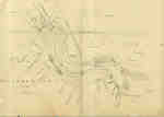
 - Second Welland Canal - Book 1, Survey Map 11 - St. Catharines and Locks 3 and 4


 Survey map of the Second Welland Canal created by the Welland Canal Company showing the Town of St. Catharines. Identified structures associated with the Canal include Lock 3 and its Lock House, Lock 4 and its Lock House, Hydraulic Race, and a floating tow path. The surveyors' measurements and notes …

 Survey map of the Second Welland Canal created by the Welland Canal Company showing the Town of St. Catharines. Identified structures associated with the Canal include Lock 3 and its …Brock University Archives
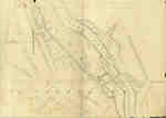
 - Second Welland Canal - Book 1, Survey Map 12 - St. Catharines and Lock 4


 Survey map of the Second Welland Canal created by the Welland Canal Company showing the Town of St. Catharines. Identified structures associated with the Canal include Lock 4, Hydraulic Race, floating tow path, and the Canal waterway itself. The surveyors' measurements and notes can be seen in red and black …

 Survey map of the Second Welland Canal created by the Welland Canal Company showing the Town of St. Catharines. Identified structures associated with the Canal include Lock 4, Hydraulic Race, …Brock University Archives
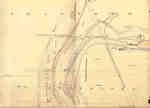
 - Second Welland Canal - Book 1, Survey Map 13 - St. Catharines and Locks 4 and 5

 Survey map of the Second Welland Canal created by the Welland Canal Company showing the Town of St. Catharines. Identified structures associated with the Canal include Lock 4, Lock House, Lock 5, Small Lock House, the towing path, and Gasometer for Canal. The surveyors' measurements and notes can be seen …
 Survey map of the Second Welland Canal created by the Welland Canal Company showing the Town of St. Catharines. Identified structures associated with the Canal include Lock 4, Lock House, …Brock University Archives
 - Second Welland Canal - Book 1, Survey Map 14 - St. Catharines and Lock 5

 Survey map of the Second Welland Canal created by the Welland Canal Company showing the Canal along the eastern edge of the Town of St. Catharines. Identified structures associated with the Canal include Lock 5 and the towing path. The surveyors' measurements and notes can be seen in red and …
 Survey map of the Second Welland Canal created by the Welland Canal Company showing the Canal along the eastern edge of the Town of St. Catharines. Identified structures associated with …Brock University Archives
 - Second Welland Canal - Book 1, Survey Map 15 - Hydraulic Race and Aqueduct in Grantham

 Survey map of the Second Welland Canal created by the Welland Canal Company showing the Canal along the eastern edge of the Town of St. Catharines. Identified structures associated with the Canal include Lock 7, Lock House Lot, and the towing path. The surveyors' measurements and notes can be seen …
 Survey map of the Second Welland Canal created by the Welland Canal Company showing the Canal along the eastern edge of the Town of St. Catharines. Identified structures associated with …Brock University Archives
 - Roman Catholic Mission, Fort William
 A drawing attributed to William Armstrong, 1873, of the Roman Catholic Mission on the Kaministiquia River, Mission Island, Fort William, Ontario.
  A drawing attributed to William Armstrong, 1873, of the Roman Catholic Mission on the Kaministiquia River, Mission Island, Fort William, Ontario.Thunder Bay Public Library
 - Mary J. L. Black Library

 An architectural drawing of the enlarged facilities of the Mary J. L. Black Library (one of the four branches of Thunder Bay Public Library), done by Ranta and Tett.
 An architectural drawing of the enlarged facilities of the Mary J. L. Black Library (one of the four branches of Thunder Bay Public Library), done by Ranta and Tett.Thunder Bay Public Library
 - Drawing of Old Fort William
 Photograph (taken by H. Lockwood) of a Bruce McNally drawing depicting life in the days of the Northwest Company at Fort William.
  Photograph (taken by H. Lockwood) of a Bruce McNally drawing depicting life in the days of the Northwest Company at Fort William.Thunder Bay Public Library
 - Drawing of Fort William
 Photograph (taken by H. Lockwood) of a Bruce McNally drawing depicting life in the fur trading days of the Northwest Company at Fort William.
  Photograph (taken by H. Lockwood) of a Bruce McNally drawing depicting life in the fur trading days of the Northwest Company at Fort William.Thunder Bay Public Library
 - Drawing of Fort William
 Photograph (taken by H. Lockwood) of a Bruce McNally drawing depicting life in the fur trading days of the Northwest Company at Fort William.
  Photograph (taken by H. Lockwood) of a Bruce McNally drawing depicting life in the fur trading days of the Northwest Company at Fort William.Thunder Bay Public Library
 - Drawing of Fort William
 Photograph (taken by H. Lockwood) of a Bruce McNally drawing depicting life in the fur trading days of the Northwest Company at Fort William.
  Photograph (taken by H. Lockwood) of a Bruce McNally drawing depicting life in the fur trading days of the Northwest Company at Fort William.Thunder Bay Public Library
 - Drawing of Fort William
 Photograph (taken by H. Lockwood) of a Bruce McNally drawing depicting life in the fur trading days of the Northwest Company at Fort William.
  Photograph (taken by H. Lockwood) of a Bruce McNally drawing depicting life in the fur trading days of the Northwest Company at Fort William.Thunder Bay Public Library
 - Drawing of Fort William
 Photograph (taken by H. Lockwood) of a Bruce McNally drawing depicting life in the fur trading days of the Northwest Company at Fort William.
  Photograph (taken by H. Lockwood) of a Bruce McNally drawing depicting life in the fur trading days of the Northwest Company at Fort William.Thunder Bay Public Library
 - Historic Port Arthur

 Black and white photograph of a drawing of Port Arthur in its early days (circa 1665).
 Black and white photograph of a drawing of Port Arthur in its early days (circa 1665).Thunder Bay Public Library
 - Portrait of Fort William

 Black and white photograph taken of a portrait concerning Fort William. This piece depicts a small tugboat pulling a group of manned canoes along the Kaministiquia River.
 Black and white photograph taken of a portrait concerning Fort William. This piece depicts a small tugboat pulling a group of manned canoes along the Kaministiquia River.Thunder Bay Public Library
 - Drawing of Fort William
 Photograph (taken by H. Lockwood) of a Bruce McNally drawing depicting life in the fur trading days of the Northwest Company at Fort William.
  Photograph (taken by H. Lockwood) of a Bruce McNally drawing depicting life in the fur trading days of the Northwest Company at Fort William.Thunder Bay Public Library
 - Prince Arthur's Landing

 A sketch of Prince Arthur's Landing at the time of the Red River Expedition. Further information found in Thunder Bay: A History - The Golden Gateway of the Great Northwest by Joseph M. Mauro.
 A sketch of Prince Arthur's Landing at the time of the Red River Expedition. Further information found in Thunder Bay: A History - The Golden Gateway of the Great Northwest …Thunder Bay Public Library
 - Prince Arthur Hotel

 Colour postcard of a painting of the Prince Arthur Hotel, located in Port Arthur. The postcard was produced by the Photogelatine Engraving Co. Ltd.
 Colour postcard of a painting of the Prince Arthur Hotel, located in Port Arthur. The postcard was produced by the Photogelatine Engraving Co. Ltd.Thunder Bay Public Library
Page 1 of 1

