Results


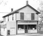
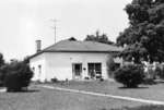
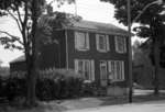
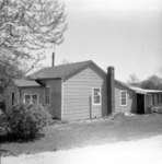
- Goldring Store, 1967

 The Goldring Store was located at 1506 Brock Street South. From the 1890s until 1911, the store was operated by the Jackson family. The Goldring family operated the store from 1911 to 1967 when the building was demolished.
 The Goldring Store was located at 1506 Brock Street South. From the 1890s until 1911, the store was operated by the Jackson family. The Goldring family operated the store from …Whitby Public Library
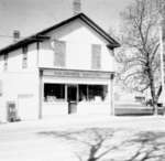
 - Goldring Store, c.1960
 The Goldring Store was located at 1506 Brock Street South. From the 1890s until 1911, the store was operated by the Jackson family. The Goldring family operated the store from 1911 to 1967 when the building was demolished.
  The Goldring Store was located at 1506 Brock Street South. From the 1890s until 1911, the store was operated by the Jackson family. The Goldring family operated the store from …Whitby Public Library
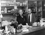
 - Goldring Store, 1967
 The Goldring Store was located at 1506 Brock Street South. The Goldring family operated the store from 1911 to 1967 when the building was demolished.
  The Goldring Store was located at 1506 Brock Street South. The Goldring family operated the store from 1911 to 1967 when the building was demolished.Whitby Public Library
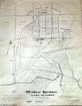
 - Town Plot of Windsor, 1979
 Photographic image of the Town Plot of Windsor site plan. The plan was created to improve the design of Whitby Harbour. This plan is a 1979 copy of the 1838 original by F.P. Rubige. The 1838 version is based on a 1837 survey by J.J. Dennehy. Plan shows early settlements …
  Photographic image of the Town Plot of Windsor site plan. The plan was created to improve the design of Whitby Harbour. This plan is a 1979 copy of the 1838 …Whitby Public Library
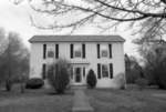
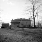
 - Dufferin Street School, 1975
 Dufferin Street School was built in 1851 on the west side of Dufferin Street south of Victoria Street. It served as the school for Port Whitby from 1852-1915 when it was replaced by Brock Street School. Dufferin Street School has been a private residence since 1916.
  Dufferin Street School was built in 1851 on the west side of Dufferin Street south of Victoria Street. It served as the school for Port Whitby from 1852-1915 when it …Whitby Public Library
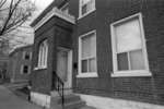
 - John Allingham Watson House, 1621 Brock Street South, c.2006
 Located at 1621 Brock Street South, this house was built in 1858 as a hotel by Thomas Bredin. From 1874 to 1973 it was owned by John Allingham Watson and his descendants. The basement is made of Kingston limestone, brought to Whitby in sailing vessels. The house was demolished in …
  Located at 1621 Brock Street South, this house was built in 1858 as a hotel by Thomas Bredin. From 1874 to 1973 it was owned by John Allingham Watson and …Whitby Public Library
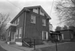
 - 1600 Brock Street South, c.2006
 This house was built circa 1854 for James Cameron a retired farmer who settled on the site of the Ontario Hospital lands in 1831. His son, Donald Grant Cameron then owned the house, and in turn, Donald Cameron's daughter Clara (Mrs. Charles Bottomley) owned the home. Legend states that the …
  This house was built circa 1854 for James Cameron a retired farmer who settled on the site of the Ontario Hospital lands in 1831. His son, Donald Grant Cameron then …Whitby Public Library
 - 1600 Brock Street South, c.2006
 This house was built circa 1854 for James Cameron a retired farmer who settled on the site of the Ontario Hospital lands in 1831. His son, Donald Grant Cameron then owned the house, and in turn, Donald Cameron's daughter Clara (Mrs. Charles Bottomley) owned the home. Legend states that the …
  This house was built circa 1854 for James Cameron a retired farmer who settled on the site of the Ontario Hospital lands in 1831. His son, Donald Grant Cameron then …Whitby Public Library
 - John Allingham Watson House, 1621 Brock Street South, c.2006
 Located at 1621 Brock Street South, this house was built in 1858 as a hotel by Thomas Bredin. From 1874 to 1973 it was owned by John Allingham Watson and his descendants. The basement is made of Kingston limestone, brought to Whitby in sailing vessels. This house was demolished in …
  Located at 1621 Brock Street South, this house was built in 1858 as a hotel by Thomas Bredin. From 1874 to 1973 it was owned by John Allingham Watson and …Whitby Public Library
 - John Allingham Watson House, 1621 Brock Street South, c.2006
 Located at 1621 Brock Street South, this house was built in 1858 as a hotel by Thomas Bredin. From 1874 to 1973 it was owned by John Allingham Watson and his descendants. The basement is made of Kingston limestone, brought to Whitby in sailing vessels. The house was demolished in …
  Located at 1621 Brock Street South, this house was built in 1858 as a hotel by Thomas Bredin. From 1874 to 1973 it was owned by John Allingham Watson and …Whitby Public Library
 - Station Gallery, April 1976
 The Whitby Junction Station was built at the foot of Byron Street on the Grand Trunk Railway in 1903 near the current GO Transit platform. The station closed in 1969 and in 1970 it was moved to the north-east corner of Victoria and Henry Streets for use as an art …
  The Whitby Junction Station was built at the foot of Byron Street on the Grand Trunk Railway in 1903 near the current GO Transit platform. The station closed in 1969 …Whitby Public Library
 - Dayton Tire, April 1976
 The Dayton Tire factory was built in 1954-55 for the Dunlop Tire and Rubber Company. In 1974 it was sold to Firestone Tire and the name changed to Dayton Tire and later Whitby Tire. The company closed in 1980 and was divided into small industrial units. This building is located …
  The Dayton Tire factory was built in 1954-55 for the Dunlop Tire and Rubber Company. In 1974 it was sold to Firestone Tire and the name changed to Dayton Tire …Whitby Public Library
 - Station Gallery, July 1975
 The Whitby Junction Station was built at the foot of Byron Street on the Grand Trunk Railway in 1903 near the current GO Transit platform. The station closed in 1969 and in 1970 it was moved to the north-east corner of Victoria and Henry Streets for use as an art …
  The Whitby Junction Station was built at the foot of Byron Street on the Grand Trunk Railway in 1903 near the current GO Transit platform. The station closed in 1969 …Whitby Public Library
 - 1615 Brock Street South, Castle Fox House (former Port Whitby Post Office), July 1975
 This brick house was built circa 1841 for Abner Nash (1785-1851) who owned a Brewery on Pringle Creek at Watson Street. The mill stones at the Port Whitby Fire Hall are from Nash's Brewery. The house was later owned by Castle Fox (1825-1909), a shoemaker. From 1894 to 1913 it …
  This brick house was built circa 1841 for Abner Nash (1785-1851) who owned a Brewery on Pringle Creek at Watson Street. The mill stones at the Port Whitby Fire Hall …Whitby Public Library
 - John Allingham Watson House, 1621 Brock Street South, July 1975
 Located at 1621 Brock Street South, this house was built in 1858 as a hotel by Thomas Bredin. From 1874 to 1973 it was owned by John Allingham Watson and his descendants. The basement is made of Kingston limestone, brought to Whitby in sailing vessels. This house was demolished in …
  Located at 1621 Brock Street South, this house was built in 1858 as a hotel by Thomas Bredin. From 1874 to 1973 it was owned by John Allingham Watson and …Whitby Public Library
 - Whitby Mental Health Centre, April 2006
 The centre is now called Ontario Shores Centre for Mental Health Sciences.
  The centre is now called Ontario Shores Centre for Mental Health Sciences.Whitby Public Library
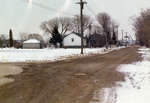
 - Charles Street Looking South, 1977
 This view was taken from the corner of Watson Street and Charles Street looking south on Charles Street.
  This view was taken from the corner of Watson Street and Charles Street looking south on Charles Street.Whitby Public Library
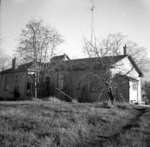
 - Dufferin Street School, February 1963
 Dufferin Street School was built in 1851 on the west side of Dufferin Street south of Victoria Street. It served as the school for Port Whitby from 1852-1915 when it was replaced by Brock Street School. Dufferin Street School has been a private residence since 1916.
  Dufferin Street School was built in 1851 on the west side of Dufferin Street south of Victoria Street. It served as the school for Port Whitby from 1852-1915 when it …Whitby Public Library
 - Dufferin Street School, February 1963
 Dufferin Street School was built in 1851 on the west side of Dufferin Street south of Victoria Street. It served as the school for Port Whitby from 1852-1915 when it was replaced by Brock Street School. Dufferin Street School has been a private residence since 1916.
  Dufferin Street School was built in 1851 on the west side of Dufferin Street south of Victoria Street. It served as the school for Port Whitby from 1852-1915 when it …Whitby Public Library
 - Old Customs House, c. 1969
 The Old Customs House was located in Port Whitby on the south side of Victoria Street at the railway tracks.
  The Old Customs House was located in Port Whitby on the south side of Victoria Street at the railway tracks.Whitby Public Library

