Results


- Tremaine's Map of the County of Halton 1858 – Township of Esquesing
 This map lays out the land division and ownership of the Esquesing region as of 1858. It is one of eight maps of the Halton townships. It also includes depictions of important local buildings including the Credit Paper Mills, Gage Hacaman & Company, and the Residence of William Pickard Esq. …
  This map lays out the land division and ownership of the Esquesing region as of 1858. It is one of eight maps of the Halton townships. It also includes depictions …Oakville Public Library
 - Tremaine's Map of the County of Halton 1858 – Township of Nassagaweya

 This map lays out the land division and ownership of the Nassagaweya region as of 1858. It is one of four maps of the Halton townships. It also includes depictions of important local buildings including the Halton County Courthouse, Nassagaweya Mills, the residence of P.W. Dayfoot Esq., and Pine and …
 This map lays out the land division and ownership of the Nassagaweya region as of 1858. It is one of four maps of the Halton townships. It also includes depictions …Oakville Public Library
 - Tremaine's Map of the County of Halton 1858 – Township of Esquesing II


 This map lays out the land division and ownership of the northern Esquesing region as of 1858. It is one of eight maps of the Halton townships. It also includes depictions of important local buildings including the Canadian Collegiate Institute, the residence of James Barber Esquire, and Credit Paper Mills. …

 This map lays out the land division and ownership of the northern Esquesing region as of 1858. It is one of eight maps of the Halton townships. It also includes …Oakville Public Library
 - Tremaine's Map of the County of Halton - Township of Nelson II


 This map lays out the land division and ownership of the Nelson township region as of 1858. It is one of eight maps of the Halton townships. It also includes depictions of important local buildings including H.P. Zimmerman’s Crist & Flouring Mills, the residence of K.H. Munn Esquire, and Bronte …

 This map lays out the land division and ownership of the Nelson township region as of 1858. It is one of eight maps of the Halton townships. It also includes …Oakville Public Library
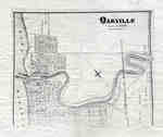
 - Map of Oakville 1877

 This map was compiled using original registered surveys from J.H. Pope.
 This map was compiled using original registered surveys from J.H. Pope.Oakville Public Library
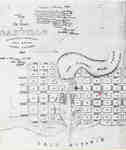
 - Plan of Oakville, Township of Trafalgar, Upper Canada, 1835
 A map from 1835 showing the town of Oakville from Brock Street to Allan Street, including the Sixteen Mile Creek. This map features the church, market square, wharf and an intended damn site north of the Colborne Street bridge.
  A map from 1835 showing the town of Oakville from Brock Street to Allan Street, including the Sixteen Mile Creek. This map features the church, market square, wharf and an …Oakville Public Library
 - The Northern Part of Trafalgar 1877
 This map shows the land distribution and lot owners of Northern Trafalgar during 1877. It also contains a Post Office address list. This map was taken from the Illustrated Historical Atlas of Halton.
  This map shows the land distribution and lot owners of Northern Trafalgar during 1877. It also contains a Post Office address list. This map was taken from the Illustrated Historical …Oakville Public Library
 - Map of Oakville 1837
 The Drawing has been prepared from information gathered from a copy of the first registered plan of Oakville, by Deputy Provincial Surveyor, Robert W. Kerr in 1836, under the direction of Col. William Chisholm, the founder of Oakville. The Plan was registered January 12th 1850. James Madill, Oakville, 1973
  The Drawing has been prepared from information gathered from a copy of the first registered plan of Oakville, by Deputy Provincial Surveyor, Robert W. Kerr in 1836, under the direction …Oakville Public Library
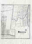
 - Map of Bronte 1877
 This map depicts the land division of the Town of Bronte, which, at this time, stretched from West St. in the west. East St. in the East, Concession St. in the north and Lake Ontario in the South. It also includes the plan of Oakville east of Dunn St. AT/440 …
  This map depicts the land division of the Town of Bronte, which, at this time, stretched from West St. in the west. East St. in the East, Concession St. in …Oakville Public Library
 - Plan of Oakville 1876
 This map shows the division of land in Oakville surrounding the Sixteen Mile Creek. It was verified by the Department of Crown Lands the same year it was created.
  This map shows the division of land in Oakville surrounding the Sixteen Mile Creek. It was verified by the Department of Crown Lands the same year it was created.Oakville Public Library
 - Tremaine's Map of the County of Halton 1858 - Nelson
 This map lays out the land division and ownership of the Nelson region as of 1858. It is one of eight maps of the Halton townships. It also includes depictions of important local buildings including the Bronte Steam Mills, Wellington Square Steam Mills, and the Residence of John Triller Esq. …
  This map lays out the land division and ownership of the Nelson region as of 1858. It is one of eight maps of the Halton townships. It also includes depictions …Oakville Public Library
 - Tremaine's Map of the County of Halton 1858 - Southern Trafalgar Township
 This map lays out the land division and ownership of the southern Trafalgar township region as of 1858. It is one of eight maps of the Halton townships. It also includes depictions of important local buildings including the residence of Robert. K. Chisholm Esq., the Canadian Hotel, and Oakville Steam …
  This map lays out the land division and ownership of the southern Trafalgar township region as of 1858. It is one of eight maps of the Halton townships. It also …Oakville Public Library
 - Tremaine's Map of the County of Halton 1858 - Trafalgar Township
 This map lays out the land division and ownership of the Trafalgar township region as of 1858. It is one of eight maps of the Halton townships. It also includes depictions of important local buildings including the residence of George K. Chisholm Esq., Chisholm Brothers’ Grist Mill, and the residence …
  This map lays out the land division and ownership of the Trafalgar township region as of 1858. It is one of eight maps of the Halton townships. It also includes …Oakville Public Library
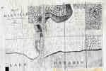
 - Map of Trafalgar Township 1806
 Trafalgar Plan of the Second Township In the tract of Land lately Purchased from the Mississagna Indians [sic] Sam T. Wilmot Surveyor "Trafalgar Dist of Gore Partial"...
  Trafalgar Plan of the Second Township In the tract of Land lately Purchased from the Mississagna Indians [sic] Sam T. Wilmot Surveyor "Trafalgar Dist of Gore Partial"...Oakville Public Library
 - Tremaine's Map of the County of Halton 1858
 Shows land owners' names, lots, concessions, buildings and subscribers' directory for the County of Halton.
  Shows land owners' names, lots, concessions, buildings and subscribers' directory for the County of Halton.Oakville Public Library
 - A map of the land purchased from the Mississaugas in 1806
 A map of the land purchased from the Mississaugas in 1806
  A map of the land purchased from the Mississaugas in 1806Oakville Public Library
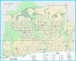
 - Oakville Community Map 2018


 Oakville Public Library
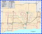
 - Oakville Cycleways Map 2018

 ...
... 
 ...Oakville Public Library
 - Oakville Transit Weekday Route Map Effective March 4, 2018

 ...
... 
 ...Oakville Public Library
 - Plan of Oakville, Township of Trafalgar, Upper Canada, 1835
 According to the book, The Shaping of Ontario: From Exploration to Confederation, compiled by Nick and Helma Mika in 1985, the plan "was drawn by Edward Palmer for William Chisholm to attract prospective land investors." Page 268.
  According to the book, The Shaping of Ontario: From Exploration to Confederation, compiled by Nick and Helma Mika in 1985, the plan "was drawn by Edward Palmer for William Chisholm …Oakville Public Library


