Results
We found 30 matching items.


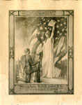
- Columbia Gives to her son the accolade of the new chivalry of Humanity


 Photographs and documents may be reproduced for research purposes only. Special permission must be obtained for use in publications, websites or for commercial purposes. All photographs and documents used from the Haldimand County Museums records on the Our Ontario website must acknowledge the source in writing on the reproductions as …

 Photographs and documents may be reproduced for research purposes only. Special permission must be obtained for use in publications, websites or for commercial purposes. All photographs and documents used from …Heritage Centre
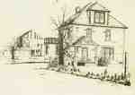
 - Farm of James Arthur Colton

 James was born in Halton County in 1885 but later moved to Woodbridge which is where this farm was located. The sketch was done by a friend of the family.
 James was born in Halton County in 1885 but later moved to Woodbridge which is where this farm was located. The sketch was done by a friend of the family.Trafalgar Township Historical Society
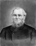
 - Jackson Holliday

 Jackson Holliday was born at Aspatria, Cumberland, England, on May 26, 1818. He came to Canada in 1832 with his step-father, and settled near Brooklin. He was married in Whitby Township on March 10, 1849 to Mary Jane Hall. He was Sabbath School Superintendent of the Methodist Episcopal Church either …
 Jackson Holliday was born at Aspatria, Cumberland, England, on May 26, 1818. He came to Canada in 1832 with his step-father, and settled near Brooklin. He was married in Whitby …Whitby Public Library
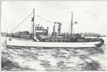
 - Drawing of HMCS OAKVILLE

 ...
... 
 ...Oakville Museum
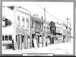
 - East Side Main Street, Thessalon, circa 1920


 This is a black and white ink sketch of the east side of Thessalon's Main Street in the early 1920s. It shows a series of two-story buildings including the Imperial Bank of Canada and the People's Meat Market. the illustrator is Barbara Halyk.

 This is a black and white ink sketch of the east side of Thessalon's Main Street in the early 1920s. It shows a series of two-story buildings including the Imperial …Thessalon Union Public Library
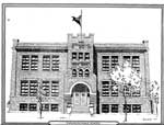
 - Drawing of the Thessalon Public School, circa 1989

 The Thessalon Public School pictured is still in existence today, and is currently the "Senior Public School."
 The Thessalon Public School pictured is still in existence today, and is currently the "Senior Public School."Thessalon Union Public Library
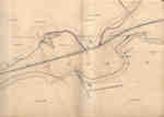
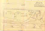
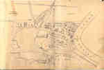
 - Second Welland Canal - Book 1, Survey Map 1 - Entrance, Lock 1 and Port Dalhousie


 Survey map of the Second Welland Canal created by the Welland Canal Company showing the areas in and around Port Dalhousie and Grantham Township. Identified structures associated with the Canal include Lock 1, Lighthouse, Lighthouse Keeper's House, East and West Piers, Harbour, Waste Weir, Store House, Collector's Office, Collector Assistant …

 Survey map of the Second Welland Canal created by the Welland Canal Company showing the areas in and around Port Dalhousie and Grantham Township. Identified structures associated with the Canal …Brock University Archives
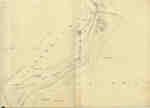
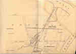
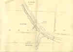
 - Second Welland Canal - Book 1, Survey Map 5 - Through Grantham Township


 Survey map of the Second Welland Canal created by the Welland Canal Company showing a portion of the Grantham Township near Port Dalhousie. Identified structures associated with the Canal include the tow path and floating tow path. The surveyors' measurements and notes can be seen in red and black ink …

 Survey map of the Second Welland Canal created by the Welland Canal Company showing a portion of the Grantham Township near Port Dalhousie. Identified structures associated with the Canal include …Brock University Archives
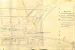
 - Second Welland Canal - Book 1, Survey Map 10 - St. Catharines


 Survey map of the Second Welland Canal created by the Welland Canal Company along the western edge of the Town of St. Catharines. Although not labelled, the Second Welland Canal can be seen running through the map along with its tow path, which is located on the southwestern edge of …

 Survey map of the Second Welland Canal created by the Welland Canal Company along the western edge of the Town of St. Catharines. Although not labelled, the Second Welland Canal …Brock University Archives
 - Trial of Dr. William H. King

 Dr. William King was the only criminal to be executed in Northumberland and was a well-known doctor of Brighton. He became infatuated with Melinda Vandervoort and began to feed his wife small doses of arsenic. After a hard-fought trial he was convicted of murder and on June 9, 1859 he …
 Dr. William King was the only criminal to be executed in Northumberland and was a well-known doctor of Brighton. He became infatuated with Melinda Vandervoort and began to feed his …Cobourg Public Library
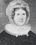
 - Rebecca Silverthorn Chisholm

 Rebecca Silverthorn Chisholm, wife of Colonel William Chisholm
 Rebecca Silverthorn Chisholm, wife of Colonel William ChisholmOakville Museum
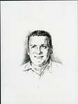
 - LH0027 Sketch of Jess Hann

 Robert Hann’s generous gift of rent-free space in his Lake Vista Plaza at Cedar and Wentworth Streets gave south Oshawa a permanent library. The gift was made in memory of Robert’s father, Jess Hann.
 Robert Hann’s generous gift of rent-free space in his Lake Vista Plaza at Cedar and Wentworth Streets gave south Oshawa a permanent library. The gift was made in memory of …Oshawa Public Libraries
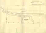
 - Second Welland Canal - Book 2, Survey Map 17 - Deep Cut and Port Robinson


 Survey map of the Second Welland Canal created by the Welland Canal Company showing the canal at Port Robinson. Identified structures and features associated with the Canal include the Deep Cut, Old Channel of Canal, and the towing path. The surveyors' measurements and notes can be seen in red and …

 Survey map of the Second Welland Canal created by the Welland Canal Company showing the canal at Port Robinson. Identified structures and features associated with the Canal include the Deep …Brock University Archives
 - Second Welland Canal - Book 3, Survey Map 1 - Canal to Chippewa Creek with Port Robinson


 Survey map of the Second Welland Canal created by the Welland Canal Company showing Port Robinson and the canal to Chippewa Creek. The surveyors' measurements and notes can be seen in red and black ink and pencil. Local area landmarks are also identified and include streets and roads (ex. Front …

 Survey map of the Second Welland Canal created by the Welland Canal Company showing Port Robinson and the canal to Chippewa Creek. The surveyors' measurements and notes can be seen …Brock University Archives
 - Second Welland Canal - Book 3, Survey Map 2 - Canal to Chippewa Creek with Port Robinson


 The current spelling of Chippewa Creek is Chippawa. Although it not possible to make out the entire name of the H. W. Timms hotel located at Front and Bridge Street on the map itself, it was discovered to belong to Henry W. Timms after consulting the 1851-52 Canada Directory.

 The current spelling of Chippewa Creek is Chippawa. Although it not possible to make out the entire name of the H. W. Timms hotel located at Front and Bridge Street …Brock University Archives
 - Second Welland Canal - Book 3, Survey Map 8 - Quaker Bridge in Thorold


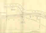
 Survey map of the Second Welland Canal created by the Welland Canal Company showing the canal in the Thorold Township between Port Robinson and Welland. Identified structures and features associated with the Canal include the towing path, back ditch, and the waterway itself. The surveyors' measurements and notes can be …

 Survey map of the Second Welland Canal created by the Welland Canal Company showing the canal in the Thorold Township between Port Robinson and Welland. Identified structures and features associated …Brock University Archives
 - Second Welland Canal - Book 3, Survey Map 21 - Village of Port Colborne


 Survey map of the Second Welland Canal created by the Welland Canal Company showing the areas in and around Port Colborne. Identified structures associated with the Canal include Lighthouse, Pier Light, Old Lock House, Collector's Office, Harbour Master's House, Canal Boundary, Back Ditch, Reserved Back Ditch, Basin, Light-Keeper's House and …

 Survey map of the Second Welland Canal created by the Welland Canal Company showing the areas in and around Port Colborne. Identified structures associated with the Canal include Lighthouse, Pier …Brock University Archives
 - Second Welland Canal - Book 3, Survey Map 9 - Canal along Chippewa Creek in Thorold


 Survey map of the Second Welland Canal created by the Welland Canal Company showing the canal in the Thorold Township between Port Robinson and Welland. Identified structures and features associated with the Canal include the towing path, back ditches, and the waterway itself. The surveyors' measurements and notes can be …

 Survey map of the Second Welland Canal created by the Welland Canal Company showing the canal in the Thorold Township between Port Robinson and Welland. Identified structures and features associated …Brock University Archives
 - Second Welland Canal - Book 3, Survey Map 10 - Canal along Chippewa Creek in Thorold


 Survey map of the Second Welland Canal created by the Welland Canal Company showing the canal in the Thorold Township between Port Robinson and Welland. Identified structures and features associated with the Canal include the towing path, a ditch, foot of the slope of bank, and the waterway itself. The …

 Survey map of the Second Welland Canal created by the Welland Canal Company showing the canal in the Thorold Township between Port Robinson and Welland. Identified structures and features associated …Brock University Archives
 - Second Welland Canal - Book 3, Survey Map 20 - Village of Port Colborne


 Survey map of the Second Welland Canal created by the Welland Canal Company showing the areas in and around Port Colborne and Grantham Township. Identified structures associated with the Canal include Basin, Guard Lock, Two Lock Tender Houses, Lock House Lot, Collectors Office House, Towing Path, North and South Back …

 Survey map of the Second Welland Canal created by the Welland Canal Company showing the areas in and around Port Colborne and Grantham Township. Identified structures associated with the Canal …Brock University Archives

