Results
We found 8 matching items.


Page 1 of 1
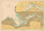
- St. Marys River from Head of Hay Lake to Whitefish Bay, 1922

 Maritime History of the Great Lakes
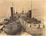
 - Glenmavis and Glenlivet
 The canallers GLENMAVIS and GLENLIVET and some of the rest of the Great Lakes Transportation Co., Ltd fleet in winter quarters at Midland in the early 1920s.
  The canallers GLENMAVIS and GLENLIVET and some of the rest of the Great Lakes Transportation Co., Ltd fleet in winter quarters at Midland in the early 1920s.Maritime History of the Great Lakes
 - Str. Chippewa, Sandusky, Put-In-Bay, Lakeside Route
 Divided back linen postcard. Postally unused.
  Divided back linen postcard. Postally unused.Maritime History of the Great Lakes
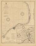
 - Lake Ontario Coast Chart No. 2. Stony Point to Little Sodus Bay. 1922
 Survey of the south eastern shores of Lake Ontario from Little Sodus Bay, Fair Haven, Oswego, Texas, Port Ontario to Stony Point Lighthouse. Major inset with Oswego Harbor.
  Survey of the south eastern shores of Lake Ontario from Little Sodus Bay, Fair Haven, Oswego, Texas, Port Ontario to Stony Point Lighthouse. Major inset with Oswego Harbor.Maritime History of the Great Lakes
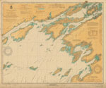
 - Lake Ontario Coast Chart No. 1. from Prince Edward Point, Ont. and Stony Point, N.Y. to Grindstone Island, St. Lawrence River. 1922
 Survey of the eastern end of Lake Ontario from Stony Point Lighthouse, Sackets Harbor, Cape Vincent, Clayton, Gananoque and Kingtston
  Survey of the eastern end of Lake Ontario from Stony Point Lighthouse, Sackets Harbor, Cape Vincent, Clayton, Gananoque and KingtstonMaritime History of the Great Lakes
 - Detroit and Cleveland Navigation Co. Steamers
 Postmarked "Detroit, Mich, Dec 7 1922"
  Postmarked "Detroit, Mich, Dec 7 1922"Maritime History of the Great Lakes
 - Saint Clair River, 1922
 Insets of Marine City, St. Clair, MI, and Russell Island
  Insets of Marine City, St. Clair, MI, and Russell IslandMaritime History of the Great Lakes
 - Saint Clair River, 1922
 Insets of Marine City, St. Clair, MI, and Russell Island
  Insets of Marine City, St. Clair, MI, and Russell IslandMaritime History of the Great Lakes
Page 1 of 1

