Results
We found 3730 matching items.


- Frank Waywell


 In this interview, Frank Waywell talks about his involvement in the war effort before, during and after World War II. Frank first started in the Royal Army Medical Corps but then felt compelled to join the air force once he saw the severity of the war. He talks about his …

 In this interview, Frank Waywell talks about his involvement in the war effort before, during and after World War II. Frank first started in the Royal Army Medical Corps but …Oakville Public Library
 - Harry Barrett


 In this interview, Harry Barrett, former mayor of Oakville, talks about his experiences prior to and in the Second World War. Harry speaks about joining and training with the cadet core for five years. While training with them, he was issued uniforms and Ross Rifles from the First World War …

 In this interview, Harry Barrett, former mayor of Oakville, talks about his experiences prior to and in the Second World War. Harry speaks about joining and training with the cadet …Oakville Public Library
 - Wess McIntosh


 In this interview, Wess McIntosh speaks about his extensive involvement with the Canadian forces, first with the naval reserves and then with the airforce. Wes joined the navy in 1933, but he also started learning to fly in 1934. From there, he received his private pilot’s license in 1934 and …

 In this interview, Wess McIntosh speaks about his extensive involvement with the Canadian forces, first with the naval reserves and then with the airforce. Wes joined the navy in 1933, …Oakville Public Library
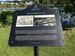
 - Frost & Wood Co. Ltd. plaque, Smiths Falls


 The plaque reads: "What began as a simple shop on Gould's Island, with a few stove and ploughs in 1893, developed into Smiths Falls most successful company and largest employer for 116 years. In 1846, company founder Ebenezer Frost partnered with Alexander Wood and by 1865 virtually every company in …

 The plaque reads: "What began as a simple shop on Gould's Island, with a few stove and ploughs in 1893, developed into Smiths Falls most successful company and largest employer …Smiths Falls Public Library
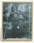
 - Loyal Orange Lodge Photograph


 Framed black and white photograph of the late Mrs. Singleton with the 1960 Battle of Boyne Flag.

 Framed black and white photograph of the late Mrs. Singleton with the 1960 Battle of Boyne Flag.Schreiber Heritage & Tourism Committee
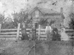
 - Thomas Park (Crawforth) House


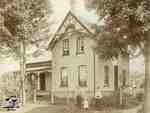
 This brick house is located in the south-east portion of lot 25, Concession 4 in Whitby Township. It was purchased by Thomas Park in 1861. At the time of this photograph the house was the home of Matthew Crawforth and his wife Eliza, daughter of Thomas Park. The house was …

 This brick house is located in the south-east portion of lot 25, Concession 4 in Whitby Township. It was purchased by Thomas Park in 1861. At the time of this …Whitby Public Library
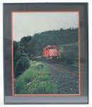
 - Framed Photograph of Unit 3076

 This engine and passenger train provided the town of Schreiber a bit of amusement when, in the summer of 1993 during Heritage Days, it was used to transport locals for a quick trip to Marathon, reminiscent of the time passenger trains were available in this area.
 This engine and passenger train provided the town of Schreiber a bit of amusement when, in the summer of 1993 during Heritage Days, it was used to transport locals for …Schreiber Heritage & Tourism Committee
 - The Tweedie Farm


 This farm on lot 29 of Concession 3 (Rossland Road) at the north-west corner of Rossland and Chocrane Street was also known as Broadfield. It was settled about 1837 by James Tweedie (1803-1857). The brick house on the property was built in 1845.

 This farm on lot 29 of Concession 3 (Rossland Road) at the north-west corner of Rossland and Chocrane Street was also known as Broadfield. It was settled about 1837 by …Whitby Public Library
 - Residence of Barnabus Gibson


 Unknown, Illustrated Historical Atlas of the County of Ontario, Ont. (Toronto, Ontario: J.H. Beers & Co., 1877), 1877 This brick house was built in 1876 on the south east corner of Hopikins and Victoria Streets on lot 22 in Whitby Township. The house was severely damaged by fire in June 2006. Barnabus Gibson was a railway contractor who later moved to Toronto.

 Unknown, Illustrated Historical Atlas of the County of Ontario, Ont. (Toronto, Ontario: J.H. Beers & Co., 1877), 1877 This brick house was built in 1876 on the south east corner of Hopikins and Victoria Streets on lot 22 in Whitby Township. The house was severely damaged by fire …Whitby Public Library
 - Mildmay Camp


 Mildmay Camp was located on the shore of Lake Ontario, east of the Cranberry Marsh in Whitby Township. It was an Anglican Church camp which was operated from around 1927 to 1953 by the Mildmay Institute of Toronto.

 Mildmay Camp was located on the shore of Lake Ontario, east of the Cranberry Marsh in Whitby Township. It was an Anglican Church camp which was operated from around 1927 …Whitby Public Library
 - Port Whitby and Port Perry Railway Engine House


 The brick engine house is located at 400 Mary Street East on the north-east corner of Mary and Hickory Streets. It was built in 1876 to replace an engine house that burned down in 1875. The building was altered in the 1960s and made into a garage.

 The brick engine house is located at 400 Mary Street East on the north-east corner of Mary and Hickory Streets. It was built in 1876 to replace an engine house …Whitby Public Library
 - Whitby Junction Station, 1906


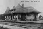
 The Whitby Junction Station was built at the foot of Byron Street on the Grand Trunk Railway in 1903 near the current GO Transit platform. In 1914, it was the scene of an unsolved murder. It closed in 1969 and in 1970 was moved to the north-east corner of Victoria …

 The Whitby Junction Station was built at the foot of Byron Street on the Grand Trunk Railway in 1903 near the current GO Transit platform. In 1914, it was the …Whitby Public Library
 - Cornish Home


 Condition: Fine. Image is dirty and slightly faded

 Condition: Fine. Image is dirty and slightly fadedSt. Marys Museum
 - The Doupe Family


 Condition: Fair. Image is dirty and matte is very worn.

 Condition: Fair. Image is dirty and matte is very worn.St. Marys Museum
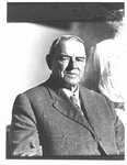
 - Bust portrait of William Griffin, Keeper of the Wellington County House of Industry and Refuge.


 McLaughlin Library ASC: Agricultural, Rural, & Scottish Images
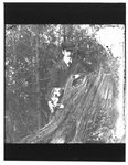
 - Portrait of John Connon, as a young man, with a dog, by a tree stump.


 McLaughlin Library ASC: Agricultural, Rural, & Scottish Images
 - Seven Men and Two Horses, Building the Railroad, 1890

 Four men sitting an three men standing with two horses on the side of the railroad tracks. These men are working on Grant Trunk Railroad. There is a utility pole in the background.
 Four men sitting an three men standing with two horses on the side of the railroad tracks. These men are working on Grant Trunk Railroad. There is a utility pole …Sundridge - Strong Union PL
 - Grand Trunk Railroad Station and Johnstone's Hardware Store, Sundridge, circa 1920

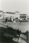
 Black and white photograph a town square and a street. The square has many people in it, including a man riding a bicycle. Across the street there's a white building which is Johnstone's Hardware Store. To the right is the Grand Trunk Railway station.
 Black and white photograph a town square and a street. The square has many people in it, including a man riding a bicycle. Across the street there's a white building …Sundridge - Strong Union PL
 - Aerial Photograph of Main Street and Highway 11, Sundridge, circa 1960

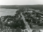
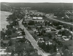
 Black and white aerial photograph of Sundridge and Lake Bernard. In the middle is the Main Street and Highway 11.
 Black and white aerial photograph of Sundridge and Lake Bernard. In the middle is the Main Street and Highway 11.Sundridge - Strong Union PL
 - Aerial Photograph of Main Street and Highway 11, Sundridge, circa 1960

 Black and white aerial photograph of Sundridge Ontario during the 1960s. Lake Bernard is on the left of the photograph. In the middle of the image is the Main Street and Highway 11 is on the right side of the photograph.
 Black and white aerial photograph of Sundridge Ontario during the 1960s. Lake Bernard is on the left of the photograph. In the middle of the image is the Main Street …Sundridge - Strong Union PL


