- Plan of Ontario Methodist Camp Ground, 1875: Auditorium Circle and Victoria Terrace


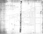
This is the plan for the Ontario Methodist Camp Ground in 1875. This was the first year that the Ontario Methodist Camp Ground owned the land sold to them by John B. Bowslaugh, which was approximately 12 1/2 acres. This map lays out the plots of land the company wanted …


This is the plan for the Ontario Methodist Camp Ground in 1875. This was the first year that the Ontario Methodist Camp Ground owned the land sold to them by …
Grimsby Chautauqua
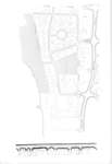
- Map of Grimsby beach circa 1950s
Grimsby Chautauqua
- Plan of Ontario Methodist Camp Ground, Blocks B and C, 1875


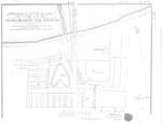
This map continues the survey of the Ontario Methodist Camp Grounds, plotting the lots for Blocks B. and C., and part of A., D., and F. This map accounts for another approximately 145 lots.


This map continues the survey of the Ontario Methodist Camp Grounds, plotting the lots for Blocks B. and C., and part of A., D., and F. This map accounts for …
Grimsby Chautauqua
- Plan of Grimsby Park, 1885


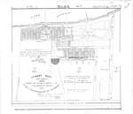
Title: Grimsby Park. New Survey. 1885. Parts of Lots 3 and 4 in the Broken Front and First Concession of Grimsby. Middle left: Proprietors certificate -- The lots coloured red and the Avenues and Streets coloured brown as shown hereon are laid out according to instructions. (signed) Noah Phelps President …


Title: Grimsby Park. New Survey. 1885. Parts of Lots 3 and 4 in the Broken Front and First Concession of Grimsby. Middle left: Proprietors certificate -- The lots coloured red …
Grimsby Chautauqua
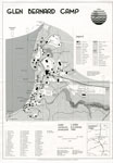
- Map of Glen Bernard Camp, circa 1985

Black and white map of Glen Bernard Camp. The camp is near Sundridge Ontario. The map is on the top half of the image. In the lower half of the image is a legend and scale.

Black and white map of Glen Bernard Camp. The camp is near Sundridge Ontario. The map is on the top half of the image. In the lower half of the …
Sundridge - Strong Union PL
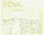
- Diagram Explaining Where Sir Isaac Brock fell in Queenston

This document is a diagram with explanations of the place where Sir Isaac Brock fell according to some who claim to have witness the event.

This document is a diagram with explanations of the place where Sir Isaac Brock fell according to some who claim to have witness the event.
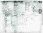
- "Plan of Part of the Niagara Frontier Showing the Communications from Thence to the 15 Mile Creek July 1814"

This photograph of a plan is titled “Plan of Part of the Niagara Frontier Showing the Communications from Thence to the 15 Mile Creek July 1814”. It was obtained by the Museum from the “National Archives of Canada, Cartographic and Architectural Archives Division” with the call number NMC-21586. It shows …

This photograph of a plan is titled “Plan of Part of the Niagara Frontier Showing the Communications from Thence to the 15 Mile Creek July 1814”. It was obtained by …
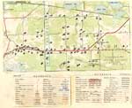
- Land holding map for Thessalon area, 1966
Thessalon Union Public Library
- Map of the Town of Paris, 1932


Pages 2 through 4 of this map appear to have been cropped from an originally larger map, and cut off abruptly at the edges.


Pages 2 through 4 of this map appear to have been cropped from an originally larger map, and cut off abruptly at the edges.
County of Brant Public Library
- 1876 Plan of the Town of Paris


This 1876 town map shows Paris as it was at the time. The lots are numbered individually. A number of notable town landmarks are indicated, with the key in the lower centre of the map.


This 1876 town map shows Paris as it was at the time. The lots are numbered individually. A number of notable town landmarks are indicated, with the key in the …
County of Brant Public Library
- The Village of Sundridge, Kent, England


A replica map of Sundridge, Kent England in 1640. The map is accompanied by a two page history of Sundridge, Kent, England. The history goes into the origins of the British Sundridge, what the area is like today, the history of the church in the area, and the impact of …


A replica map of Sundridge, Kent England in 1640. The map is accompanied by a two page history of Sundridge, Kent, England. The history goes into the origins of the …
Sundridge - Strong Union PL
- Map of Strong Township, 1942


A map of Strong Township, produced in 1942. It shows the division of property in Strong Township and names of the land owners. Lake Bernard is near the center of the township. There is a legend at the bottom of the map. Machar Township borders on the north, Chapman on …


A map of Strong Township, produced in 1942. It shows the division of property in Strong Township and names of the land owners. Lake Bernard is near the center of …
Sundridge - Strong Union PL
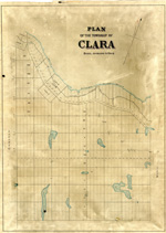
- Plan of the township of Clara, Renfrew County
ca. 1888


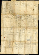
The Map came from Andre Boissonneault, a contractor. The map is hand written on an oil cloth, and covers a total area of 63922 (unit of measure unknown). Early surveyors, like William E. Logan, used Rochon micrometer telescopes and targets (disk on a calibrated pole) to measure distance. Each microscope …


The Map came from Andre Boissonneault, a contractor. The map is hand written on an oil cloth, and covers a total area of 63922 (unit of measure unknown). Early surveyors, …
Head, Clara and Maria Public Library
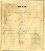
- Maria Township ca. 1886
Head, Clara and Maria Public Library
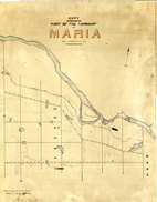
- Maria Township ca. 1866
Head, Clara and Maria Public Library
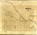
- Maria Township ca.1869
Head, Clara and Maria Public Library
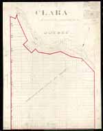
- Clara Township Map ca.1885
Head, Clara and Maria Public Library
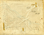
- Head Township ca.1859
Head, Clara and Maria Public Library
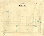
- Map of Head Township
Head, Clara and Maria Public Library
- Map of Clara Township
Head, Clara and Maria Public Library


 This is the plan for the Ontario Methodist Camp Ground in 1875. This was the first year that the Ontario Methodist Camp Ground owned the land sold to them by John B. Bowslaugh, which was approximately 12 1/2 acres. This map lays out the plots of land the company wanted …
 This is the plan for the Ontario Methodist Camp Ground in 1875. This was the first year that the Ontario Methodist Camp Ground owned the land sold to them by …Grimsby Chautauqua

 This is a map of the Grimsby Beach area in the mid-twentieth century. It shows some of the features of the Grimsby Park times which remained through the changing uses of the area. Auditorium Circle, Bell Park, and Victoria Terrace remain today as identified features in the Grimsby Beach area.

 This is a map of the Grimsby Beach area in the mid-twentieth century. It shows some of the features of the Grimsby Park times which remained through the changing uses …Grimsby Chautauqua
 This map continues the survey of the Ontario Methodist Camp Grounds, plotting the lots for Blocks B. and C., and part of A., D., and F. This map accounts for another approximately 145 lots.
 This map continues the survey of the Ontario Methodist Camp Grounds, plotting the lots for Blocks B. and C., and part of A., D., and F. This map accounts for …Grimsby Chautauqua
 Title: Grimsby Park. New Survey. 1885. Parts of Lots 3 and 4 in the Broken Front and First Concession of Grimsby. Middle left: Proprietors certificate -- The lots coloured red and the Avenues and Streets coloured brown as shown hereon are laid out according to instructions. (signed) Noah Phelps President …
 Title: Grimsby Park. New Survey. 1885. Parts of Lots 3 and 4 in the Broken Front and First Concession of Grimsby. Middle left: Proprietors certificate -- The lots coloured red …Grimsby Chautauqua
 Black and white map of Glen Bernard Camp. The camp is near Sundridge Ontario. The map is on the top half of the image. In the lower half of the image is a legend and scale.
  Black and white map of Glen Bernard Camp. The camp is near Sundridge Ontario. The map is on the top half of the image. In the lower half of the …Sundridge - Strong Union PL
 This document is a diagram with explanations of the place where Sir Isaac Brock fell according to some who claim to have witness the event.
  This document is a diagram with explanations of the place where Sir Isaac Brock fell according to some who claim to have witness the event.
 This photograph of a plan is titled “Plan of Part of the Niagara Frontier Showing the Communications from Thence to the 15 Mile Creek July 1814”. It was obtained by the Museum from the “National Archives of Canada, Cartographic and Architectural Archives Division” with the call number NMC-21586. It shows …
  This photograph of a plan is titled “Plan of Part of the Niagara Frontier Showing the Communications from Thence to the 15 Mile Creek July 1814”. It was obtained by …

 The map does not include a scale. This map and legend can be found in the Tweedsmuir History created by the Princess Elizabeth Women's Institute.

 The map does not include a scale. This map and legend can be found in the Tweedsmuir History created by the Princess Elizabeth Women's Institute.Thessalon Union Public Library
 Pages 2 through 4 of this map appear to have been cropped from an originally larger map, and cut off abruptly at the edges.
 Pages 2 through 4 of this map appear to have been cropped from an originally larger map, and cut off abruptly at the edges.County of Brant Public Library
 This 1876 town map shows Paris as it was at the time. The lots are numbered individually. A number of notable town landmarks are indicated, with the key in the lower centre of the map.
 This 1876 town map shows Paris as it was at the time. The lots are numbered individually. A number of notable town landmarks are indicated, with the key in the …County of Brant Public Library
 A replica map of Sundridge, Kent England in 1640. The map is accompanied by a two page history of Sundridge, Kent, England. The history goes into the origins of the British Sundridge, what the area is like today, the history of the church in the area, and the impact of …
 A replica map of Sundridge, Kent England in 1640. The map is accompanied by a two page history of Sundridge, Kent, England. The history goes into the origins of the …Sundridge - Strong Union PL
 A map of Strong Township, produced in 1942. It shows the division of property in Strong Township and names of the land owners. Lake Bernard is near the center of the township. There is a legend at the bottom of the map. Machar Township borders on the north, Chapman on …
 A map of Strong Township, produced in 1942. It shows the division of property in Strong Township and names of the land owners. Lake Bernard is near the center of …Sundridge - Strong Union PL
 The Map came from Andre Boissonneault, a contractor. The map is hand written on an oil cloth, and covers a total area of 63922 (unit of measure unknown). Early surveyors, like William E. Logan, used Rochon micrometer telescopes and targets (disk on a calibrated pole) to measure distance. Each microscope …
 The Map came from Andre Boissonneault, a contractor. The map is hand written on an oil cloth, and covers a total area of 63922 (unit of measure unknown). Early surveyors, …Head, Clara and Maria Public Library

 Early surveyors, like William E. Logan, used Rochon micrometer telescopes and targets (disk on a calibrated pole) to measure distance. Each microscope had a different calibration and therefore a different range. The instruments were calibrated against a distance measured with a surveyors chain (also known as Gunter’s chain). One chain …

 Early surveyors, like William E. Logan, used Rochon micrometer telescopes and targets (disk on a calibrated pole) to measure distance. Each microscope had a different calibration and therefore a different …Head, Clara and Maria Public Library

 Early surveyors, like William E. Logan, used Rochon micrometer telescopes and targets (disk on a calibrated pole) to measure distance. Each microscope had a different calibration and therefore a different range. The instruments were calibrated against a distance measured with a surveyors chain (also known as Gunter’s chain). One chain …

 Early surveyors, like William E. Logan, used Rochon micrometer telescopes and targets (disk on a calibrated pole) to measure distance. Each microscope had a different calibration and therefore a different …Head, Clara and Maria Public Library

 Early surveyors, like William E. Logan, used Rochon micrometer telescopes and targets (disk on a calibrated pole) to measure distance. Each microscope had a different calibration and therefore a different range. The instruments were calibrated against a distance measured with a surveyors chain (also known as Gunter’s chain). One chain …

 Early surveyors, like William E. Logan, used Rochon micrometer telescopes and targets (disk on a calibrated pole) to measure distance. Each microscope had a different calibration and therefore a different …Head, Clara and Maria Public Library

 Early surveyors, like William E. Logan, used Rochon micrometer telescopes and targets (disk on a calibrated pole) to measure distance. Each microscope had a different calibration and therefore a different range. The instruments were calibrated against a distance measured with a surveyors chain (also known as Gunter’s chain). One chain …

 Early surveyors, like William E. Logan, used Rochon micrometer telescopes and targets (disk on a calibrated pole) to measure distance. Each microscope had a different calibration and therefore a different …Head, Clara and Maria Public Library

 Early surveyors, like William E. Logan, used Rochon micrometer telescopes and targets (disk on a calibrated pole) to measure distance. Each microscope had a different calibration and therefore a different range. The instruments were calibrated against a distance measured with a surveyors chain (also known as Gunter’s chain). One chain …

 Early surveyors, like William E. Logan, used Rochon micrometer telescopes and targets (disk on a calibrated pole) to measure distance. Each microscope had a different calibration and therefore a different …Head, Clara and Maria Public Library

 Early surveyors, like William E. Logan, used Rochon micrometer telescopes and targets (disk on a calibrated pole) to measure distance. Each microscope had a different calibration and therefore a different range. The instruments were calibrated against a distance measured with a surveyors chain (also known as Gunter’s chain). One chain …

 Early surveyors, like William E. Logan, used Rochon micrometer telescopes and targets (disk on a calibrated pole) to measure distance. Each microscope had a different calibration and therefore a different …Head, Clara and Maria Public Library

 Early surveyors, like William E. Logan, used Rochon micrometer telescopes and targets (disk on a calibrated pole) to measure distance. Each microscope had a different calibration and therefore a different range. The instruments were calibrated against a distance measured with a surveyors chain (also known as Gunter’s chain). One chain …

 Early surveyors, like William E. Logan, used Rochon micrometer telescopes and targets (disk on a calibrated pole) to measure distance. Each microscope had a different calibration and therefore a different …Head, Clara and Maria Public Library
