Results
We found 5 matching items.


Page 1 of 1
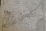
- Maps of Upper Canada, North America & Europe in 1846

 These maps are taken from the Atlas published in 1846 by W. E. Chambers & Sons, Edinburgh.
 These maps are taken from the Atlas published in 1846 by W. E. Chambers & Sons, Edinburgh.Trafalgar Township Historical Society
 - 1806 Trafalgar Township Map


 This copy of the Wilmot survey map of Trafalgar Township was photographed from a wonderful display copy. It looks like Mr. Wilmot signed his name, "Sam L. Wilmot", but it is actually "Sam S. Wilmot".

 This copy of the Wilmot survey map of Trafalgar Township was photographed from a wonderful display copy. It looks like Mr. Wilmot signed his name, "Sam L. Wilmot", but it …Trafalgar Township Historical Society
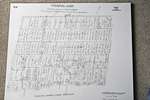
 - 1958 Map Oakville Trafalgar Bronte Area

 We were trying to ascertain where R.R. 1 Bronte was, what roads/streets it covered in the 1950's. Unfortunately this map doesn't have that information but it is as close as the Canada Post Archives can provide. In April 2020, we have added a 1918 Post Office "mail contract" asking for …
 We were trying to ascertain where R.R. 1 Bronte was, what roads/streets it covered in the 1950's. Unfortunately this map doesn't have that information but it is as close as …Trafalgar Township Historical Society
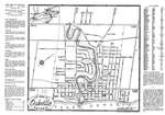
 - Oakville Town Map, 1948

 This map was sent to Mr. Stuart Wark and has been kept in the original envelope. To see the envelope, either click on the map image or open up "Page 2".
 This map was sent to Mr. Stuart Wark and has been kept in the original envelope. To see the envelope, either click on the map image or open up "Page …Trafalgar Township Historical Society
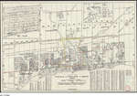
 - 1904 Map of the County of Halton, Showing Proposed County Good Roads System, Marked in Red

 Thank you to Halton Region, Heritage Services for this colour scan of the full map.
 Thank you to Halton Region, Heritage Services for this colour scan of the full map.Trafalgar Township Historical Society
Page 1 of 1


