Results
We found 9168 matching items.


- Amherst Island WI Membership Book: 1901-05

 Alphabetical list of members of Amherst Island Women's Institute branch from 1901 to 1905. Each page represents a different letter of the alphabet and names are alphabetical by surname. This book also includes P.O. address and township of each member and indicates the membership status for 1901, 1902, 1903, 1904, …
 Alphabetical list of members of Amherst Island Women's Institute branch from 1901 to 1905. Each page represents a different letter of the alphabet and names are alphabetical by surname. This …Federated Women's Institutes of Ontario
 - Maps, Reports, Estimates, &c., Relative to Improvements of the Navigation of the River St. Lawrence; and a Proposed Canal Connecting the River St. Lawrence and Lake Champlain


 Report on studies of possible canals between the Saint Lawrence and Richelieu Rivers and of the rapids of the Saint Lawrence River between Prescott and Montreal produced for the Department of Public Works in 1856, from fieldwork done between 1853 and 1856.

 Report on studies of possible canals between the Saint Lawrence and Richelieu Rivers and of the rapids of the Saint Lawrence River between Prescott and Montreal produced for the Department …Maritime History of the Great Lakes
 - Population Halton County
 ...
...  ...Oakville Public Library
 - Bicentennial Dinner - Silent Auction Summary; Jan. 29, 2000
 The Silent Auction Summary chart from the Bicentennial Gala Dinner includes the items that were for the bidding, along with the winning bidder and the price they paid. Attached to the chart is the receipt.
  The Silent Auction Summary chart from the Bicentennial Gala Dinner includes the items that were for the bidding, along with the winning bidder and the price they paid. Attached to …Niagara-on-the-Lake Public Library
 - Brant County Illustrated [Atlas]

 "County of Brant" is used to refer to a geographic region rather than the current municipality by the same name. Maps of Brantford are included in this atlas.
 "County of Brant" is used to refer to a geographic region rather than the current municipality by the same name. Maps of Brantford are included in this atlas.County of Brant Public Library
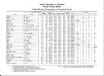
 - Table Showing Composition of Common Foods

 No date given. Provided an estimate date.
 No date given. Provided an estimate date.Federated Women's Institutes of Ontario
 - COVID-19 in York by the numbers


 The Era (Newmarket, Ontario1965), 14 May 2020, p. 17 Chart shows the daily growth in new cases has fluctuated significantly from the onset of COVID-19 pandemic in York Region

 The Era (Newmarket, Ontario1965), 14 May 2020, p. 17 Chart shows the daily growth in new cases has fluctuated significantly from the onset of COVID-19 pandemic in York RegionNewmarket Public Library
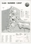
 - Map of Glen Bernard Camp, circa 1985
 Black and white map of Glen Bernard Camp. The camp is near Sundridge Ontario. The map is on the top half of the image. In the lower half of the image is a legend and scale.
  Black and white map of Glen Bernard Camp. The camp is near Sundridge Ontario. The map is on the top half of the image. In the lower half of the …Sundridge - Strong Union PL
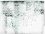
 - "Plan of Part of the Niagara Frontier Showing the Communications from Thence to the 15 Mile Creek July 1814"
 This photograph of a plan is titled “Plan of Part of the Niagara Frontier Showing the Communications from Thence to the 15 Mile Creek July 1814”. It was obtained by the Museum from the “National Archives of Canada, Cartographic and Architectural Archives Division” with the call number NMC-21586. It shows …
  This photograph of a plan is titled “Plan of Part of the Niagara Frontier Showing the Communications from Thence to the 15 Mile Creek July 1814”. It was obtained by …
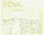
 - Diagram Explaining Where Sir Isaac Brock fell in Queenston
 This document is a diagram with explanations of the place where Sir Isaac Brock fell according to some who claim to have witness the event.
  This document is a diagram with explanations of the place where Sir Isaac Brock fell according to some who claim to have witness the event.
 - The Village of Sundridge, Kent, England

 A replica map of Sundridge, Kent England in 1640. The map is accompanied by a two page history of Sundridge, Kent, England. The history goes into the origins of the British Sundridge, what the area is like today, the history of the church in the area, and the impact of …
 A replica map of Sundridge, Kent England in 1640. The map is accompanied by a two page history of Sundridge, Kent, England. The history goes into the origins of the …Sundridge - Strong Union PL
 - Land holding map for Thessalon area, 1966


 The map does not include a scale. This map and legend can be found in the Tweedsmuir History created by the Princess Elizabeth Women's Institute.

 The map does not include a scale. This map and legend can be found in the Tweedsmuir History created by the Princess Elizabeth Women's Institute.Thessalon Union Public Library
 - 1876 Plan of the Town of Paris

 This 1876 town map shows Paris as it was at the time. The lots are numbered individually. A number of notable town landmarks are indicated, with the key in the lower centre of the map.
 This 1876 town map shows Paris as it was at the time. The lots are numbered individually. A number of notable town landmarks are indicated, with the key in the …County of Brant Public Library
 - Map of the Town of Paris, 1932

 Pages 2 through 4 of this map appear to have been cropped from an originally larger map, and cut off abruptly at the edges.
 Pages 2 through 4 of this map appear to have been cropped from an originally larger map, and cut off abruptly at the edges.County of Brant Public Library
 - Plan of the township of Clara, Renfrew County
ca. 1888

 The Map came from Andre Boissonneault, a contractor. The map is hand written on an oil cloth, and covers a total area of 63922 (unit of measure unknown). Early surveyors, like William E. Logan, used Rochon micrometer telescopes and targets (disk on a calibrated pole) to measure distance. Each microscope …
 The Map came from Andre Boissonneault, a contractor. The map is hand written on an oil cloth, and covers a total area of 63922 (unit of measure unknown). Early surveyors, …Head, Clara and Maria Public Library
 - Map of Strong Township, 1942

 A map of Strong Township, produced in 1942. It shows the division of property in Strong Township and names of the land owners. Lake Bernard is near the center of the township. There is a legend at the bottom of the map. Machar Township borders on the north, Chapman on …
 A map of Strong Township, produced in 1942. It shows the division of property in Strong Township and names of the land owners. Lake Bernard is near the center of …Sundridge - Strong Union PL
 - Road Map of United Counties of Northumberland and Durham. Dated 1928.

 Road Map of United Counties of Northumberland and Durham. Dated 1928.
 Road Map of United Counties of Northumberland and Durham. Dated 1928.Cobourg Museum Foundation
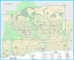
 - Oakville Community Map 2018


 Oakville Public Library
 - Oakville Cycleways Map 2018

 ...
... 
 ...Oakville Public Library
 - Oakville Transit Weekday Route Map Effective March 4, 2018

 ...
... 
 ...Oakville Public Library



![Brant County Illustrated [Atlas] Brant County Illustrated [Atlas]](https://images.ourontario.ca/Partners/cbpl/CBPL069862t.jpg)
