Results
We found 8858 matching items.


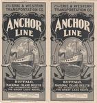
- Anchor Line

 Maritime History of the Great Lakes
 - Let us worship together : St. John's Evangelical Lutheran Church
 St. John's Lutheran Church (1837-2018) in Waterloo, Ontario was a member of the Eastern Synod of the Evangelical Lutheran Church in Canada. The congregation was formed in 1837, and a modest church was built in uptown Waterloo, at the modern-day intersection of King and Bridgeport Streets. The congregation eventually outgrew …
  St. John's Lutheran Church (1837-2018) in Waterloo, Ontario was a member of the Eastern Synod of the Evangelical Lutheran Church in Canada. The congregation was formed in 1837, and a …Wilfrid Laurier University Library
 - Waterloo's 125th Anniversary Brochure
 Brochure describing the celebratory events for Waterloo's 125th Anniversary year, 1982. The brochure includes a message from the mayor, Marjorie Carroll, and the chairman of the 125th Anniversary Committee, Bruce Lumsden.
  Brochure describing the celebratory events for Waterloo's 125th Anniversary year, 1982. The brochure includes a message from the mayor, Marjorie Carroll, and the chairman of the 125th Anniversary Committee, Bruce …Waterloo Public Library
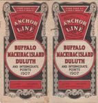
 - Anchor Line: Buffalo, Mackinac Island, Duluth and Intermediate Points, 1907
 The 1907 brochure of the Erie & Western Transportation Company's Anchor Line. The brochure features rates for passage, deck plans, itineraries, schedules, maps, and images of the new company steamers JUNIATA and TIONESTA
  The 1907 brochure of the Erie & Western Transportation Company's Anchor Line. The brochure features rates for passage, deck plans, itineraries, schedules, maps, and images of the new company steamers …Maritime History of the Great Lakes
 - Canada Steamship Lines, 1941
 The 1941 brochure of the Canada Steamship Lines featuring photographs, a map, fares and timetables.
  The 1941 brochure of the Canada Steamship Lines featuring photographs, a map, fares and timetables.Maritime History of the Great Lakes
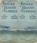
 - Arnold Transit Company, 1910
 The 1910 brochures of the Arnold Transit Company featuring a map, photographs, passenger fares, and time tables
  The 1910 brochures of the Arnold Transit Company featuring a map, photographs, passenger fares, and time tablesMaritime History of the Great Lakes
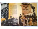
 - "Journey into Yesterday", CNR Museum train

 Brochure describing the CNR Museum Train which ran from the 1950s into early 1960s. Many of the old locomotives were decommissioned and used as travelling Museums. Some were placed in Museums like the Canada Science and Technology Museum in Ottawa. Please click above under "pages" to view additional images.
 Brochure describing the CNR Museum Train which ran from the 1950s into early 1960s. Many of the old locomotives were decommissioned and used as travelling Museums. Some were placed in …Cobourg Museum Foundation
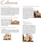
 - A Heritage Tour of Colborne, 1992

 Click on the Select arrow for Pages to see multi-page documents. The Pages box is located at the top of the page.
 Click on the Select arrow for Pages to see multi-page documents. The Pages box is located at the top of the page.Cramahe Township Public Library
 - Colborne Walking Tour Brochure, 2005

 Click on the Select arrow for Pages to see multi-page documents. The Pages box is located at the top of the page.
 Click on the Select arrow for Pages to see multi-page documents. The Pages box is located at the top of the page.Cramahe Township Public Library
 - Bryan's Review of Oakville Illustrated 1923-24


 Oakville Public Library
 - Abstract of Title to Lot 30 West of the Grand River, with Map

 This abstract of title provides the transactional history of the portions of Lot 30 in Dumfries, which had at various times belonged to Thomas Clark, William Dickson, John Holme, Samuel Street and Hiram Capron. It was prepared in 1855 at the time of the incorporation of Paris in order to …
 This abstract of title provides the transactional history of the portions of Lot 30 in Dumfries, which had at various times belonged to Thomas Clark, William Dickson, John Holme, Samuel …
 - Indenture Between The Great Western Railway Company and Hiram Capron

 This land indenture documents an agreement between Capron and the Great Western Railway Company. This is not the first agreement between Capron and the Great Western Railway company; an earlier document was signed in 1848. Capron built a highway and sold several lots near the strip of land he had …
 This land indenture documents an agreement between Capron and the Great Western Railway Company. This is not the first agreement between Capron and the Great Western Railway company; an earlier …
 - Ordinance

 Original map
 Original mapMusée Sturgeon River House Museum
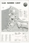
 - Map of Glen Bernard Camp, circa 1985
 Black and white map of Glen Bernard Camp. The camp is near Sundridge Ontario. The map is on the top half of the image. In the lower half of the image is a legend and scale.
  Black and white map of Glen Bernard Camp. The camp is near Sundridge Ontario. The map is on the top half of the image. In the lower half of the …Sundridge - Strong Union PL
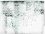
 - "Plan of Part of the Niagara Frontier Showing the Communications from Thence to the 15 Mile Creek July 1814"
 This photograph of a plan is titled “Plan of Part of the Niagara Frontier Showing the Communications from Thence to the 15 Mile Creek July 1814”. It was obtained by the Museum from the “National Archives of Canada, Cartographic and Architectural Archives Division” with the call number NMC-21586. It shows …
  This photograph of a plan is titled “Plan of Part of the Niagara Frontier Showing the Communications from Thence to the 15 Mile Creek July 1814”. It was obtained by …
 - Diagram Explaining Where Sir Isaac Brock fell in Queenston
 This document is a diagram with explanations of the place where Sir Isaac Brock fell according to some who claim to have witness the event.
  This document is a diagram with explanations of the place where Sir Isaac Brock fell according to some who claim to have witness the event.
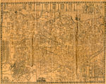
 - The Village of Sundridge, Kent, England

 A replica map of Sundridge, Kent England in 1640. The map is accompanied by a two page history of Sundridge, Kent, England. The history goes into the origins of the British Sundridge, what the area is like today, the history of the church in the area, and the impact of …
 A replica map of Sundridge, Kent England in 1640. The map is accompanied by a two page history of Sundridge, Kent, England. The history goes into the origins of the …Sundridge - Strong Union PL
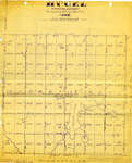
 - Land holding map for Thessalon area, 1966


 The map does not include a scale. This map and legend can be found in the Tweedsmuir History created by the Princess Elizabeth Women's Institute.

 The map does not include a scale. This map and legend can be found in the Tweedsmuir History created by the Princess Elizabeth Women's Institute.Thessalon Union Public Library
 - 1876 Plan of the Town of Paris

 This 1876 town map shows Paris as it was at the time. The lots are numbered individually. A number of notable town landmarks are indicated, with the key in the lower centre of the map.
 This 1876 town map shows Paris as it was at the time. The lots are numbered individually. A number of notable town landmarks are indicated, with the key in the …County of Brant Public Library
 - Map of the Town of Paris, 1932

 Pages 2 through 4 of this map appear to have been cropped from an originally larger map, and cut off abruptly at the edges.
 Pages 2 through 4 of this map appear to have been cropped from an originally larger map, and cut off abruptly at the edges.County of Brant Public Library

