Results
We found 11 matching items.


Page 1 of 1
- Greendale Farm

 The house on Greendale Farm was owned by William Jackson. It was built by one of the Campbell family in the 1850s. The stone gates were a new addition to the farm. The farm was located on lot 30 of Concession 6.
 The house on Greendale Farm was owned by William Jackson. It was built by one of the Campbell family in the 1850s. The stone gates were a new addition to …Whitby Public Library
 - Grass Park
 Grass Park is located at 41 Baldwin Street. It is a triangle shaped piece of land bounded by Roebuck Street, Baldwin Street and Mill Street (Cassels Road). This view is looking west from the intersection of Mill Street (Cassels Road) on the left, and Roebuck Street on the right. The …
  Grass Park is located at 41 Baldwin Street. It is a triangle shaped piece of land bounded by Roebuck Street, Baldwin Street and Mill Street (Cassels Road). This view is …Whitby Public Library
 - Baldwin Street looking north from Roebuck Street
 Jephsons Hardware store was located at the northeast corner of Baldwin and Roebuck Streets.
  Jephsons Hardware store was located at the northeast corner of Baldwin and Roebuck Streets.Whitby Public Library
 - Birds Eye View, Brooklin, Ontario
 This picture was taken from the Public and Continuation School on the south east corner of Highway 12 and Winchester Road. The United Church was located at the south-east corner of Mill Street (Cassels Road) and Princess Street.
  This picture was taken from the Public and Continuation School on the south east corner of Highway 12 and Winchester Road. The United Church was located at the south-east corner …Whitby Public Library
 - Brooklin Public and Continuation School
 The Brooklin Public and Continuation School was located on Baldwin Street. It was built in 1923 on the south east corner of Highway 12 and Winchester Road. It was officially opened on January 30, 1924 and closed in 1972. It was demolished in 1982.
  The Brooklin Public and Continuation School was located on Baldwin Street. It was built in 1923 on the south east corner of Highway 12 and Winchester Road. It was officially …Whitby Public Library
 - Community Park Gates
 This park is located on Winchester Road East opposite Simcoe Street. The stone gates were installed in 1921.
  This park is located on Winchester Road East opposite Simcoe Street. The stone gates were installed in 1921.Whitby Public Library
 - Brooklin United Church
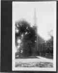
 Brooklin United Church is located at 19 Cassels Road East. It was built in 1867 on the south-east corner of Mill Street (Cassels Road) and Princess Street as the Brooklin Methodist Church. In 1925 it became the Brooklin United Church.
  Brooklin United Church is located at 19 Cassels Road East. It was built in 1867 on the south-east corner of Mill Street (Cassels Road) and Princess Street as the Brooklin …Whitby Public Library
 - Dedication of cross at Legion Plot in Groveside Cemetery, 1936

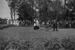
 The soldiers' plot at Groveside Cemetery was established in 1933 and the wooden cross was replaced by a stone cross in 1959.
 The soldiers' plot at Groveside Cemetery was established in 1933 and the wooden cross was replaced by a stone cross in 1959.Whitby Public Library
 - Dedication of cross at Legion Plot in Groveside Cemetery, 1936

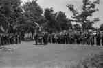
 Reverend E. Ralph Adye was Rector of All Saints' Anglican Church from 1930 to 1941. The soldiers' plot at Groveside Cemetery was established in 1933 and the wooden cross was replaced by a stone cross in 1959.
 Reverend E. Ralph Adye was Rector of All Saints' Anglican Church from 1930 to 1941. The soldiers' plot at Groveside Cemetery was established in 1933 and the wooden cross was …Whitby Public Library
 - Legion Cross at Groveside Cemetery, 1936
 Black and white negative showing the wooden cross on the Legion plot in Groveside Cemetery. The cross was dedicated on 26 July 1936 by Archdeacon G. Warren of York Diocese. It was replaced by a stone cross in 1959. Highway 12 is visible in the background.
  Black and white negative showing the wooden cross on the Legion plot in Groveside Cemetery. The cross was dedicated on 26 July 1936 by Archdeacon G. Warren of York Diocese. …Whitby Public Library
 - Legion Cross at Groveside Cemetery, 1936
 Black and white negative showing the wooden cross on the Legion plot in Groveside Cemetery. The cross was dedicated on 26 July 1936 by Archdeacon G. Warren of York Diocese. It was replaced by a stone cross in 1959.
  Black and white negative showing the wooden cross on the Legion plot in Groveside Cemetery. The cross was dedicated on 26 July 1936 by Archdeacon G. Warren of York Diocese. …Whitby Public Library
Page 1 of 1


