Results


Page 1 of 1
- Ontonagon
 Stereoview of the harbour of Ontonagon, probably from he 1870s. One schooner is moored just left of centre.
  Stereoview of the harbour of Ontonagon, probably from he 1870s. One schooner is moored just left of centre.Maritime History of the Great Lakes
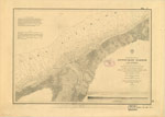
 - Preliminary Chart of Ontonagon Harbor, Lake Superior, 1859
 PRELIMINARY CHART OF ONTONAGON HARBOR LAKE SUPERIOR From surveys under the direction of the TOPOGRAPHICAL BUREAU OF THE WAR DEPARTMENT in obedience to Acts of Congress requiring the SURVEY OF THE NORTH AND NORTH WESTERN LAKES Surveyed and drawn under the direction of Captain J. N. MACOMB ...
  PRELIMINARY CHART OF ONTONAGON HARBOR LAKE SUPERIOR From surveys under the direction of the TOPOGRAPHICAL BUREAU OF THE WAR DEPARTMENT in obedience to Acts of Congress requiring the SURVEY OF …Maritime History of the Great Lakes
 - The Dinkey and crew of Hopkins
 Illustrated appeared with article "Notable Rescue of Lake Superior," Marine Review, February 1912, p. 68
  Illustrated appeared with article "Notable Rescue of Lake Superior," Marine Review, February 1912, p. 68Maritime History of the Great Lakes
 - Lake Superior. Sheet 2 [1823-24, 1863]
 This edition adds a significant number of place names, including lights, fishing stations and Hudson Bay Company posts along with additional notes about local magnetic variations. From the American charts have been added insets for Ontonagon, Agate Harbour and Marquette.
  This edition adds a significant number of place names, including lights, fishing stations and Hudson Bay Company posts along with additional notes about local magnetic variations. From the American charts …Maritime History of the Great Lakes
 - Lake Superior [1878]
 North American Lakes Lake Superior The Canadian Shore from the Admiralty Survey by Lieut't H. W. Bayfield, r. N., 1823-5 The Coast and Plans of the United States from the United States Government Surveys of 1855-72. ... Magnetic Variation in 1883; Westerly increasing, Easterly decreasing ...
  North American Lakes Lake Superior The Canadian Shore from the Admiralty Survey by Lieut't H. W. Bayfield, r. N., 1823-5 The Coast and Plans of the United States from the …Maritime History of the Great Lakes
Page 1 of 1


![Lake Superior. Sheet 2 [1823-24, 1863] Lake Superior. Sheet 2 [1823-24, 1863]](https://images.MaritimeHistoryoftheGreatLakes.ca/images/MHGL000122608t.jpg)
![Lake Superior [1878] Lake Superior [1878]](https://images.MaritimeHistoryoftheGreatLakes.ca/images/MHGL000122621t.jpg)
