Results
We found 52 matching items.


- Painter Family on Handcar, c.1930
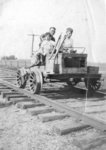
 Black and white photograph showing the Painter family on a railway handcar. The photograph was taken near the station at Myrtle on the Whitby, Port Perry, and Lindsay Railway. George Painter was the station operator. Left to right: Mildred Painter, Kenneth Painter, George Painter, Stanley Painter.
  Black and white photograph showing the Painter family on a railway handcar. The photograph was taken near the station at Myrtle on the Whitby, Port Perry, and Lindsay Railway. George …Whitby Public Library
 - Painter Family, c.1935-1936
 George Painter was the station operator at Myrtle Station, which was a stop on the Whitby, Port Perry, and Lindsay rail line.
  George Painter was the station operator at Myrtle Station, which was a stop on the Whitby, Port Perry, and Lindsay rail line.Whitby Public Library
 - Painter Family Children at Myrtle Station, c.1926
 George Painter was the station operator at Myrtle Station, which a stop on the Whitby, Port Perry, and Lindsay rail line.
  George Painter was the station operator at Myrtle Station, which a stop on the Whitby, Port Perry, and Lindsay rail line.Whitby Public Library
 - John Bright House

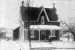
 This home was located on the west side of the side road between lots 21 and 21, Concession 9, Whitby Township. It was built in the early 1870s and was the residence of Malcolm McTaggart, Reeve of Whitby Township. Later the residence belonged to John Bright who served as Dominion …
 This home was located on the west side of the side road between lots 21 and 21, Concession 9, Whitby Township. It was built in the early 1870s and was …Whitby Public Library
 - Myrtle Station
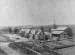
 Myrtle Station was founded at the junction of Highway 12 and the Ontario and Quebec Railway which was built through Whitby Township in 1884. Both the hotel and store in this photograph were destroyed by fire before 1900.
  Myrtle Station was founded at the junction of Highway 12 and the Ontario and Quebec Railway which was built through Whitby Township in 1884. Both the hotel and store in …Whitby Public Library
 - Myrtle Station
 Myrtle Station was founded at the junction of Highway 12 and the Ontario and Quebec Railway which was built through Whitby Township in 1884. After the first hotel and store were destroyed by fire a second hotel and store were built. Later, they too were destroyed by fire.
  Myrtle Station was founded at the junction of Highway 12 and the Ontario and Quebec Railway which was built through Whitby Township in 1884. After the first hotel and store …Whitby Public Library
 - Beacock General Store
 Myrtle Station was founded at the junction of Highway 12 and the Ontario and Quebec Railway which was built through Whitby Township in 1884. Beacock's General Store was destroyed by fire on October 6, 1933.
  Myrtle Station was founded at the junction of Highway 12 and the Ontario and Quebec Railway which was built through Whitby Township in 1884. Beacock's General Store was destroyed by …Whitby Public Library
 - Congregation on the steps of Methodist Church
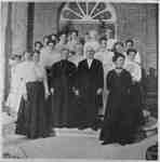
 Myrtle Station Methodist Church was built on the east side of Highway 12 south of the railway tracks in 1908-9. This photograph may have been taken at the opening of the church in 1909.
  Myrtle Station Methodist Church was built on the east side of Highway 12 south of the railway tracks in 1908-9. This photograph may have been taken at the opening of …Whitby Public Library
 - Post Office and General Store, Myrtle Station
 J.E. Beacock's General Store was located on the east side of Highway 12 north of the C.P.R. tracks. The store was destroyed by fire on October 6, 1933.
  J.E. Beacock's General Store was located on the east side of Highway 12 north of the C.P.R. tracks. The store was destroyed by fire on October 6, 1933.Whitby Public Library
 - Street View, Myrtle Station, c.1925
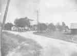
 At the time of this photograph, these houses were located on the east side of Highway 12 north of the C.P.R. tracks at Myrtle Station.Whitby’s house numbering system was provided by Rev. Dr. James Roy Van Wyck (1877-1941), a retired Presbyterian minister. Van Wyck provided this service to the town, …
  At the time of this photograph, these houses were located on the east side of Highway 12 north of the C.P.R. tracks at Myrtle Station.Whitby’s house numbering system was provided …Whitby Public Library
 - Canadian Pacific Railway Station, Myrtle Station, Ontario
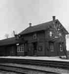
 These railway buildings were located on the east side of Highway 12 at Myrtle Station, Ontario. The grain elevator was built in 1887 and destroyed by fire January 25, 1968. The station was built around 1884 and demolished in 1974.
  These railway buildings were located on the east side of Highway 12 at Myrtle Station, Ontario. The grain elevator was built in 1887 and destroyed by fire January 25, 1968. …Whitby Public Library
 - Train at Grain Elevator and Railway Station
 These railway buildings were located on the east side of Highway 12 at Myrtle Station, Ontario. The grain elevator was built in 1887 and destroyed by fire January 25, 1968. The station was built around 1884 and demolished in 1974.
  These railway buildings were located on the east side of Highway 12 at Myrtle Station, Ontario. The grain elevator was built in 1887 and destroyed by fire January 25, 1968. …Whitby Public Library
 - House at Myrtle Station, c.1925
 At the time of this photograph this house was located on the west side of Highway 12 at the north end of Myrtle Station. Whitby’s house numbering system was provided by Rev. Dr. James Roy Van Wyck (1877-1941), a retired Presbyterian minister. Van Wyck provided this service to the town, …
  At the time of this photograph this house was located on the west side of Highway 12 at the north end of Myrtle Station. Whitby’s house numbering system was provided …Whitby Public Library
 - Myrtle Railway Station, April 11, 1966
 This station was built on the south side of the C.P.R. tracks east of Highway 12 circa 1884. It was demolished circa 1977.
  This station was built on the south side of the C.P.R. tracks east of Highway 12 circa 1884. It was demolished circa 1977.Whitby Public Library
 - House at Myrtle Station, c.1910
 This was the first house south of the Methodist Church on the east side of Highway 12 at Myrtle Station.Whitby’s house numbering system was provided by Rev. Dr. James Roy Van Wyck (1877-1941), a retired Presbyterian minister. Van Wyck provided this service to the town, free of charge, during the …
  This was the first house south of the Methodist Church on the east side of Highway 12 at Myrtle Station.Whitby’s house numbering system was provided by Rev. Dr. James Roy …Whitby Public Library
 - Myrtle Station United Church

 Myrtle Station United Church was located on the east side of Highway 12 south side of the tracks at Myrtle Station. It was built in 1908-9.
 Myrtle Station United Church was located on the east side of Highway 12 south side of the tracks at Myrtle Station. It was built in 1908-9.Whitby Public Library
 - "The Victors," Brights Barn Raising
 This barn raising took place at the farm of John Bright on the west side of Highway 12 north of the CPR tracks.
  This barn raising took place at the farm of John Bright on the west side of Highway 12 north of the CPR tracks.Whitby Public Library
 - "The Feed," Brights Barn Raising
 This barn raising took place at the farm of John Bright on the west side of Highway 12 north of the CPR tracks.
  This barn raising took place at the farm of John Bright on the west side of Highway 12 north of the CPR tracks.Whitby Public Library
 - J.W. Disney farmhouse and livery barn
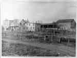
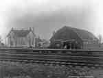
 This house and livery barn were located on the south side of the CPR tracks nearly opposite the railway station at Myrtle Station. The livery barn was demolished in 1927.
  This house and livery barn were located on the south side of the CPR tracks nearly opposite the railway station at Myrtle Station. The livery barn was demolished in 1927.Whitby Public Library
 - C.P.R. Railway Station
 This railroad station was built in 1884 when the Ontario and Quebec Railway was built through Whitby Township. It was located on the south side of the tracks, east of Highway 12. The building was painted a light colour for some time. In 1914 it was painted red. In 1974 …
  This railroad station was built in 1884 when the Ontario and Quebec Railway was built through Whitby Township. It was located on the south side of the tracks, east of …Whitby Public Library

