Results
We found 13 matching items.


Page 1 of 1
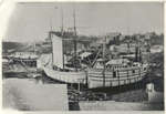
- Louis Shickluna's shipyard at St. Catharines, c 1863
 Used to illustrate Ivan S. Brookes, Hamilton Harbor, 1826-1901.
  Used to illustrate Ivan S. Brookes, Hamilton Harbor, 1826-1901.Maritime History of the Great Lakes
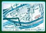
 - Hand Spike Windlass
 Barge Eveready and the method used in raising the anchor.
  Barge Eveready and the method used in raising the anchor.Maritime History of the Great Lakes
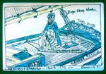
 - Larbord & Starbord
 Showing the old fashioned way of steering a sailing ship.
  Showing the old fashioned way of steering a sailing ship.Maritime History of the Great Lakes
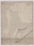
 - Lake Huron. Rattle Snake Harbour [1828, 1863]
 Lake Huron Rattle Snake Harbour by Lieut. H. W. Bayfield R. N. NB The sounds are in feet Variation 1861 increasing 4' annually London Published according to Act of Parliament at the Hydrographical Office of the Admiralty, 3d June 1828. Corr'tns 11861. June 63 J. & C. Walker Sculpt...
  Lake Huron Rattle Snake Harbour by Lieut. H. W. Bayfield R. N. NB The sounds are in feet Variation 1861 increasing 4' annually London Published according to Act of Parliament …Maritime History of the Great Lakes
 - Upper Canada: Plans of Ports in Lake Huron:
Penetanguishene, Collingwood, Goderich
 Georgian Bay Penetanguishene Harbour Surveyed by Lieut. Henry W. Bayfield, R. N. 1822 -- Georgian Bay Collingwood harbour Surveyed by Mr. Wm. Gibbard, C.E. April 1858 -- Goderich Harbour Surveyed by Mr. F. A. Wise July 1861 Lighthouse, Lat. 49. 45' 0 N. Long 81. 41'. W. from Greenwich ...
  Georgian Bay Penetanguishene Harbour Surveyed by Lieut. Henry W. Bayfield, R. N. 1822 -- Georgian Bay Collingwood harbour Surveyed by Mr. Wm. Gibbard, C.E. April 1858 -- Goderich Harbour Surveyed …Maritime History of the Great Lakes
 - Plan of Toronto Harbour, Lake Ontario [1863]
 Although based on the 1817 chart, this edition is substantially revised. The streets and wharves of the city of Toronto have been completely redrawn to reflect the new wharves and the infilling of the waterfront. The shoal around Gibraltar Point has been reconfigured, and shows the buoys at the Western …
  Although based on the 1817 chart, this edition is substantially revised. The streets and wharves of the city of Toronto have been completely redrawn to reflect the new wharves and …Maritime History of the Great Lakes
 - Lake Erie. Long Point Bay [1839, 1863]
 This edition added lights, place names a road and a note about the New Channel silting up in 1862.
  This edition added lights, place names a road and a note about the New Channel silting up in 1862.Maritime History of the Great Lakes
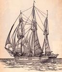
 - Barque SARAH ANN MARSH

 Maritime History of the Great Lakes
 - Survey of the River Niagara [1817, 1863]
 Survey of the River Niagara. Made under the direction of Capt'n W'm Fitz W'm. Owen, in the Year 1817 The enlarged Plan of the Entrance, & that on the smaller Scale distinguished by upright Soundings, is from the United States Survey corrected to 1856. The Soundings are laid down in …
  Survey of the River Niagara. Made under the direction of Capt'n W'm Fitz W'm. Owen, in the Year 1817 The enlarged Plan of the Entrance, & that on the smaller …Maritime History of the Great Lakes
 - Lake Superior. Sheet 2 [1823-24, 1863]
 This edition adds a significant number of place names, including lights, fishing stations and Hudson Bay Company posts along with additional notes about local magnetic variations. From the American charts have been added insets for Ontonagon, Agate Harbour and Marquette.
  This edition adds a significant number of place names, including lights, fishing stations and Hudson Bay Company posts along with additional notes about local magnetic variations. From the American charts …Maritime History of the Great Lakes
 - North East End of Lake Michigan, 1863
 SURVEY OF THE NORTHERN AND NORTH WESTERN LAKES Made in obedience to acts of Congress and under the direction of THE BUREAU OF ENGINEERS OF THE WAR DEPARTMENT NORTH EAST END OF LAKE MICHIGAN INCLUDING GRAND AND LITTLE TRAVERSE BYAS AND THE FOX AND MANITOU ISLANDS Projected from
  SURVEY OF THE NORTHERN AND NORTH WESTERN LAKES Made in obedience to acts of Congress and under the direction of THE BUREAU OF ENGINEERS OF THE WAR DEPARTMENT NORTH EAST …Maritime History of the Great Lakes
 - West End of Fond Du Lac of Lake Superior (1863)
 SURVEY OF THE NORTH AND NORTH WESTERN LAKES Made in obedience to Acts of Congress and under the direction of THE BUREAU OF TOPOGRAPHICAL ENGINEERS OF THE WAR DEPARTMENT PRELIMINARY CHART OF WEST END OF FOND DU LAC OF LAKE SUPERIOR EMBRACING SUPERIOR, ST. LOUIS AND ALLOUEZ BAYS AND THE …
  SURVEY OF THE NORTH AND NORTH WESTERN LAKES Made in obedience to Acts of Congress and under the direction of THE BUREAU OF TOPOGRAPHICAL ENGINEERS OF THE WAR DEPARTMENT PRELIMINARY …Maritime History of the Great Lakes
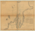
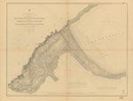
 - Chart of part of the North Coast of Lake Superior from Grand Portage Bay to Hawk Islet, including Isle Royale [1823-25, 1863]
 Chart of part of the North Coast of Lake Superior, from Grand Portage Bay to Hawk Islet, including Isle Royale Surveyed by Lieu't Henry W'y Bayfield R. N. and his Assistant Mr. Philip E. Collins Mid'n R. N. N.B.The Soundings are in Feet --inset-- Track Survey of the River ...
  Chart of part of the North Coast of Lake Superior, from Grand Portage Bay to Hawk Islet, including Isle Royale Surveyed by Lieu't Henry W'y Bayfield R. N. and his …Maritime History of the Great Lakes
Page 1 of 1

![Lake Huron. Rattle Snake Harbour [1828, 1863] Lake Huron. Rattle Snake Harbour [1828, 1863]](https://images.MaritimeHistoryoftheGreatLakes.ca/images/MHGL000122587t.jpg)
![Plan of Toronto Harbour, Lake Ontario [1863] Plan of Toronto Harbour, Lake Ontario [1863]](https://images.MaritimeHistoryoftheGreatLakes.ca/images/MHGL000122607t.jpg)
![Lake Erie. Long Point Bay [1839, 1863] Lake Erie. Long Point Bay [1839, 1863]](https://images.MaritimeHistoryoftheGreatLakes.ca/images/MHGL000122615t.jpg)
![Survey of the River Niagara [1817, 1863] Survey of the River Niagara [1817, 1863]](https://images.MaritimeHistoryoftheGreatLakes.ca/images/MHGL000122603t.jpg)
![Lake Superior. Sheet 2 [1823-24, 1863] Lake Superior. Sheet 2 [1823-24, 1863]](https://images.MaritimeHistoryoftheGreatLakes.ca/images/MHGL000122608t.jpg)
![Chart of part of the North Coast of Lake Superior from Grand Portage Bay to Hawk Islet, including Isle Royale [1823-25, 1863] Chart of part of the North Coast of Lake Superior from Grand Portage Bay to Hawk Islet, including Isle Royale [1823-25, 1863]](https://images.MaritimeHistoryoftheGreatLakes.ca/images/MHGL000122610t.jpg)
