Results
We found 68 matching items.


- Sakoose Mine Bunkhouses in Dyment
 Also known as Watson or Golden Whale mine. Sakoose mine as located in the New Klondike District south of Dyment in 1898.
  Also known as Watson or Golden Whale mine. Sakoose mine as located in the New Klondike District south of Dyment in 1898.Dryden Public Library
 - Pakwash Bay (1946)
 Bush plane bringing in supplies to Pakwash Bay, 1946.
  Bush plane bringing in supplies to Pakwash Bay, 1946.Thunder Bay Public Library
 - A Scow Hauling Trucks (1946)
 Gravel Trucks being transported from Sioux Lookout to the Ear Falls construction area by scow. Once they reached the shore, trucks were driven to English River, where they were loaded onto other scows.
  Gravel Trucks being transported from Sioux Lookout to the Ear Falls construction area by scow. Once they reached the shore, trucks were driven to English River, where they were loaded …Thunder Bay Public Library
 - Tomlinson Bros.Contractors - Gravel Pits - Ear Falls
 Tomlinson Bros. Contractors were awarded the contract to build the highway to Red Lake, Ontario in 1946. Truckers, Bert and Harold Mcgonicle pose by their trucks in a gravel pit near Ear Falls, Ontario. The road building required the clearing of 1325 acres of land and the excavation of 400,000 …
  Tomlinson Bros. Contractors were awarded the contract to build the highway to Red Lake, Ontario in 1946. Truckers, Bert and Harold Mcgonicle pose by their trucks in a gravel pit …Thunder Bay Public Library
 - Barge Tow
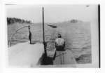
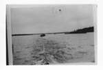
 Barge being towed down Lake Seul to Ear Falls Portage
  Barge being towed down Lake Seul to Ear Falls PortageThunder Bay Public Library
 - Barge Tow
 Barge being towed down Lac Seul to Ear Falls Portage
  Barge being towed down Lac Seul to Ear Falls PortageThunder Bay Public Library
 - Lac Seul Dam (1941)
 A view of the Lac Seul Dam on the English River taken from the top of stairway to the generating system, October 9, 1941.
  A view of the Lac Seul Dam on the English River taken from the top of stairway to the generating system, October 9, 1941.Ear Falls Public Library
 - Ear Falls Dam - Unit #4
 Black and white photo of Unit #4 of the Ear Falls Generating Station. Here, workers are pouring the concrete floor for the lower section of the dam.
  Black and white photo of Unit #4 of the Ear Falls Generating Station. Here, workers are pouring the concrete floor for the lower section of the dam.Ear Falls Public Library
 - Ear Falls Dam. Dev #4
 Photo showing concrete forms used in Dev #4 of the Lac Seul Dam construction. Regular conduits of concrete were built instead of wood stave pipes. The wood pipes had been used in the first two units of dam construction.
  Photo showing concrete forms used in Dev #4 of the Lac Seul Dam construction. Regular conduits of concrete were built instead of wood stave pipes. The wood pipes had been …Ear Falls Public Library
 - Ear Falls - Dev #4
 Photo showing the lower section of the Lac Seul dam construction, where re-inforced steel was used as forms for the concrete.
  Photo showing the lower section of the Lac Seul dam construction, where re-inforced steel was used as forms for the concrete.Ear Falls Public Library
 - Ear Falls Dev - Unit #4 (1946)
 Black and white photo of the inside of the tunnel at Ear Falls Generating Station Unit #4, May 5 1946.
  Black and white photo of the inside of the tunnel at Ear Falls Generating Station Unit #4, May 5 1946.Ear Falls Public Library
 - Rotor - Ear Falls Generating Station (May 1948)
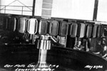
 Black and white photo of lowering of the rotor at the Ear Falls Generating Plant, Unit #4 May 27, 1948.
  Black and white photo of lowering of the rotor at the Ear Falls Generating Plant, Unit #4 May 27, 1948.Ear Falls Public Library
 - Hydro Colony - Ear Falls (1957)

 Aerial photograph of the Hydro colony of Ear Falls, Ontario 1957. The area was created to house the hydro workers and their families.
 Aerial photograph of the Hydro colony of Ear Falls, Ontario 1957. The area was created to house the hydro workers and their families.Ear Falls Public Library
 - Ear Falls Generating Station
 Photo shows the emergency exit at the Ear Falls Generating Station, September 12, 1942.
  Photo shows the emergency exit at the Ear Falls Generating Station, September 12, 1942.Ear Falls Public Library
 - Ear Falls Generating Station
 Photo of the emergency exit, Lac Seul/Ear Falls generating station, September 12, 1942.
  Photo of the emergency exit, Lac Seul/Ear Falls generating station, September 12, 1942.Ear Falls Public Library
 - Generating Station Switchboard
 Ear Falls generating station switchboard, March 20, 1933.
  Ear Falls generating station switchboard, March 20, 1933.Ear Falls Public Library
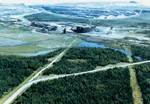
 - Aerial View of Griffith Mine - Buildings
 Mine tailings and disposal., Top right - Pellet Reducing kiln. Round structure is tailing tank. To the right is the crusher buildings.
  Mine tailings and disposal., Top right - Pellet Reducing kiln. Round structure is tailing tank. To the right is the crusher buildings.Ear Falls Public Library
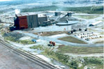
 - Aerial View of Griffith Mine
 Building to the right is pellet plant. To the left is the kiln, and in the background is the open pit mine.
  Building to the right is pellet plant. To the left is the kiln, and in the background is the open pit mine.Ear Falls Public Library
 - Aerial View of the Griffith Mine
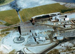
 Big red and grey building is the pellet plant. To the right is the tailings tank and crusher behind it.
  Big red and grey building is the pellet plant. To the right is the tailings tank and crusher behind it.Ear Falls Public Library
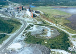
 - Aerial View of the Griffith Mine
 White building to the right is the kiln. Large dark buildings to the left is pellet plant.
  White building to the right is the kiln. Large dark buildings to the left is pellet plant.Ear Falls Public Library


