Results
We found 3 matching items.


Page 1 of 1
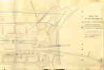
- Second Welland Canal - Book 3, Survey Map 21 - Village of Port Colborne


 Survey map of the Second Welland Canal created by the Welland Canal Company showing the areas in and around Port Colborne. Identified structures associated with the Canal include Lighthouse, Pier Light, Old Lock House, Collector's Office, Harbour Master's House, Canal Boundary, Back Ditch, Reserved Back Ditch, Basin, Light-Keeper's House and …

 Survey map of the Second Welland Canal created by the Welland Canal Company showing the areas in and around Port Colborne. Identified structures associated with the Canal include Lighthouse, Pier …Brock University Archives
 - Second Welland Canal - Book 3, Survey Map 20 - Village of Port Colborne


 Survey map of the Second Welland Canal created by the Welland Canal Company showing the areas in and around Port Colborne and Grantham Township. Identified structures associated with the Canal include Basin, Guard Lock, Two Lock Tender Houses, Lock House Lot, Collectors Office House, Towing Path, North and South Back …

 Survey map of the Second Welland Canal created by the Welland Canal Company showing the areas in and around Port Colborne and Grantham Township. Identified structures associated with the Canal …Brock University Archives
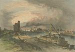
 - Entrance to Welland Canal
 Illustration of Port Colborne harbour and the southern terminus of the Welland Canal during the second canal era, c.1881. The west pier and lighthouse are depicted in the background.
  Illustration of Port Colborne harbour and the southern terminus of the Welland Canal during the second canal era, c.1881. The west pier and lighthouse are depicted in the background.Port Colborne Historical and Marine Museum
Page 1 of 1


