Results
We found 89 matching items.


- Worden Cemetary
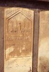
 Worden Pioneer cemetery at corner of Highway 7 (27 Sideroad) and 5th line. Close-up of Elizabeth Worden gravestone wife of samuel Worden
  Worden Pioneer cemetery at corner of Highway 7 (27 Sideroad) and 5th line. Close-up of Elizabeth Worden gravestone wife of samuel WordenEsquesing Historical Society
 - Acton Fairview Cemetery, memorial to Fred Crewson
 – Acton Fairview Cemetery, memorial to Fred Crewson, 1962.
  – Acton Fairview Cemetery, memorial to Fred Crewson, 1962.Esquesing Historical Society
 - Large Stone House John G Irving Farm
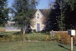
 SCOTCH BLOCK - John G. Irving farm on east half of lot 6, Concession 1. The large stone farmhouse was owned by K. Fry in 1986.
  SCOTCH BLOCK - John G. Irving farm on east half of lot 6, Concession 1. The large stone farmhouse was owned by K. Fry in 1986.Esquesing Historical Society
 - The Barn of Hugh Hunter
 CREWSONS CORNERS - The barn of Hugh Hunter, being #6038 32 Sideroad, Esquesing.
  CREWSONS CORNERS - The barn of Hugh Hunter, being #6038 32 Sideroad, Esquesing.Esquesing Historical Society
 - The Pottery Shop
 CREWSONS CORNERS - The pottery shop, former Shell station on the Nassagewayacorner on Highway #7.
  CREWSONS CORNERS - The pottery shop, former Shell station on the Nassagewayacorner on Highway #7.Esquesing Historical Society
 - Nassagaweya-Esqueising Townline
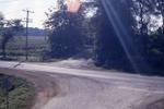
 CREWSONS CORNERS - Highway #7 runs across this picture with the Esquesing- Nassagewaya Townline (dead-end) running south. Photo taken by Mark Rowe from on top of the CNR bridge.
  CREWSONS CORNERS - Highway #7 runs across this picture with the Esquesing- Nassagewaya Townline (dead-end) running south. Photo taken by Mark Rowe from on top of the CNR bridge.Esquesing Historical Society
 - Looking North at Crewson's Corners
 CREWSONS CORNERS - Looking north from the CNR bridge into the Corners.
  CREWSONS CORNERS - Looking north from the CNR bridge into the Corners.Esquesing Historical Society
 - The Thomas Lazenby home in Eramosa twp.
 CREWSONS CORNERS - The Thomas Lazenby home in Eramosa twp.
  CREWSONS CORNERS - The Thomas Lazenby home in Eramosa twp.Esquesing Historical Society
 - The Former Hotel/Store
 The former hotel/store on the Erin Twp side. Susan Townsend (Taillifer) bought it in 1938 from Charles Lambert and continued it as a store. The store section was later removed.
  The former hotel/store on the Erin Twp side. Susan Townsend (Taillifer) bought it in 1938 from Charles Lambert and continued it as a store. The store section was later removed.Esquesing Historical Society
 - A Stone Stable
 A stone stable near the Ballinafad sideroad, in Erin Twp. The stone barn behind was built by Morgan Crewson in 1847.
  A stone stable near the Ballinafad sideroad, in Erin Twp. The stone barn behind was built by Morgan Crewson in 1847.Esquesing Historical Society
 - A Stone Stable near Balinifad
 A stone stable near the Ballinafad sideroad, in Erin Twp. The stone barn behind was built by Morgan Crewson in 1847.
  A stone stable near the Ballinafad sideroad, in Erin Twp. The stone barn behind was built by Morgan Crewson in 1847.Esquesing Historical Society
 - The Hunter Home
 - The Hunter home at #6038 Ballinafad Sideroad in Esquesing. Owners of this property have included the Cripps, Soper and Nightengale families.
  - The Hunter home at #6038 Ballinafad Sideroad in Esquesing. Owners of this property have included the Cripps, Soper and Nightengale families.Esquesing Historical Society
 - Home Build by Morgan Crewson
 CREWSONS CORNERS - The Smith and Yates (1993) home, built by Morgan Crewson.
  CREWSONS CORNERS - The Smith and Yates (1993) home, built by Morgan Crewson.Esquesing Historical Society
 - The Halton Hills Body Shop
 CREWSONS CORNERS - The Halton Hills Body shop, being in business for 25 years (1993). Looking west along the Ballinafad Sideroad.
  CREWSONS CORNERS - The Halton Hills Body shop, being in business for 25 years (1993). Looking west along the Ballinafad Sideroad.Esquesing Historical Society
 - CHURCHILL - The lone pine looking east in the cemetery
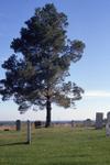
 CHURCHILL - The lone pine looking east in the cemetery established about 1838. This is also the site of Churchill Common School.
  CHURCHILL - The lone pine looking east in the cemetery established about 1838. This is also the site of Churchill Common School.Esquesing Historical Society
 - Churchill Cemetery across from the church
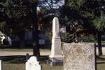
 CHURCHILL - Monuments in the cemetery across from the church.
  CHURCHILL - Monuments in the cemetery across from the church.Esquesing Historical Society
 - Churchill Community Church
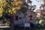
 The Churchill Community Church, built in 1843 for the Congregational Church, joining the United Church in 1926. When threatened with closure about 1968, the congregation took back control and declared itself a community church. Photo
  The Churchill Community Church, built in 1843 for the Congregational Church, joining the United Church in 1926. When threatened with closure about 1968, the congregation took back control and declared …Esquesing Historical Society
 - Churchill Cemetery Plaque
 The historic plaque at the cemetery.
  The historic plaque at the cemetery.Esquesing Historical Society
 - Worden Pioneer cemetery
Close-up of the cairn.
 Worden Pioneer cemetery at corner of Highway 7 (27 Sideroad) and 5thline. Close-up of the cairn.
  Worden Pioneer cemetery at corner of Highway 7 (27 Sideroad) and 5thline. Close-up of the cairn.Esquesing Historical Society
 - Worden Pioneer cemetery
 Worden Pioneer cemetery at corner of Highway 7 (27 Sideroad) and 5th line. Close-up of the cairn.
  Worden Pioneer cemetery at corner of Highway 7 (27 Sideroad) and 5th line. Close-up of the cairn.Esquesing Historical Society

