Results
We found 18 matching items.


Page 1 of 1
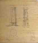
- Lighthouse at Mississauga Point- 1909 copy of an 1804 original plan
 A 1909 copy of an 1804 original plan of the lighthouse that was erected on Mississauga Point, signed by Gustavus Nicolls and copied by J. Simpson. The lighthouse, the first on the Great Lakes, was dismantled in 1814 in order to build Fort Mississauga. Some of the stone from the …
  A 1909 copy of an 1804 original plan of the lighthouse that was erected on Mississauga Point, signed by Gustavus Nicolls and copied by J. Simpson. The lighthouse, the first …
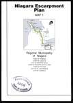
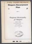
 - Niagara Escarpment Plan: Regional Municipality of Niagara, 1994 (Map 1)
 Map of a section of the Niagara Escarpment, encompassing the Regional Municipality of Niagara. This includes Grimsby, Lincoln, Niagara Falls, Niagara-on-the-Lake, Pelham, St. Catharines, and Thorold. Compiled as a part of a full proposed revision to the Niagara Escarpment Plan in 1994. Map information was supplied by the Department of …
  Map of a section of the Niagara Escarpment, encompassing the Regional Municipality of Niagara. This includes Grimsby, Lincoln, Niagara Falls, Niagara-on-the-Lake, Pelham, St. Catharines, and Thorold. Compiled as a part …Niagara-on-the-Lake Public Library
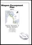
 - Niagara Escarpment Plan: Regional Municipality of Hamilton-Wentworth, 1994 (Map 2)
 Map of a section of the Niagara Escarpment, encompassing the Regional Municipality of Hamilton-Wentworth. This includes Ancaster, Dundas, Flamborough, Hamilton, and Stoney Creek. Compiled as a part of a full proposed revision to the Niagara Escarpment Plan in 1994. Map information was supplied by the Department of Energy, Mines, and …
  Map of a section of the Niagara Escarpment, encompassing the Regional Municipality of Hamilton-Wentworth. This includes Ancaster, Dundas, Flamborough, Hamilton, and Stoney Creek. Compiled as a part of a full …Niagara-on-the-Lake Public Library
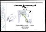
 - Niagara Escarpment Plan: Regional Municipality of Halton, 1994 (Map 3)
 Map of a section of the Niagara Escarpment, encompassing the Regional Municipality of Halton. This includes Burlington, Halton Hills, and Milton. Compiled as a part of a full proposed revision to the Niagara Escarpment Plan in 1994. Map information was supplied by the Department of Energy, Mines, and Resources c. …
  Map of a section of the Niagara Escarpment, encompassing the Regional Municipality of Halton. This includes Burlington, Halton Hills, and Milton. Compiled as a part of a full proposed revision …Niagara-on-the-Lake Public Library
 - Niagara Escarpment Plan: County of Dufferin and Municipality of Peel, 1994 (Map 4)
 Map of a section of the Niagara Escarpment, encompassing the Regional Municipality of Peel and the County of Dufferin. This includes the town of Caledon and Township of Mono. Compiled as a part of a full proposed revision to the Niagara Escarpment Plan in 1994. Map information was supplied by …
  Map of a section of the Niagara Escarpment, encompassing the Regional Municipality of Peel and the County of Dufferin. This includes the town of Caledon and Township of Mono. Compiled …Niagara-on-the-Lake Public Library
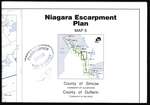
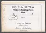
 - Niagara Escarpment Plan: County of Simcoe and County of Dufferin, 1994 (Map 5)
 Map of a section of the Niagara Escarpment, encompassing the Counties of Simcoe and Dufferin. This includes the Townships of Clearview and Mulmur. Compiled as a part of a full proposed revision to the Niagara Escarpment Plan in 1994. Map information was supplied by the Department of Energy, Mines, and …
  Map of a section of the Niagara Escarpment, encompassing the Counties of Simcoe and Dufferin. This includes the Townships of Clearview and Mulmur. Compiled as a part of a full …Niagara-on-the-Lake Public Library
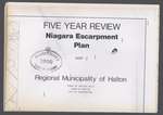
 - Niagara Escarpment Plan: Regional Municipality of Halton, 1991 (Map 3)
 Map of a section of the Niagara Escarpment, encompassing the Municipality of Halton. This includes Halton Hills, Milton, and Burlington. Compiled as a part of a full proposed revision to the Niagara Escarpment Plan in 1991. Map information was supplied by the Department of Energy, Mines, and Resources c. 1980. …
  Map of a section of the Niagara Escarpment, encompassing the Municipality of Halton. This includes Halton Hills, Milton, and Burlington. Compiled as a part of a full proposed revision to …Niagara-on-the-Lake Public Library
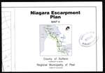
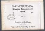
 - Niagara Escarpment Plan: County of Dufferin and Regional Municipality of Peel, 1991 (Map 4)
 Map of a section of the Niagara Escarpment, encompassing the County of Dufferin and Municipality of Peel. This includes the township of Mono and town of Caledon. Compiled as a part of a full proposed revision to the Niagara Escarpment Plan in 1991. Map information was supplied by the Department …
  Map of a section of the Niagara Escarpment, encompassing the County of Dufferin and Municipality of Peel. This includes the township of Mono and town of Caledon. Compiled as a …Niagara-on-the-Lake Public Library
 - Niagara Escarpment Plan: County of Dufferin and County of Simcoe, 1991 (Map 5)
 Map of a section of the Niagara Escarpment, encompassing the County of Dufferin and County of Simcoe. This includes Nottawasaga, Mulmur, and Melancthon. Compiled as a part of a full proposed revision to the Niagara Escarpment Plan in 1991. Map information was supplied by the Department of Energy, Mines, and …
  Map of a section of the Niagara Escarpment, encompassing the County of Dufferin and County of Simcoe. This includes Nottawasaga, Mulmur, and Melancthon. Compiled as a part of a full …Niagara-on-the-Lake Public Library
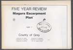
 - Niagara Escarpment Plan: County of Grey, 1991 (Map 7)
 Map of a section of the Niagara Escarpment, encompassing part of the County of Grey. This includes Derby, Holland, Keppel, Sarawak, Sydenham, and Owen Sound. Compiled as a part of a full proposed revision to the Niagara Escarpment Plan in 1991. Map information was supplied by the Department of Energy, …
  Map of a section of the Niagara Escarpment, encompassing part of the County of Grey. This includes Derby, Holland, Keppel, Sarawak, Sydenham, and Owen Sound. Compiled as a part of …Niagara-on-the-Lake Public Library
 - Niagara Escarpment Plan: Regional Municipality of Niagara, 1991 (Map 1)
 Map of a section of the Niagara Escarpment, encompassing the Municipality of Niagara. This includes Grimsby, Lincoln, Niagara-on-the-Lake, Pelham, Thorold, Niagara Falls, and St. Catharines. Compiled as a part of a full proposed revision to the Niagara Escarpment Plan in 1991. Map information was supplied by the Department of Energy, …
  Map of a section of the Niagara Escarpment, encompassing the Municipality of Niagara. This includes Grimsby, Lincoln, Niagara-on-the-Lake, Pelham, Thorold, Niagara Falls, and St. Catharines. Compiled as a part of …Niagara-on-the-Lake Public Library
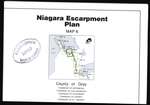
 - Niagara Escarpment Plan: County of Grey, 1994 (Map 6)
 Map of a section of the Niagara Escarpment, encompassing the County of Grey. This includes the Townships of Artemeisa, Collingwood, Euphrasia, Osprey, and St. Vincent. Compiled as a part of a full proposed revision to the Niagara Escarpment Plan in 1994. Map information was supplied by the Department of Energy, …
  Map of a section of the Niagara Escarpment, encompassing the County of Grey. This includes the Townships of Artemeisa, Collingwood, Euphrasia, Osprey, and St. Vincent. Compiled as a part of …Niagara-on-the-Lake Public Library
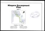
 - Niagara Escarpment Plan: County of Grey, 1994 (Map 7)
 Map of a section of the Niagara Escarpment, encompassing the County of Grey. This includes the Townships of Derby, Holland, Keppel, Sarawak, Sydenham, and the city of Owen Sound. Compiled as a part of a full proposed revision to the Niagara Escarpment Plan in 1994. Map information was supplied by …
  Map of a section of the Niagara Escarpment, encompassing the County of Grey. This includes the Townships of Derby, Holland, Keppel, Sarawak, Sydenham, and the city of Owen Sound. Compiled …Niagara-on-the-Lake Public Library
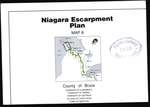
 - Niagara Escarpment Plan: County of Bruce, 1994 (Map 8)
 Map of a section of the Niagara Escarpment, encompassing the County of Bruce. This includes the Townships Albermarle, Amabel, and Eastnor, the town of Wiarton, and the Village of Lion's Head. Compiled as a part of a full proposed revision to the Niagara Escarpment Plan in 1994. Map information was …
  Map of a section of the Niagara Escarpment, encompassing the County of Bruce. This includes the Townships Albermarle, Amabel, and Eastnor, the town of Wiarton, and the Village of Lion's …Niagara-on-the-Lake Public Library
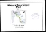
 - Niagara Escarpment Plan: County of Bruce, 1994 (Map 9)
 Map of a section of the Niagara Escarpment, encompassing the Bruce. This includes the Townships of Lindsay and St. Edmunds. Compiled as a part of a full proposed revision to the Niagara Escarpment Plan in 1994. Map information was supplied by the Department of Energy, Mines, and Resources c. 1989-1992. …
  Map of a section of the Niagara Escarpment, encompassing the Bruce. This includes the Townships of Lindsay and St. Edmunds. Compiled as a part of a full proposed revision to …Niagara-on-the-Lake Public Library
 - Plan of Queenston before 1920, sketch

 Scale: 100 Ft.= 1 in
 Scale: 100 Ft.= 1 inNiagara-on-the-Lake Public Library
 - Sketch of lots in Queenston

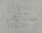
 Sketch of some lots in a village of Queenston, located between Dumfries, Princess, Partition and Queen [today: Queenston] streets. One lot marked in red indicates location of the Queenston Baptist Church. Drawing on wax paper; undated.
 Sketch of some lots in a village of Queenston, located between Dumfries, Princess, Partition and Queen [today: Queenston] streets. One lot marked in red indicates location of the Queenston Baptist …Niagara-on-the-Lake Public Library
 - Plan of Solomon's Temple

 English-born watercolour painter Joseph Thomas Rolph specialized in engraving and lithography after moving to Toronto, where he was one of the most popular artists in this field in 19th century. When the Ontario School of Art was founded in 1876, he also worked there as a teacher of engraving.
 English-born watercolour painter Joseph Thomas Rolph specialized in engraving and lithography after moving to Toronto, where he was one of the most popular artists in this field in 19th century. …Niagara-on-the-Lake Public Library
Page 1 of 1

