Results


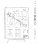
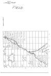
- Schéma routier du canton de Field / Field Township road diagram
 Reproduction d'un document / Reproduction of a document
  Reproduction d'un document / Reproduction of a documentClub généalogique du Nipissing Ouest
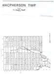
 - Carte du canton de MacPherson / MacPherson Township map
 Reproduction d'un document / Reproduction of a document
  Reproduction d'un document / Reproduction of a documentClub généalogique du Nipissing Ouest
 - Carte du canton de Springer / Springer Township map
 Reproduction d'un document / Reproduction of a document
  Reproduction d'un document / Reproduction of a documentClub généalogique du Nipissing Ouest
 - Carte du canton de Grant / Grant Township map
 Reproduction d'un document / Reproduction of a document
  Reproduction d'un document / Reproduction of a documentClub généalogique du Nipissing Ouest
 - Carte du canton de Caldwell (Section du Nord) / Caldwell (North Section) Township map
 Reproduction d'un document / Reproduction of a document
  Reproduction d'un document / Reproduction of a documentClub généalogique du Nipissing Ouest
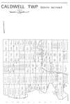
 - Carte du canton de Caldwell (Section du Sud) / Caldwell (South Section) Township map
 Reproduction d'un document / Reproduction of a document
  Reproduction d'un document / Reproduction of a documentClub généalogique du Nipissing Ouest
 - Carte du canton de Kirkpatrick / Kirkpatrick Township map
 Reproduction d'un document / Reproduction of a document
  Reproduction d'un document / Reproduction of a documentClub généalogique du Nipissing Ouest
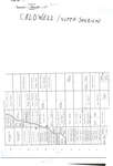
 - Schéma routier du canton de Caldwell / Caldwell Township road diagram
 Schéma routier détaillé du canton de Caldwell incluant le placement des routes, pont, croisements et bâtiments. / Detailed road diagram for the Township of Caldwell including the placement of roads, bridges, crossings and buildings.
  Schéma routier détaillé du canton de Caldwell incluant le placement des routes, pont, croisements et bâtiments. / Detailed road diagram for the Township of Caldwell including the placement of roads, …Club généalogique du Nipissing Ouest
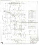
 - Carte du canton de Field / Field Township map
 Reproduction d'un document / Reproduction of a document
  Reproduction d'un document / Reproduction of a documentClub généalogique du Nipissing Ouest
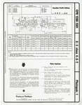
 - Diagram of Steam Engine

 Images follow diagram.
 Images follow diagram.Schreiber Public Library
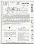
 - Diagram of Steam Engine

 Diagrams of Steam Engines with descriptions. Information included about the engines including measurements.
 Diagrams of Steam Engines with descriptions. Information included about the engines including measurements.Schreiber Public Library
 - Map of Tansley, 1877
 ...
...  ...Burlington Historical Society
 - Map of Village of Burlington, 1877
 The Village of Burlington, incorporated in September 1873, included the former Port Nelson (with the easterly border on "Guelph St.", now the Guelph Line); Wellington Square from the 3 wharves (Baxters, Torrances and Buntons) to Caroline Street; the Great Western Railway station in the hamlet of Freeman; and some outlying …
  The Village of Burlington, incorporated in September 1873, included the former Port Nelson (with the easterly border on "Guelph St.", now the Guelph Line); Wellington Square from the 3 wharves …Burlington Historical Society
 - Map of Port Nelson (Plan 45, registered 1869)
 ...
...  ...Burlington Historical Society
 - Map of Kilbride (Plan 18, registered 1852 and Plan 58, registered 1873), 1877
 The street names in the original subdivison plan registered by William Panton and Francis Baker in 1853 are drawn from names in their families. Rebecca Street is now Cedar Springs Road. Thomas Street and Baker Street are now Kilbride Street.
  The street names in the original subdivison plan registered by William Panton and Francis Baker in 1853 are drawn from names in their families. Rebecca Street is now Cedar Springs …Burlington Historical Society
 - Map of Cumminsville (Plan 26, registered 1857), 1877
 ...
...  ...Burlington Historical Society
 - Map of Hannahsville (Plan 48, registered 1870) , 1873
 The hamlet was named Hannahsville by Caleb Hopkins, after his wife Hannah Green, but by 1877 it was renamed Nelson. The Hopkins property was on the northeast corner of Dundas Street and Guelph Line. The Hopkins Burying Vault shown at the upper left was covered over when Guelph Line was …
  The hamlet was named Hannahsville by Caleb Hopkins, after his wife Hannah Green, but by 1877 it was renamed Nelson. The Hopkins property was on the northeast corner of Dundas …Burlington Historical Society
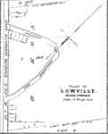
 - Map of Lowville (Plan 22, registered 1857), 1877
 ...
...  ...Burlington Historical Society
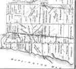
 - Map of East Flamborough, detail, 1875
 ...
...  ...Burlington Historical Society
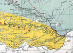
 - Map of North Lake Area
 Map shows 'PeeDee' line through the North Lake area in Northwestern Ontario.
  Map shows 'PeeDee' line through the North Lake area in Northwestern Ontario.The Duke Hunt Museum

