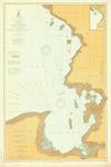
- Lake Ontario, 1877

"Survey of the Northern and Northwestern Lakes made in obedience to acts of Congress and orders from the Headquarters of the Corps of Engineers, War Department. Lake Ontario Projected from trigonometrical Surveys executed under the orders of Major C. B. Comstock, Corps of Engineers, Brvt. ...

"Survey of the Northern and Northwestern Lakes made in obedience to acts of Congress and orders from the Headquarters of the Corps of Engineers, War Department. Lake Ontario Projected from …
Maritime History of the Great Lakes
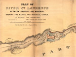
- Plan of River St. Lawrence Between Prescott and Montreal Shewing the Rapids, and Provincial Canals, to Improve the Navigation.

George Mathews, Montreal is credited as the lithographer

George Mathews, Montreal is credited as the lithographer
Maritime History of the Great Lakes
- Chart of Lake Ontario

Chart of Lake Ontario From Actual Survey by Augustus Ford U.S.N. Entered according to Act of congress in the Year 1836 by Augustus Ford in the Clerk's Office of the District Court of the Northern District of New York N. Curriers, Lith 148 Nassau St. N.Y.

Chart of Lake Ontario From Actual Survey by Augustus Ford U.S.N. Entered according to Act of congress in the Year 1836 by Augustus Ford in the Clerk's Office of the …
Maritime History of the Great Lakes
- Lake Ontario, 1880

"Survey of the Northern and Northwestern Lakes made in obedience to acts of Congress and orders from the Headquarters of the Corps of Engineers, War Department. Lake Ontario Projected from trigonometrical Surveys executed under the orders of Major C. B. Comstock, Corps of ...

"Survey of the Northern and Northwestern Lakes made in obedience to acts of Congress and orders from the Headquarters of the Corps of Engineers, War Department. Lake Ontario Projected from …
Maritime History of the Great Lakes
- Lake Michigan Coast Chart No. 1 from Manitowoc to Portage, 1877

"Survey of the Northern and Northwestern Lakes Made in obedience to acts of Congress and orders From the Headquarters of the Corps of Engineers, War Department. Lake Michigan Coast Chart No. 1 From Manitowoc to Portage. Projected from trigonometrical Surveys executed under the orders of ...

"Survey of the Northern and Northwestern Lakes Made in obedience to acts of Congress and orders From the Headquarters of the Corps of Engineers, War Department. Lake Michigan Coast Chart …
Maritime History of the Great Lakes
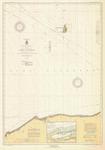
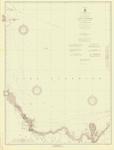
- Lake Superior, 1936
Maritime History of the Great Lakes
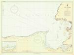
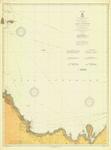
- Lake Superior, 1919

insets of Grand Marais, MN, Grand Marais, MI, Michipicoten Harbor, ON, Gargantua Harbor, ON

insets of Grand Marais, MN, Grand Marais, MI, Michipicoten Harbor, ON, Gargantua Harbor, ON
Maritime History of the Great Lakes
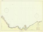
- Lake Superior, 1924
Maritime History of the Great Lakes
- Lake Superior, 1937
Maritime History of the Great Lakes
- Lake Superior, 1911
Maritime History of the Great Lakes
- Lake Superior, 1906

Eastern Lake Superior; Shelter Bay to St. Marys River to Slate Islands

Eastern Lake Superior; Shelter Bay to St. Marys River to Slate Islands
Maritime History of the Great Lakes
- East End of Lake Superior including Whitefish Bay and Head of St. Marys River , 1912
Maritime History of the Great Lakes
- East End of Lake Superior including Whitefish Bay and Head of St. Marys River , 1904
Maritime History of the Great Lakes
- East End of Lake Superior including Whitefish Bay and Head of St. Marys River , 1931
Maritime History of the Great Lakes
- Lake Superior: Mouth of Big Two Hearted River to Grand Portal, MI, 1931

including Caribou Island, ON; inset of Grand Marais, MI

including Caribou Island, ON; inset of Grand Marais, MI
Maritime History of the Great Lakes
- Lake Superior, 1937

Montreal River to St Marys River to AuSable Point; inset of Grand Marais, MI

Montreal River to St Marys River to AuSable Point; inset of Grand Marais, MI
Maritime History of the Great Lakes
- Lake Superior: from Grand Portal to Big Bay Point, MI, 1923

including Manitou Island and Stannard Rock; including Marquette and Munising

including Manitou Island and Stannard Rock; including Marquette and Munising
Maritime History of the Great Lakes
- Lake Superior: from Grand Portal to Big Bay Point, MI, 1910

including Manitou Island and Stannard Rock

including Manitou Island and Stannard Rock
Maritime History of the Great Lakes
- Lake Superior, 1937

from Grand Portal to Big Bay Point, MI; including Grand Marais, MI, Marquette, and Munising

from Grand Portal to Big Bay Point, MI; including Grand Marais, MI, Marquette, and Munising
Maritime History of the Great Lakes
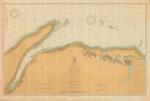
- Lake Superior: Huron Bay and Huron Islands, 1915
Maritime History of the Great Lakes


 "Survey of the Northern and Northwestern Lakes made in obedience to acts of Congress and orders from the Headquarters of the Corps of Engineers, War Department. Lake Ontario Projected from trigonometrical Surveys executed under the orders of Major C. B. Comstock, Corps of Engineers, Brvt. ...
  "Survey of the Northern and Northwestern Lakes made in obedience to acts of Congress and orders from the Headquarters of the Corps of Engineers, War Department. Lake Ontario Projected from …Maritime History of the Great Lakes
 George Mathews, Montreal is credited as the lithographer
  George Mathews, Montreal is credited as the lithographerMaritime History of the Great Lakes
 Chart of Lake Ontario From Actual Survey by Augustus Ford U.S.N. Entered according to Act of congress in the Year 1836 by Augustus Ford in the Clerk's Office of the District Court of the Northern District of New York N. Curriers, Lith 148 Nassau St. N.Y.
  Chart of Lake Ontario From Actual Survey by Augustus Ford U.S.N. Entered according to Act of congress in the Year 1836 by Augustus Ford in the Clerk's Office of the …Maritime History of the Great Lakes
 "Survey of the Northern and Northwestern Lakes made in obedience to acts of Congress and orders from the Headquarters of the Corps of Engineers, War Department. Lake Ontario Projected from trigonometrical Surveys executed under the orders of Major C. B. Comstock, Corps of ...
  "Survey of the Northern and Northwestern Lakes made in obedience to acts of Congress and orders from the Headquarters of the Corps of Engineers, War Department. Lake Ontario Projected from …Maritime History of the Great Lakes
 "Survey of the Northern and Northwestern Lakes Made in obedience to acts of Congress and orders From the Headquarters of the Corps of Engineers, War Department. Lake Michigan Coast Chart No. 1 From Manitowoc to Portage. Projected from trigonometrical Surveys executed under the orders of ...
  "Survey of the Northern and Northwestern Lakes Made in obedience to acts of Congress and orders From the Headquarters of the Corps of Engineers, War Department. Lake Michigan Coast Chart …Maritime History of the Great Lakes
 Maritime History of the Great Lakes
 insets of Grand Marais, MN, Grand Marais, MI, Michipicoten Harbor, ON, Gargantua Harbor, ON
  insets of Grand Marais, MN, Grand Marais, MI, Michipicoten Harbor, ON, Gargantua Harbor, ONMaritime History of the Great Lakes
 Maritime History of the Great Lakes
 Maritime History of the Great Lakes
 Maritime History of the Great Lakes
 Eastern Lake Superior; Shelter Bay to St. Marys River to Slate Islands
  Eastern Lake Superior; Shelter Bay to St. Marys River to Slate IslandsMaritime History of the Great Lakes
 Maritime History of the Great Lakes
 Maritime History of the Great Lakes
 Maritime History of the Great Lakes
 including Caribou Island, ON; inset of Grand Marais, MI
  including Caribou Island, ON; inset of Grand Marais, MIMaritime History of the Great Lakes
 Montreal River to St Marys River to AuSable Point; inset of Grand Marais, MI
  Montreal River to St Marys River to AuSable Point; inset of Grand Marais, MIMaritime History of the Great Lakes
 including Manitou Island and Stannard Rock; including Marquette and Munising
  including Manitou Island and Stannard Rock; including Marquette and MunisingMaritime History of the Great Lakes
 including Manitou Island and Stannard Rock
  including Manitou Island and Stannard RockMaritime History of the Great Lakes
 from Grand Portal to Big Bay Point, MI; including Grand Marais, MI, Marquette, and Munising
  from Grand Portal to Big Bay Point, MI; including Grand Marais, MI, Marquette, and MunisingMaritime History of the Great Lakes
 Maritime History of the Great Lakes

