Results
We found 3228 matching items.


- Second Welland Canal - Book 1, Survey Map 11 - St. Catharines and Locks 3 and 4


 Survey map of the Second Welland Canal created by the Welland Canal Company showing the Town of St. Catharines. Identified structures associated with the Canal include Lock 3 and its Lock House, Lock 4 and its Lock House, Hydraulic Race, and a floating tow path. The surveyors' measurements and notes …

 Survey map of the Second Welland Canal created by the Welland Canal Company showing the Town of St. Catharines. Identified structures associated with the Canal include Lock 3 and its …Brock University Archives
 - Second Welland Canal - Book 1, Survey Map 12 - St. Catharines and Lock 4


 Survey map of the Second Welland Canal created by the Welland Canal Company showing the Town of St. Catharines. Identified structures associated with the Canal include Lock 4, Hydraulic Race, floating tow path, and the Canal waterway itself. The surveyors' measurements and notes can be seen in red and black …

 Survey map of the Second Welland Canal created by the Welland Canal Company showing the Town of St. Catharines. Identified structures associated with the Canal include Lock 4, Hydraulic Race, …Brock University Archives
 - Second Welland Canal - Book 1, Survey Map 13 - St. Catharines and Locks 4 and 5

 Survey map of the Second Welland Canal created by the Welland Canal Company showing the Town of St. Catharines. Identified structures associated with the Canal include Lock 4, Lock House, Lock 5, Small Lock House, the towing path, and Gasometer for Canal. The surveyors' measurements and notes can be seen …
 Survey map of the Second Welland Canal created by the Welland Canal Company showing the Town of St. Catharines. Identified structures associated with the Canal include Lock 4, Lock House, …Brock University Archives
 - Second Welland Canal - Book 1, Survey Map 14 - St. Catharines and Lock 5

 Survey map of the Second Welland Canal created by the Welland Canal Company showing the Canal along the eastern edge of the Town of St. Catharines. Identified structures associated with the Canal include Lock 5 and the towing path. The surveyors' measurements and notes can be seen in red and …
 Survey map of the Second Welland Canal created by the Welland Canal Company showing the Canal along the eastern edge of the Town of St. Catharines. Identified structures associated with …Brock University Archives
 - Second Welland Canal - Book 1, Survey Map 15 - Hydraulic Race and Aqueduct in Grantham

 Survey map of the Second Welland Canal created by the Welland Canal Company showing the Canal along the eastern edge of the Town of St. Catharines. Identified structures associated with the Canal include Lock 7, Lock House Lot, and the towing path. The surveyors' measurements and notes can be seen …
 Survey map of the Second Welland Canal created by the Welland Canal Company showing the Canal along the eastern edge of the Town of St. Catharines. Identified structures associated with …Brock University Archives
 - Welland Canal Survey of Lands Francis Goring Parnell, 1826
 Survey map and description of Francis Goring Parnell's land created by The Welland Canal Company. Included is a written description of the land along with a drawing of the land. Noteable features include; line between Widow Secord and Parnell's land, line between Rykert and Parnell's land. The deed for the …
  Survey map and description of Francis Goring Parnell's land created by The Welland Canal Company. Included is a written description of the land along with a drawing of the land. …Brock University Archives
 - Welland Canal Survey of Lands Zachariah Rykert, 1827
 urvey map and description of Zachariah Rykert's land created by The Welland Canal Company. Included is a written description of the land along with a drawing of the land. Noteable features include; line between Rykert and Parnell's land, lot divisions. The land totals 5.5 acres. Surveyor notes are seen in …
  urvey map and description of Zachariah Rykert's land created by The Welland Canal Company. Included is a written description of the land along with a drawing of the land. Noteable …Brock University Archives
 - Welland Canal Survey of Lands John Soper, 1826
 Survey map and description of John Soper's land created by The Welland Canal Company. Included is a written description of the land along with a drawing of the land. Noteable features include; line between lots, high water mark of canal, concession line. The land totals 1 acre. The survey was …
  Survey map and description of John Soper's land created by The Welland Canal Company. Included is a written description of the land along with a drawing of the land. Noteable …Brock University Archives
 - Welland Canal Survey of Lands Philip Carrol, 1830, 1846, n.d.
 See also Pp 109-113
  See also Pp 109-113Brock University Archives
 - Welland Canal Survey of Lands John Heslop's Estate
 Survey map and description of John Heslop's Estate's land created by The Welland Canal Company. Included is a written description of the land along with a drawing of the land. Noteable features include; line between Heslop and Carrol's land. The land totals 11 acres, 2 roads and 36 perches. The …
  Survey map and description of John Heslop's Estate's land created by The Welland Canal Company. Included is a written description of the land along with a drawing of the land. …Brock University Archives
 - Welland Canal Survey of Lands Alem Marr, 1834
 Survey map and description of Alem Marr's land created by The Welland Canal Company. Included is a written description of the land along with a drawing of the land. Noteable features include; line between Marr and Shotwell's land, road allowance. The land totals 10 acres, 1 road and 28 perches. …
  Survey map and description of Alem Marr's land created by The Welland Canal Company. Included is a written description of the land along with a drawing of the land. Noteable …Brock University Archives
 - Welland Canal Survey of Lands William Chisholm 1836
 Survey map and description of William Chisholm's land created by The Welland Canal Company. Included is a written description of the land along with a drawing of the land. Noteable features include; line between Elias Adams and Chisholm's land, line between Chisholm and Shipman's land, canal. The land is a …
  Survey map and description of William Chisholm's land created by The Welland Canal Company. Included is a written description of the land along with a drawing of the land. Noteable …Brock University Archives
 - Welland Canal Survey of Lands William C. Chace 1826
 Survey map and description of William C. Chace's land created by The Welland Canal Company. Included is a written description of the land along with a drawing of the land. Noteable features include; concession line. The land totals 1/4 of an acre. The survey was signed and submitted on August …
  Survey map and description of William C. Chace's land created by The Welland Canal Company. Included is a written description of the land along with a drawing of the land. …Brock University Archives
 - Welland Canal Survey of Lands Elias Adams, n.d.
 Survey map and description of Elias Adam's land created by The Welland Canal Company. Included is a written description of the land along with a drawing of the land. The land was used for hydraulic purposes. Noteable features include; line between Adams and Sanderson's land, line between Adams and Chisholm's …
  Survey map and description of Elias Adam's land created by The Welland Canal Company. Included is a written description of the land along with a drawing of the land. The …Brock University Archives
 - Welland Canal Survey of Lands Isabella Steward and William Sanderson, 1826
 This image contains two seperate surveys.
  This image contains two seperate surveys.Brock University Archives
 - Welland Canal Survey of Lands St. Catharines Ditch, 1831

 See Pages 154-157
 See Pages 154-157Brock University Archives
 - Welland Canal Survey of Lands Oliver Phelps, 1832
 See also page 161. Please note the measurments listed under "overall dimensions" are for the text only if the text appears on a seperate page from the drawing.
  See also page 161. Please note the measurments listed under "overall dimensions" are for the text only if the text appears on a seperate page from the drawing.Brock University Archives
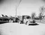
 - Truck Towing a Tractor, St. Catharines, ON
 IHC catalogue number: 3842. First Farmall 100 delievery for Dalziel Farm Equipment, on St. Paul Street. Alternate views taken, but not scanned. IHC catalogue number: 3844 & 3845.
  IHC catalogue number: 3842. First Farmall 100 delievery for Dalziel Farm Equipment, on St. Paul Street. Alternate views taken, but not scanned. IHC catalogue number: 3844 & 3845.McLaughlin Library ASC: Agricultural, Rural, & Scottish Images
 - Niagara, St. Catharines & Toronto Electric Railway crossing a bridge, 1930
 McKinnon Industries is now the General Motors Plant 1 on Ontario Street. Physical details: very good condition.
  McKinnon Industries is now the General Motors Plant 1 on Ontario Street. Physical details: very good condition.Esquesing Historical Society
 - Second Welland Canal - Book 1, Survey Map 10 - St. Catharines


 Survey map of the Second Welland Canal created by the Welland Canal Company along the western edge of the Town of St. Catharines. Although not labelled, the Second Welland Canal can be seen running through the map along with its tow path, which is located on the southwestern edge of …

 Survey map of the Second Welland Canal created by the Welland Canal Company along the western edge of the Town of St. Catharines. Although not labelled, the Second Welland Canal …Brock University Archives

