Results
We found 4 matching items.


Page 1 of 1
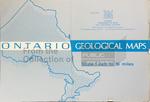
- LHM087 Ontario Geological Maps
 Scale listed on map as 1" to 16 miles
  Scale listed on map as 1" to 16 milesOshawa Public Libraries
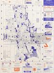
 - LHM021 Advertising Street Map Oshawa
 This map shows Oshawa with street names and highways highlighted on the map, and local advertisements around it.
  This map shows Oshawa with street names and highways highlighted on the map, and local advertisements around it.Oshawa Public Libraries
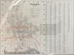
 - LHM024 Map of Oshawa, Ontario: The Go-ahead City
 This map shows Oshawa with street names and highways highlighted, and a large street index.
  This map shows Oshawa with street names and highways highlighted, and a large street index.Oshawa Public Libraries
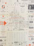
 - LHM026 Oshawa, Ontario Map (National Map Service)
 The map shows Oshawa with streets and highways highlighted, a street index, and local advertisements around the border.
  The map shows Oshawa with streets and highways highlighted, a street index, and local advertisements around the border.Oshawa Public Libraries
Page 1 of 1


