Results


- Jane Archibald in "Le Chien de Watteau"
 "Le Chien de Watteau" was a Laurier Opera production staged on November 20th and 21st, 1998 under the direction of Catherine Black. Wilfrid Laurier University is located in Waterloo, Ontario. It began in 1911 as the Evangelical Lutheran Seminary of Canada. In 1924 Waterloo College was established, providing courses in …
  "Le Chien de Watteau" was a Laurier Opera production staged on November 20th and 21st, 1998 under the direction of Catherine Black. Wilfrid Laurier University is located in Waterloo, Ontario. …Wilfrid Laurier University Library
 - Aerial View of Whitby looking Northwest, October 7, 1998
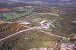
 A colour slide of an aerial view of Whitby looking northwest. The street on the right of the photograph is Cochrane Street. The subdivision on the left of the photograph is Williamsburg.
  A colour slide of an aerial view of Whitby looking northwest. The street on the right of the photograph is Cochrane Street. The subdivision on the left of the photograph …Whitby Public Library
 - Aerial View of Whitby looking Northwest, October 7, 1998
 A colour slide of an aerial view of Whitby looking northwest. The street on the right of the photograph is Cochrane Street. The subdivision on the left of the photograph is Williamsburg.
  A colour slide of an aerial view of Whitby looking northwest. The street on the right of the photograph is Cochrane Street. The subdivision on the left of the photograph …Whitby Public Library
 - Aerial View of Whitby looking South, October 7, 1998
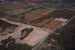
 A colour slide of an aerial view of Whitby looking south. In the centre of the photograph is the subdivision of Whitby Shores under construction. On the right side of the photograph is Ontario Shores Centre for Mental Health Sciences. In the foreground of the photograph is Lake Ontario.
  A colour slide of an aerial view of Whitby looking south. In the centre of the photograph is the subdivision of Whitby Shores under construction. On the right side of …Whitby Public Library
 - Aerial View of Whitby looking Northwest, October 7, 1998
 A colour slide of an aerial view of Whitby looking northwest. In the top of the photograph is the subdivision of Williamsburg under construction. The bottom right of the photograph is the intersection of Cochrane Street and Rossland Road.
  A colour slide of an aerial view of Whitby looking northwest. In the top of the photograph is the subdivision of Williamsburg under construction. The bottom right of the photograph …Whitby Public Library
 - Aerial View of Whitby looking Northwest, October 7, 1998
 A colour slide of an aerial view of Whitby looking northwest. In this view Weall and Cullen Nurseries and Cullen Gardens and Miniature Village can be seen.
  A colour slide of an aerial view of Whitby looking northwest. In this view Weall and Cullen Nurseries and Cullen Gardens and Miniature Village can be seen.Whitby Public Library
 - Aerial View of Whitby looking Northwest, October 7, 1998
 A colour slide of an aerial view of Whitby looking northwest. On the left side of the photograph is the Williamsburg subdivision under construction. Cochrane Street can be in the centre of the photograph.
  A colour slide of an aerial view of Whitby looking northwest. On the left side of the photograph is the Williamsburg subdivision under construction. Cochrane Street can be in the …Whitby Public Library
 - Aerial View of Whitby looking Northwest, October 7, 1998
 A colour slide of an aerial view of Whitby looking northwest. On the left side of the photograph is the Williamsburg subdivision under construction. The intersection of Cochrane Street and Rossland Road can be seen at the bottom of the photograph.
  A colour slide of an aerial view of Whitby looking northwest. On the left side of the photograph is the Williamsburg subdivision under construction. The intersection of Cochrane Street and …Whitby Public Library
 - Aerial View of Whitby looking Northwest, October 7, 1998
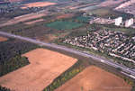
 A colour slide of an aerial view of Whitby looking northwest. The street in the bottom right of the photograph is Cochrane Street.
  A colour slide of an aerial view of Whitby looking northwest. The street in the bottom right of the photograph is Cochrane Street.Whitby Public Library
 - Aerial View of Whitby looking Northwest, October 7, 1998
 A colour slide of an aerial view of Whitby looking northwest. The street in the bottom right of the photograph is Cochrane Street. At the top right of the photograph is Weall and Cullen Nurseries on Taunton Road.
  A colour slide of an aerial view of Whitby looking northwest. The street in the bottom right of the photograph is Cochrane Street. At the top right of the photograph …Whitby Public Library
 - Aerial View of Cochrane Street, October 7, 1998
 A colour slide of an aerial view of Cochrane Street looking north to Rossland Road.
  A colour slide of an aerial view of Cochrane Street looking north to Rossland Road.Whitby Public Library
 - Aerial View of Cochrane Street looking North, October 7, 1998
 A colour slide of an aerial view of Cochrane Street looking north in Whitby, Ontario.
  A colour slide of an aerial view of Cochrane Street looking north in Whitby, Ontario.Whitby Public Library
 - Aerial View of Cochrane Street looking North, October 7, 1998
 A colour slide of an aerial view of Cochrane Street looking north in Whitby, Ontario. This view is of Cochrane Street south of Bonacord Avenue.
  A colour slide of an aerial view of Cochrane Street looking north in Whitby, Ontario. This view is of Cochrane Street south of Bonacord Avenue.Whitby Public Library
 - Aerial View of Cochrane Street, October 7, 1998
 A colour slide of an aerial view of Cochrane Street looking north in Whitby, Ontario. This view is of Cochrane Street at Bonacord Avenue.
  A colour slide of an aerial view of Cochrane Street looking north in Whitby, Ontario. This view is of Cochrane Street at Bonacord Avenue.Whitby Public Library
 - Aerial View of Whitby Shores, October 7, 1998
 A colour slide of an aerial view of the subdivision of Whitby Shores under construction. Lynde Shores Conservation area is on the left side of the photograph.
  A colour slide of an aerial view of the subdivision of Whitby Shores under construction. Lynde Shores Conservation area is on the left side of the photograph.Whitby Public Library
 - Aerial View of Whitby looking North, October 7, 1998
 A colour slide of an aerial view of Whitby looking north. In this view the subdivision of West Lynde is in the foreground. Highway 2 (Dundas Street) is in the centre of the photograph.
  A colour slide of an aerial view of Whitby looking north. In this view the subdivision of West Lynde is in the foreground. Highway 2 (Dundas Street) is in the …Whitby Public Library
 - Aerial View of Whitby looking North, October 7, 1998
 A colour slide of an aerial view of Whitby looking north. In this view the intersection of Cochrane Street and Highway 2 (Dundas Street) is on the right side of the photograph.
  A colour slide of an aerial view of Whitby looking north. In this view the intersection of Cochrane Street and Highway 2 (Dundas Street) is on the right side of …Whitby Public Library
 - Aerial View of Whitby looking South, October 7, 1998
 A colour slide of an aerial view of Whitby looking south. In the centre of the photograph is the subdivision of Whitby Shores under construction. Lynde Creek is to the left of the photograph.
  A colour slide of an aerial view of Whitby looking south. In the centre of the photograph is the subdivision of Whitby Shores under construction. Lynde Creek is to the …Whitby Public Library
 - Aerial View of Whitby looking East, October 7, 1998
 A colour slide of an aerial view of Whitby looking east. In the centre of the photograph is the subdivision of Whitby Shores under construction. Lynde Creek and Lake Ontario are in the foreground.
  A colour slide of an aerial view of Whitby looking east. In the centre of the photograph is the subdivision of Whitby Shores under construction. Lynde Creek and Lake Ontario …Whitby Public Library
 - Aerial View of Whitby looking West, October 7, 1998
 A colour slide of an aerial view of Whitby looking west. In this view Highway 401 is in the centre of the photograph. The West Lynde subdivision is on the right side of the photograph.
  A colour slide of an aerial view of Whitby looking west. In this view Highway 401 is in the centre of the photograph. The West Lynde subdivision is on the …Whitby Public Library

