Results


- Worden Cemetary
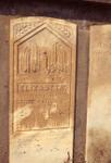
 Worden Pioneer cemetery at corner of Highway 7 (27 Sideroad) and 5th line. Close-up of Elizabeth Worden gravestone wife of samuel Worden
  Worden Pioneer cemetery at corner of Highway 7 (27 Sideroad) and 5th line. Close-up of Elizabeth Worden gravestone wife of samuel WordenEsquesing Historical Society
 - Devitt/Voelker House, 36 Young Street, Waterloo, Ontario
 The house was designated an historical site in 1977, and the first historic site in Waterloo to be commemorated with a plaque in 1978. See LHVF Historic Designated properties Voelker House for more detail. See City of Waterloo site: http://www.waterloo.ca/en/contentresources/resources/government/heritage_property_devitt_voelker_house.pdf
  The house was designated an historical site in 1977, and the first historic site in Waterloo to be commemorated with a plaque in 1978. See LHVF Historic Designated properties Voelker …Waterloo Public Library
 - Aerial view of Waterloo Park and Silver Lake, Waterloo, Ontario
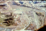
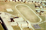
 Waterloo Memorial Arena was built in 1946 and dedicated to local residents who died in the First and Second world wars. It was officially opened on February 15, 1947. The arena was built by Silver Lake in Waterloo Park on the site of a former garbage dump. The building was …
  Waterloo Memorial Arena was built in 1946 and dedicated to local residents who died in the First and Second world wars. It was officially opened on February 15, 1947. The …Waterloo Public Library
 - Labatt Brewery, Waterloo, Ontario
 Formerly the Kuntz Brewery started by David Kuntz in the 1830s. The business was called Spring Brewery because it used water from a spring on the property. In the early 1870s, his son Louis took over, renaming it L. Kuntz’s Park Brewery. After 1929 it was sold and became Carling-Kuntz …
  Formerly the Kuntz Brewery started by David Kuntz in the 1830s. The business was called Spring Brewery because it used water from a spring on the property. In the early …Waterloo Public Library
 - Aerial view of University avenue and Weber street, Waterloo, Ontario
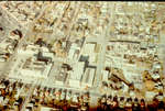
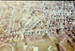
 Aerial view of the area around University Avenue (running diagonally up the image) and Weber Street (horizontally across the image),looking east towards Conestoga parkway. Large apartment towers at left are the Richmond Towers at 300 Regina street north.
  Aerial view of the area around University Avenue (running diagonally up the image) and Weber Street (horizontally across the image),looking east towards Conestoga parkway. Large apartment towers at left are …Waterloo Public Library
 - Aerial view of King and Erb Streets, Waterloo, Ontario
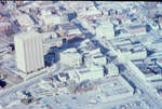
 Aerial view of the area of King and Erb streets in UpTown Waterloo in 1994. Marsland Centre is the tall building on the left, library can be seen behind it. Buildings have been altered or demolished since this image was taken.
  Aerial view of the area of King and Erb streets in UpTown Waterloo in 1994. Marsland Centre is the tall building on the left, library can be seen behind it. …Waterloo Public Library
 - Aerial view of MacGregor Public School, Waterloo, Ontario
 Built in 1951 on former site of Central School which was built in 1855.
  Built in 1951 on former site of Central School which was built in 1855.Waterloo Public Library
 - Aerial view of Waterloo Collegiate Institute, Waterloo, Ontario
 Built in 1960.
  Built in 1960.Waterloo Public Library
 - Worden Pioneer cemetery
 Worden Pioneer cemetery at corner of Highway 7 (27 Sideroad) and 5th line. Close-up of the cairn.
  Worden Pioneer cemetery at corner of Highway 7 (27 Sideroad) and 5th line. Close-up of the cairn.Esquesing Historical Society
 - ESQUESING - Worden Pioneer cemetery at corner of Highway 7 (27 Sideroad) and 5th line.
 ESQUESING - Worden Pioneer cemetery at corner of Highway 7 (27 Sideroad) and 5th line.
  ESQUESING - Worden Pioneer cemetery at corner of Highway 7 (27 Sideroad) and 5th line.Esquesing Historical Society
 - Front veranda of "Hill Hall"
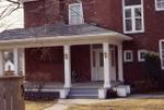
 Front veranda of "Hill Hall" red brick house on Main Street.
  Front veranda of "Hill Hall" red brick house on Main Street.Esquesing Historical Society
 - Hill Hall
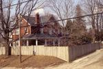
 "Hill Hall" on Main Street, taken from Cobblehill Road.
  "Hill Hall" on Main Street, taken from Cobblehill Road.Esquesing Historical Society
 - Church St. Acton
 Church Street looking east. St. Joseph's RC Church is on the right.
  Church Street looking east. St. Joseph's RC Church is on the right.Esquesing Historical Society
 - The Wool Combing on Church Street
 The Wool Combing on Church Street, built as Mackenzie Lumber.
  The Wool Combing on Church Street, built as Mackenzie Lumber.Esquesing Historical Society
 - The Rectory at St John's
 The rectory of St. Joseph's Church on John Street.
  The rectory of St. Joseph's Church on John Street.Esquesing Historical Society
 - Beardmore water tower taken from John Street.
 Beardmore water tower taken from John Street.
  Beardmore water tower taken from John Street.Esquesing Historical Society
 - The Church Street apartments, on the site of Beverly House.
 The Church Street apartments, on the site of Beverly House.
  The Church Street apartments, on the site of Beverly House.Esquesing Historical Society
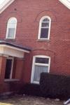
 - Brick House on Church St. with Window Detail
 Window detail of brick house on Church Street.
  Window detail of brick house on Church Street.Esquesing Historical Society
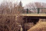
 - Beardmore Crescent bridge.
 Beardmore Crescent bridge.
  Beardmore Crescent bridge.Esquesing Historical Society
 - Beardmore Crescent.
 Beardmore Crescent.
  Beardmore Crescent.Esquesing Historical Society

