Results
We found 2 matching items.


Page 1 of 1
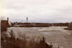
- The 1979 Sturgeon River flood at the Abitibi mill.
 The flow in the Sturgeon River during its height on May 1, 1979 was recorded by Ontario as being the maximum flow ever in the river which means it was a one in 300 year flood which destroyed the Field village and took away the Crystal Falls bridge.
  The flow in the Sturgeon River during its height on May 1, 1979 was recorded by Ontario as being the maximum flow ever in the river which means it was …Société historique de Nipissing Ouest
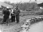
 - May 1979 flood raised the Sturgeon River 19 feet above normal.
 From late April into May 1979, the Sturgeon River rampage affected many communities including: Caldwell, Crystal Falls, Field, Sturgeon Falls, Springer Township and the Nipissing First Nation territory.
  From late April into May 1979, the Sturgeon River rampage affected many communities including: Caldwell, Crystal Falls, Field, Sturgeon Falls, Springer Township and the Nipissing First Nation territory.Société historique de Nipissing Ouest
Page 1 of 1


