Results


Page 1 of 1
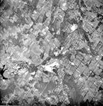
- Aerial photograph of Acton and areas east to 8th Line.
 Aerial photograph of Acton and areas east to 8th Line. Fairy Lake is the large black area on the left, Indusmin Quarries at lower centre. The CN rail line cuts across the photo. Fourth line stretches from 32 Sideroad south to 15 Sideroad on this small-scale photo, approximately a scale …
  Aerial photograph of Acton and areas east to 8th Line. Fairy Lake is the large black area on the left, Indusmin Quarries at lower centre. The CN rail line cuts …Esquesing Historical Society
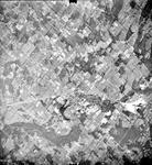
 - Aerial photograph of part of Nassageweya, Erin and Esquesing townships.
 Aerial photograph of part of Nassageweya, Erin and Esquesing townships with Acton and Fairy Lake at lower centre. The curve in Highway #7 at Silver creek is at top right. This photo has a scale of approximately 1:75 000.
  Aerial photograph of part of Nassageweya, Erin and Esquesing townships with Acton and Fairy Lake at lower centre. The curve in Highway #7 at Silver creek is at top right. …Esquesing Historical Society
Page 1 of 1


