Results
We found 55 matching items.


- The Brennan School, South River Area, circa 1960

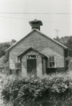
 This is a black and white photograph of the Brennan School, South River Area, circa 1960. The picture's showing the entrance to the former school. The building has one floor, with the exterior wood siding painted light on the top, with a darker part on the bottom few feet. The …
 This is a black and white photograph of the Brennan School, South River Area, circa 1960. The picture's showing the entrance to the former school. The building has one floor, …South River - Machar Union PL
 - Robert Allen Baling Hay, Thessalon, circa 1970

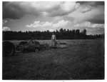
 The ink notation below this photo states "Robert Allen Stooking baled hay in the 1960's." This photo can be found in the Tweedsmuir History created by the Princess Elizabeth Women's Institute.
 The ink notation below this photo states "Robert Allen Stooking baled hay in the 1960's." This photo can be found in the Tweedsmuir History created by the Princess Elizabeth Women's …Thessalon Union Public Library
 - LH2207 Oshawa General Hospital - Breaking Ground


 Black and white photo of two men in suits breaking sod for a new addition to the Oshawa General Hospital.

 Black and white photo of two men in suits breaking sod for a new addition to the Oshawa General Hospital.Oshawa Public Libraries
 - Alderville First Nation Cenotaph

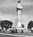
 The Cenotaph was constructed in 1927 by Alf McKeel and Son of Campbellford who supplied the design and donated the materials for the project. Volunteers supplied the labour. The cube on the very top symbolizes the four courners of the earth. The three globes beneath the cube symbolize the Holy …
 The Cenotaph was constructed in 1927 by Alf McKeel and Son of Campbellford who supplied the design and donated the materials for the project. Volunteers supplied the labour. The cube …Cobourg Public Library
 - Thomas Gillbard Public School

 The New Public School was later named Central Public School and then renamed again, to Thomas Gillbard Public School. In 2005 the school building was sold and conversion to condominiums began in 2006
 The New Public School was later named Central Public School and then renamed again, to Thomas Gillbard Public School. In 2005 the school building was sold and conversion to condominiums …Cobourg Public Library
 - Victoria Park

 As far back as the early 1800s Cobourg's main beach was used as a stopover location for travellers along the Lake Ontario'79064s north shore. The beach was a place of stopover and encampment, especially at the west end of the beach where the large stream entered the lake. This area …
 As far back as the early 1800s Cobourg's main beach was used as a stopover location for travellers along the Lake Ontario'79064s north shore. The beach was a place of …Cobourg Public Library
 - Gore's Landing overlooking Rice Lake

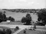
 Overlooking Rice Lake from Church Hill Rd. Gore's Landing Marina is in the back corner
 Overlooking Rice Lake from Church Hill Rd. Gore's Landing Marina is in the back cornerCobourg Public Library
 - Calvary Baptist Church, King St. West, Cobourg

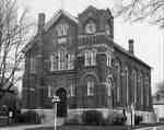
 In May 1885 the first recorded motion to organize a Baptist church was recorded and by September 18th of the same year the first service was held in the YMCA Hall with delegates from seven neighbouring Baptist Churches. In the same year a lot was bought on the north side …
 In May 1885 the first recorded motion to organize a Baptist church was recorded and by September 18th of the same year the first service was held in the YMCA …Cobourg Public Library
 - 317 King Street West

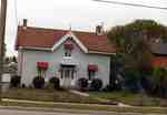
 In 1851 Joseph Arundel Philp (died 1865) and his son (1826-1911), of the same name, built this one and a half story wood house, sheathed in stucco. They had arrived from England in 1832. Both were plasterers. Joseph Arundel Philp Sr. was married to Eleanor Winn (1805-1855). The house was …
 In 1851 Joseph Arundel Philp (died 1865) and his son (1826-1911), of the same name, built this one and a half story wood house, sheathed in stucco. They had arrived …Cobourg Public Library
 - 303 King Street West

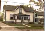
 Alexander Cook built this one and a half storey dwelling in 1851-52
 Alexander Cook built this one and a half storey dwelling in 1851-52Cobourg Public Library
 - Strathmore (Brookside School)

 Judge George Mackenzie Clark, a successful lawyer, local politician, staunch Conservative, and personal friend of Sir John A. Macdonald, purchased the future site of Brookside School in 1869. His wife was the daughter of William Weller. Initially this purchase totaled 180 acres, but it was immediately subdivided into smaller parcels …
 Judge George Mackenzie Clark, a successful lawyer, local politician, staunch Conservative, and personal friend of Sir John A. Macdonald, purchased the future site of Brookside School in 1869. His wife …Cobourg Public Library
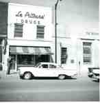
 - LePatourel drug store, Brant Street, 1960

 ...
... 
 ...Burlington Historical Society
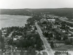
 - Aerial Photograph of Main Street and Highway 11, Sundridge, circa 1960

 Black and white aerial photograph of Sundridge and Lake Bernard. In the middle is the Main Street and Highway 11.
 Black and white aerial photograph of Sundridge and Lake Bernard. In the middle is the Main Street and Highway 11.Sundridge - Strong Union PL
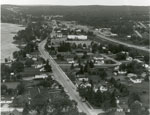
 - Aerial Photograph of Main Street and Highway 11, Sundridge, circa 1960

 Black and white aerial photograph of Sundridge Ontario during the 1960s. Lake Bernard is on the left of the photograph. In the middle of the image is the Main Street and Highway 11 is on the right side of the photograph.
 Black and white aerial photograph of Sundridge Ontario during the 1960s. Lake Bernard is on the left of the photograph. In the middle of the image is the Main Street …Sundridge - Strong Union PL
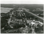
 - Aerial Photograph of Sundridge, circa 1960

 Black and white aerial photograph of Sundridge Ontario during the 1960s. A small portion of Lake Bernard can be seen in the upper left hand portion of the image. Hwy 11 can be seen on the right hand side of the photograph.
 Black and white aerial photograph of Sundridge Ontario during the 1960s. A small portion of Lake Bernard can be seen in the upper left hand portion of the image. Hwy …Sundridge - Strong Union PL
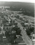
 - Aerial Photograph of Main Street and Highway 11, Sundridge, ON, circa 1960

 Black and white aerial photograph of Sundridge during the 1960s. Highway 11 is on the right side of the image, and the main street of Sundridge is the prominent road on the left side of the photograph.
 Black and white aerial photograph of Sundridge during the 1960s. Highway 11 is on the right side of the image, and the main street of Sundridge is the prominent road …Sundridge - Strong Union PL
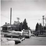
 - Brant Street--Brant St. and Lakeshore Rd., 1960

 ...
... 
 ...Burlington Historical Society
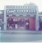
 - Crest Hardware, 383 Brant Street, owner Chris Graham standing at the door, 1960

 Chris Graham had been a travelling salesman in wholesale hardware from 1928. He moved to Burlington and purchased a hardware store from Joe Smith, which he sold in 1960 to Osbaldeston's. He then opened this Brant Street store. Paul Graham took over the business when his father retired in 1971. …
 Chris Graham had been a travelling salesman in wholesale hardware from 1928. He moved to Burlington and purchased a hardware store from Joe Smith, which he sold in 1960 to …Burlington Historical Society
 - Trinity United Church, formerly Burlington Methodist Church, Elizabeth Street, ca 1960

 The front (west) elevation. Designed by Hamilton architect Charles Mills and built in 1893 by George Blair, to replace an earlier building destroyed by fire on Christmas day 1892. In 1965 it was replaced by a new structure at 2121 Caroline Street, Wellington Square United Church. This church was demolished, …
 The front (west) elevation. Designed by Hamilton architect Charles Mills and built in 1893 by George Blair, to replace an earlier building destroyed by fire on Christmas day 1892. In …Burlington Historical Society
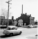
 - Canadian Canners, 1960

 ...
... 
 ...Burlington Historical Society

