Results
We found 100 matching items.


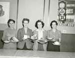
- Women serving a meal at Canadian Women's Army Corps' Camp Knollwood, in Kitchener, Ontario

 The CWAC No. 3 Basic Training Centre, opened in Kitchener, Ontario, in October 1942. The training centre was located in Knollwood Park, close to the present day Kitchener Memorial Auditorium complex. Prior to its opening, Camp Knollwood had been used for military training for men. The No. 3 Basic Training …
 The CWAC No. 3 Basic Training Centre, opened in Kitchener, Ontario, in October 1942. The training centre was located in Knollwood Park, close to the present day Kitchener Memorial Auditorium …Kitchener Public Library
 - Waterloo College baccalaureate service program, 1942
 Wilfrid Laurier University is located in Waterloo, Ontario. It began in 1911 as the Evangelical Lutheran Seminary of Canada. In 1924 Waterloo College was established, providing courses in post-secondary education. In 1960 Waterloo College became Waterloo Lutheran University, and in 1973 changed its name to Wilfrid Laurier University.
  Wilfrid Laurier University is located in Waterloo, Ontario. It began in 1911 as the Evangelical Lutheran Seminary of Canada. In 1924 Waterloo College was established, providing courses in post-secondary education. …Wilfrid Laurier University Library
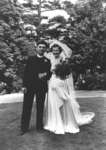
 - Ulrich Leupold and Gertrude Daber wedding portrait, July 11, 1942
 The photograph is affixed to an album page. Ulrich S. Leupold, Dean of Waterloo Lutheran Seminary. He was also a director of music and lecturer in religious knowledge at Waterloo College. Reverend Leupold was born in Berlin, Germany (1909-1970). Before coming to Canada, he earned his PhD at the University …
  The photograph is affixed to an album page. Ulrich S. Leupold, Dean of Waterloo Lutheran Seminary. He was also a director of music and lecturer in religious knowledge at Waterloo …Wilfrid Laurier University Library
 - Organization meeting, Women's Missionary Society, St. Peter's Evangelical Lutheran Church, Kitchener, Ontario
 St. Peter’s Lutheran Church is a member of the Eastern Synod of the Evangelical Lutheran Church in Canada. It is located at 49 Queen Street North in Kitchener, Ontario. The congregation was organized in 1863 as Die Evangelische Lutherische St. Petri Gemeinde. The first church building was completed in 1863, …
  St. Peter’s Lutheran Church is a member of the Eastern Synod of the Evangelical Lutheran Church in Canada. It is located at 49 Queen Street North in Kitchener, Ontario. The …Wilfrid Laurier University Library
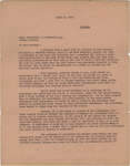
 - Letter from C. Mortimer Bezeau to William Lyon Mackenzie King, April 18, 1942
 William Lyon Mackenzie King (1874-1950) was Canada's longest serving Prime Minister with a total of 22 years (1921-1930 and 1935-1948). King was born in Berlin, Ontario (present day Kitchener) on December 17, 1874. He graduated from the University of Toronto and went on to study economics at Harvard and Chicago …
  William Lyon Mackenzie King (1874-1950) was Canada's longest serving Prime Minister with a total of 22 years (1921-1930 and 1935-1948). King was born in Berlin, Ontario (present day Kitchener) on …Wilfrid Laurier University Library
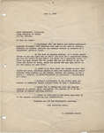
 - Letter from C. Mortimer Bezeau to William Lyon Mackenzie King, July 4, 1942
 William Lyon Mackenzie King (1874-1950) was Canada's longest serving Prime Minister with a total of 22 years (1921-1930 and 1935-1948). King was born in Berlin, Ontario (present day Kitchener) on December 17, 1874. He graduated from the University of Toronto and went on to study economics at Harvard and Chicago …
  William Lyon Mackenzie King (1874-1950) was Canada's longest serving Prime Minister with a total of 22 years (1921-1930 and 1935-1948). King was born in Berlin, Ontario (present day Kitchener) on …Wilfrid Laurier University Library
 - Wilfrid Bitzer on Benton Street Tennis Court
 Wilfrid Bitzer was very involved in Kitchener-Waterloo tennis. In 1935, he represented the K-W Granite Club on the Twin City Tennis Association committee and went on to lead other local tournaments.
  Wilfrid Bitzer was very involved in Kitchener-Waterloo tennis. In 1935, he represented the K-W Granite Club on the Twin City Tennis Association committee and went on to lead other local …Waterloo Public Library
 - Tennis Players on Benton Street Tennis Court

 Wilfrid Bitzer was very involved in Kitchener-Waterloo tennis. In 1935, he represented the K-W Granite Club on the Twin City Tennis Association committee and went on to lead other local tournaments.
 Wilfrid Bitzer was very involved in Kitchener-Waterloo tennis. In 1935, he represented the K-W Granite Club on the Twin City Tennis Association committee and went on to lead other local …Waterloo Public Library
 - Fire Insurance Map 1942, Map 3
 1942 Map. Duke Street became Dupont Street. Queen Street became Regina Street. Cedar Street became Bridgeport Road and was also called Laurel Street east of Peppler Street.
  1942 Map. Duke Street became Dupont Street. Queen Street became Regina Street. Cedar Street became Bridgeport Road and was also called Laurel Street east of Peppler Street.Waterloo Public Library
 - Fire Insurance Map 1942, Map 4
 1942 Map. Duke Street became Dupont Street. Queen Street became Regina Street. Cedar Street became Bridgeport Road and was also called Laurel Street east of Peppler Street.
  1942 Map. Duke Street became Dupont Street. Queen Street became Regina Street. Cedar Street became Bridgeport Road and was also called Laurel Street east of Peppler Street.Waterloo Public Library
 - Fire Insurance Map 1942, Map 2
 Fire Insurance map of southwest business district of Waterloo, Young Street to the north, Duke (later Dupont) Street to the south, Albert Street to the west and King Street to the east. Town Hall, Library, Fire Hall and Market building as well as many businesses identified on the map.
  Fire Insurance map of southwest business district of Waterloo, Young Street to the north, Duke (later Dupont) Street to the south, Albert Street to the west and King Street to …Waterloo Public Library
 - Waterloo Public Library Annual Report 1942
 Reports between 1930 and 1939 missing.
  Reports between 1930 and 1939 missing.Waterloo Public Library
 - Fire Insurance Map 1942, Map 13
 1946, 1951 and 1956 show a service station and White Rose Inn and restaurant at 188 King north. Unclear if the service station and inn were jointly owned or two separate businesses. Main Street became Lodge Street. Schneider's Road became University Avenue at King Street. Snider Street became Fountain Street. …
  1946, 1951 and 1956 show a service station and White Rose Inn and restaurant at 188 King north. Unclear if the service station and inn were jointly owned or two …Waterloo Public Library
 - Fire Insurance Map 1942, Map 14
 Fire Insurance map from 1942 of a northwest section of of Waterloo, Erb Street between McDougall Avenue and Amos Avenue. A separate section showing Bridgeport Road and Margaret Avenue is included.
  Fire Insurance map from 1942 of a northwest section of of Waterloo, Erb Street between McDougall Avenue and Amos Avenue. A separate section showing Bridgeport Road and Margaret Avenue is …Waterloo Public Library
 - Fire Insurance Map 1942, Map 15
 Victoria Street became Avondale Avenue. Shantz Street became Canbar Avenue and no longer exists. Knox Avenue no longer exists. Elizabeth Street became Beverley Street. Rudy Street became Roslin Avenue. Charles Street became Dunbar Avenue.
  Victoria Street became Avondale Avenue. Shantz Street became Canbar Avenue and no longer exists. Knox Avenue no longer exists. Elizabeth Street became Beverley Street. Rudy Street became Roslin Avenue. Charles …Waterloo Public Library
 - Fire Insurance Map 1942, Map 5
 Fire Insurance map from 1942 of the southeast business district of Waterloo, Erb Street to the north, George Street to the south, King Street to the west and Willow Street (not visible) to the east. Some of the businesses visible on the map include: L.J. Klopp, Dry Goods; Rennel Drugs; …
  Fire Insurance map from 1942 of the southeast business district of Waterloo, Erb Street to the north, George Street to the south, King Street to the west and Willow Street …Waterloo Public Library
 - Fire Insurance Map 1942, Map 6
 Earl Street became Severn Avenue. Fischer Street became Belmont Avenue. Victoria Street became Avondale Avenue.
  Earl Street became Severn Avenue. Fischer Street became Belmont Avenue. Victoria Street became Avondale Avenue.Waterloo Public Library
 - Fire Insurance Map 1942, Map 9
 Rudy Avenue became Roslin (sometimes Roslyn in directories) Avenue. Victoria Street later became Avondale Avenue. Charles Street became Dunbar Street. Elizabeth Street became Beverley Street. Weaver Street (sometimes Weber Street in directories) follows the current Dawson Street and ended at the Seagram's Distillery complex.
  Rudy Avenue became Roslin (sometimes Roslyn in directories) Avenue. Victoria Street later became Avondale Avenue. Charles Street became Dunbar Street. Elizabeth Street became Beverley Street. Weaver Street (sometimes Weber Street …Waterloo Public Library
 - Fire Insurance Map 1942, Map 8
 Rudy Avenue became Roslin (sometimes Roslyn in directories) Avenue. Victoria Street later became Avondale Avenue. Charles Street became Dunbar Street. Weaver Street (sometimes Weber Street in directories) follows the current Dawson Street and ended at the Seagram's Distillery complex.
  Rudy Avenue became Roslin (sometimes Roslyn in directories) Avenue. Victoria Street later became Avondale Avenue. Charles Street became Dunbar Street. Weaver Street (sometimes Weber Street in directories) follows the current …Waterloo Public Library
 - Fire Insurance Map 1942, Map 7
 Fire Insurance map from 1942 of the southeast business and residential district of Waterloo, William Street to the north, Union Street to the south, King Street to the west and the CNR tracks to the east. Places of interest include: the Badminton Club on Bowman Street; Boyer Lumber Company on …
  Fire Insurance map from 1942 of the southeast business and residential district of Waterloo, William Street to the north, Union Street to the south, King Street to the west and …Waterloo Public Library

