Results
We found 9 matching items.


Page 1 of 1
- Lake Superior, 1924

 Maritime History of the Great Lakes
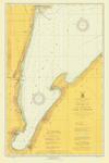
 - Lake Superior: Keweenaw Bay, 1924
 including L'Anse and Portage Entry
  including L'Anse and Portage EntryMaritime History of the Great Lakes
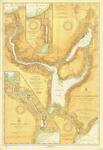
 - Lake Superior:Keweenaw Waterway, 1924
 including Torch Lake; insets of Portage River and Entry; and Portage Lake Upper Entrance and Canal
  including Torch Lake; insets of Portage River and Entry; and Portage Lake Upper Entrance and CanalMaritime History of the Great Lakes
 - West End of Lake Superior: Little Girl Point, MI to Beaver Bay, MN, 1924
 including the Apostle Islands, Ashland, Superior and Duluth; insets of Port Wing, WI, Two Harbors, MN and St. Louis River
  including the Apostle Islands, Ashland, Superior and Duluth; insets of Port Wing, WI, Two Harbors, MN and St. Louis RiverMaritime History of the Great Lakes
 - Lake Ontario Coast Chart No. 3. Little Sodus Bay to Charlotte. 1924
 Survey of the southern shore of Lake Ontario from Charlotte, Pultneyville, Sodus Point to Little Sodus Bay and Fair Haven.
  Survey of the southern shore of Lake Ontario from Charlotte, Pultneyville, Sodus Point to Little Sodus Bay and Fair Haven.Maritime History of the Great Lakes
 - Lake Ontario Coast Chart No. 4. Charlotte to Thirty Mile Point. 1924
 Survey of the southern shore of Lake Ontario from Charlotte, Braddock Point, Oak Orchard to Thirty Mile Point.
  Survey of the southern shore of Lake Ontario from Charlotte, Braddock Point, Oak Orchard to Thirty Mile Point.Maritime History of the Great Lakes
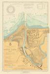
 - Fairport harbor, OH, 1924

 Maritime History of the Great Lakes
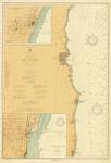
 - Lake Michigan, 1924
 Waukegon to Port Washington; Insets of Port Washington and Waukegan; includes Racine, Kenosha and Milwaukee
  Waukegon to Port Washington; Insets of Port Washington and Waukegan; includes Racine, Kenosha and MilwaukeeMaritime History of the Great Lakes
 - Lake Michigan, 1924
 South Lake Michigan, Waukegan to Benton Harbor; Inset of Michigan City; includes Chicago, Evanston, Indiana Harbor, Gary, Calumet Harbor, New Buffalo, St. Joseph, Benton Harbor
  South Lake Michigan, Waukegan to Benton Harbor; Inset of Michigan City; includes Chicago, Evanston, Indiana Harbor, Gary, Calumet Harbor, New Buffalo, St. Joseph, Benton HarborMaritime History of the Great Lakes
Page 1 of 1


