Results


Page 1 of 1
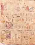
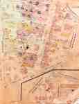
- Fire Insurance Map 1920 - 1929
 1920 map updated in 1929. See detail photographs for enhanced view of the map.
  1920 map updated in 1929. See detail photographs for enhanced view of the map.Waterloo Public Library
 - Fire Insurance Map 1920 - 1929
 1920 map updated in 1929. Queen Street later became Regina Street. Weaver Street was a small lane approximately where Willis Way is today. On the east side of King Street and south it continued as Weaver and later became Herbert Street. Park Avenue later became Alexandra Avenue. Morley Street no …
  1920 map updated in 1929. Queen Street later became Regina Street. Weaver Street was a small lane approximately where Willis Way is today. On the east side of King Street …Waterloo Public Library
 - Onondaga Township Map

 This is a copy of an Onondaga Township map. The map was made circa 1920. The original document was provided by Barbara Plant during a Scan & Share Day event held at the Onondaga Hall on February 11, 2012.
 This is a copy of an Onondaga Township map. The map was made circa 1920. The original document was provided by Barbara Plant during a Scan & Share Day event …County of Brant Public Library
Page 1 of 1


