Results


Page 1 of 1
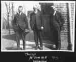
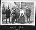
- Whitby Collegiate Institute Teachers
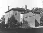
 The Whitby Collegiate Institute was built in 1873 and was located on the south side of Colborne Street between King and Centre Streets. The school was demolished in 1975-1976.
  The Whitby Collegiate Institute was built in 1873 and was located on the south side of Colborne Street between King and Centre Streets. The school was demolished in 1975-1976.Whitby Public Library
 - Whitby Collegiate Institute Teachers
 The Whitby Collegiate Institute was built in 1873 and was located on the south side of Colborne Street between King and Centre Streets. The school was demolished in 1975-1976.
  The Whitby Collegiate Institute was built in 1873 and was located on the south side of Colborne Street between King and Centre Streets. The school was demolished in 1975-1976.Whitby Public Library
 - Gravestone of Sylvester Lynde
 This grave marker was erected in 1919 in Union Cemetery for Sylvester Bernard Lynde (1800-1883), eldest son of Jabez Lynde (1773-1856). Jabez Lynde and his family arrived at Whitby in 1804 and settled in the area now known as Lynde Creek. Sylvester Lynde bought property in north Whitby Township known …
  This grave marker was erected in 1919 in Union Cemetery for Sylvester Bernard Lynde (1800-1883), eldest son of Jabez Lynde (1773-1856). Jabez Lynde and his family arrived at Whitby in …Whitby Public Library
 - John Lynde Grave Marker
 John Lynde, father of Jabez Lynde, died at Whitby in August 1817. The stone was probably made of marble in the 1850s and set on the Lynde property. In 1926 it was reset in the pioneer section of Groveside Cemetery south of Brooklin.
  John Lynde, father of Jabez Lynde, died at Whitby in August 1817. The stone was probably made of marble in the 1850s and set on the Lynde property. In 1926 …Whitby Public Library
 - Henry Street School, 1919
 Henry Street School was built in 1854 on the block bounded by King, Dunlop, Henry, and Gilbert Streets and is now occupied by R.A. Sennett Public School. The school, which faced Henry Street, was destroyed by fire on 4 July 1920.
  Henry Street School was built in 1854 on the block bounded by King, Dunlop, Henry, and Gilbert Streets and is now occupied by R.A. Sennett Public School. The school, which …Whitby Public Library
 - Employee Picnic at Corbett's Point 1919

 Corbett's Point is located on the shore of Lake Ontario, east of Thickson Road.
 Corbett's Point is located on the shore of Lake Ontario, east of Thickson Road.Whitby Public Library
 - Lynde Creek

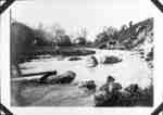
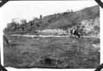
 This section of Lynde Creek is somewhere between Highway 2/Dundas Street and Concession 3 (Rossland Road).
 This section of Lynde Creek is somewhere between Highway 2/Dundas Street and Concession 3 (Rossland Road).Whitby Public Library
 - Lynde Creek

 This photograph was taken along Lynde Creek somewhere between Highway 2/Dundas Street and Concession 3/Rossland Road.
 This photograph was taken along Lynde Creek somewhere between Highway 2/Dundas Street and Concession 3/Rossland Road.Whitby Public Library
 - Ontario Ladies' College Aerial View, 1919
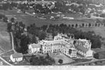
 Black and white negative of a photograph of a postcard showing an aerial view of Ontario Ladies' College. View looking north-west.
  Black and white negative of a photograph of a postcard showing an aerial view of Ontario Ladies' College. View looking north-west.Whitby Public Library
 - Whitby Aerial View, 1919
 Black and white negative of a photograph of an aerial postcard of Whitby. View looking west from above Athol Street.
  Black and white negative of a photograph of an aerial postcard of Whitby. View looking west from above Athol Street.Whitby Public Library
 - Port Whitby Aerial View, 1919
 Black and white negative of a photograph of an aerial postcard of Port Whtiby. View looking west shows Port Whitby south of Victoria Street with the harbour and Ontario Hospital in the background.
  Black and white negative of a photograph of an aerial postcard of Port Whtiby. View looking west shows Port Whitby south of Victoria Street with the harbour and Ontario Hospital …Whitby Public Library
 - Whitby Aerial View, 1919
 Black and white negative of a photograph of an aerial postcard showing Whitby. View looking north from Trent Street. The wing of the airplane is visible at left.
  Black and white negative of a photograph of an aerial postcard showing Whitby. View looking north from Trent Street. The wing of the airplane is visible at left.Whitby Public Library
 - Byron Street Looking North, 1919
 In the 1980s, Bill Little moved the two houses at right across the street to the south-east corner of Mary and Byron and they became part of the shopping area known as Pearsons Lanes.
  In the 1980s, Bill Little moved the two houses at right across the street to the south-east corner of Mary and Byron and they became part of the shopping area …Whitby Public Library
Page 1 of 1

