Results
We found 936 matching items.


- Byron Street, c.1918
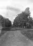
 Black and white negative of a photograph of a postcard showing Byron Street looking south from John Street. The Patterson home, on the south-west corner of Byron and John Streets, is visible at right. Byron Street is at left.
  Black and white negative of a photograph of a postcard showing Byron Street looking south from John Street. The Patterson home, on the south-west corner of Byron and John Streets, …Whitby Public Library
 - Byron Street, c.1918
 Black and white negative of a photograph of a postcard showing Byron Street looking north from Mary Street. The house on the left was owned by Sheriff John F. Paxton.
  Black and white negative of a photograph of a postcard showing Byron Street looking north from Mary Street. The house on the left was owned by Sheriff John F. Paxton.Whitby Public Library
 - King Street looking North, c.1918
 Black and white negative of a photograph showing King Street looking north from Gilbert Street. The house at right is at the north-east corner of King and Gilbert.
  Black and white negative of a photograph showing King Street looking north from Gilbert Street. The house at right is at the north-east corner of King and Gilbert.Whitby Public Library
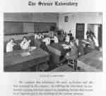
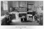
 - Whitby Collegiate Institute Science Laboratory, 1918

 The Whitby Collegiate Institute was built in 1873 and was located on the south side of Colborne Street between King and Centre Streets. The school was demolished in 1975-1976.
 The Whitby Collegiate Institute was built in 1873 and was located on the south side of Colborne Street between King and Centre Streets. The school was demolished in 1975-1976.Whitby Public Library
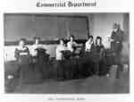
 - Whitby Collegiate Institute Typewriting Room, 1918
 The Whitby Collegiate Institute was built in 1873 and was located on the south side of Colborne Street between King and Centre Streets. The school was demolished in 1975-1976.
  The Whitby Collegiate Institute was built in 1873 and was located on the south side of Colborne Street between King and Centre Streets. The school was demolished in 1975-1976.Whitby Public Library
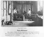
 - Whitby Collegiate Institute Forge Room, 1918
 Whitby Collegiate Institute was built in 1873 and was located on the south side of Colborne Street between King and Centre Streets. The school was demolished in 1975-1976.
  Whitby Collegiate Institute was built in 1873 and was located on the south side of Colborne Street between King and Centre Streets. The school was demolished in 1975-1976.Whitby Public Library
 - Whitby Collegiate Institute Carpenter Shop, 1918
 Whitby Collegiate Institute was built in 1873 and was located on the south side of Colborne Street between King and Centre Streets. The school was demolished in 1975-1976.
  Whitby Collegiate Institute was built in 1873 and was located on the south side of Colborne Street between King and Centre Streets. The school was demolished in 1975-1976.Whitby Public Library
 - Whitby Junction Station

 The Whitby junction Station was built at the foot of Byron Street on the Grand Trunk Railway in 1903. It closed in 1969 and in 1970 it was moved to the north-east corner of Victoria and Henry Streets for use as an art gallery. The station was used as a …
 The Whitby junction Station was built at the foot of Byron Street on the Grand Trunk Railway in 1903. It closed in 1969 and in 1970 it was moved to …Whitby Public Library
 - All Saints' Anglican Church, c. 1918
 All Saints' Anglican Church was built in 1865-66 at 300 Dundas Street West.
  All Saints' Anglican Church was built in 1865-66 at 300 Dundas Street West.Whitby Public Library
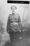
 - Portrait Photo of James Palmer
 Alex Brown is a local Whitby area veteran. He is a member of the Royal Canadian Legion. Private James Henry Palmer was born in Darlington Township on August 21, 1893 and moved to Whitby in 1908. He was blinded during service in the First World War. He was married in …
  Alex Brown is a local Whitby area veteran. He is a member of the Royal Canadian Legion. Private James Henry Palmer was born in Darlington Township on August 21, 1893 …Whitby Public Library
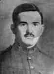
 - Portrait Photograph of Michael Fallon, c.1918

 Michael Fallon was born at Whitby in 1888. He enlisted with the 75th Battalion in Barrie in 1916. He was killed in action in France on August 17, 1918. He was a son of John and Sophie Fallon.
 Michael Fallon was born at Whitby in 1888. He enlisted with the 75th Battalion in Barrie in 1916. He was killed in action in France on August 17, 1918. He …Whitby Public Library
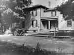
 - Residence of Frank Erskine, c.1918.
 This brick house is located on the west side of Centre Street North, between John and Walnut Streets (306 Centre Street North). It was called Blair Athol by the Erskine family when they lived there from 1917 to after 1935. The lady in front of the house is Mamie Figett, …
  This brick house is located on the west side of Centre Street North, between John and Walnut Streets (306 Centre Street North). It was called Blair Athol by the Erskine …Whitby Public Library
 - Residence of John Tait Mathison, 1918
 This house at 210 Trent Street West, was the home of John Tait Mathison, a marble and granite tombstone maker. The house is on the north side of Trent Street between Byron and Centre Streets. The little girl on the front step is Mary Mathison.Whitby’s house numbering system was provided …
  This house at 210 Trent Street West, was the home of John Tait Mathison, a marble and granite tombstone maker. The house is on the north side of Trent Street …Whitby Public Library
 - Residence of W.G. Walters, c.1918

 This frame house was located on the north-east corner of Green and Dunlop Streets (at 225 Green Street). It was demolished in 1977. Mr. Walters operated a dry goods store in Whitby from 1887 until his death in 1933. This picture shows the Dunlop Street side of the house.Whitby’s house …
 This frame house was located on the north-east corner of Green and Dunlop Streets (at 225 Green Street). It was demolished in 1977. Mr. Walters operated a dry goods store …Whitby Public Library
 - Postcard of Kingston Road, Whitby, Ontario, Canada

 This is a view from Kingston Road (also known as Dundas Street) looking east from a point just west of Brock Street. At right are the Dominion Bank and the post office. At left is the Standard Bank.
 This is a view from Kingston Road (also known as Dundas Street) looking east from a point just west of Brock Street. At right are the Dominion Bank and the …Whitby Public Library
 - Postcard of Brock Street, Whitby, Ontario
 This is a general view of Brock Street with automobiles along the right side of the road.
  This is a general view of Brock Street with automobiles along the right side of the road.Whitby Public Library
 - Royal Hotel
 The Royal Hotel was located at 171 Brock Street North. It was designed by Toronto architect Henry Langley and was built in 1873.
  The Royal Hotel was located at 171 Brock Street North. It was designed by Toronto architect Henry Langley and was built in 1873.Whitby Public Library
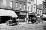
 - Wagon on Brock Street South
 A black and white photograph of the stores on the west side of Brock Street north of Colborne Street. At the far left is A.P. Wright shop. Beside that is Bolton's Restaurant. In the foreground are an automobile and teamster Leslie Moore’s wagon delivering pop to Bolton’s Restaurant. The side …
  A black and white photograph of the stores on the west side of Brock Street north of Colborne Street. At the far left is A.P. Wright shop. Beside that is …Whitby Public Library
 - Brock Street looking south from Elm Street
 A black and white photograph of Brock Street looking south from Elm Street in Downtown Whitby. Buildings can be seen and a car is parked at the left side of the image.
  A black and white photograph of Brock Street looking south from Elm Street in Downtown Whitby. Buildings can be seen and a car is parked at the left side of …Whitby Public Library
 - Brock Street south of Royal Hotel
 The Coca Cola advertisement is on Hewis Block. This is a view of Brock Street looking south from the Royal Hotel.
  The Coca Cola advertisement is on Hewis Block. This is a view of Brock Street looking south from the Royal Hotel.Whitby Public Library


