Results
We found 5 matching items.


Page 1 of 1
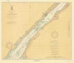
- St. Lawrence River, 1917
 Chippewa Point to Brooks Point; Includes Brockville and Morristown
  Chippewa Point to Brooks Point; Includes Brockville and MorristownMaritime History of the Great Lakes
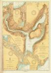
 - Lake Superior:Keweenaw Waterway, 1917
 including Torch Lake; insets of Portage River and Entry; and Portage Lake Upper Entrance and Canal
  including Torch Lake; insets of Portage River and Entry; and Portage Lake Upper Entrance and CanalMaritime History of the Great Lakes
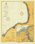
 - Lake Ontario Coast Chart No. 2. Stony Point to Little Sodus Bay. 1917
 Survey of the south eastern shores of Lake Ontario from Little Sodus Bay, Fair Haven, Oswego, Texas, Port Ontario to Stony Point Lighthouse. Major inset with Oswego Harbor.
  Survey of the south eastern shores of Lake Ontario from Little Sodus Bay, Fair Haven, Oswego, Texas, Port Ontario to Stony Point Lighthouse. Major inset with Oswego Harbor.Maritime History of the Great Lakes
 - General Chart of Lake Superior. 1917
 Survey of Lake Superior with insets for the Harbor of Refuge at Grand Marais, MI and Michipicoten Harbor, ON
  Survey of Lake Superior with insets for the Harbor of Refuge at Grand Marais, MI and Michipicoten Harbor, ONMaritime History of the Great Lakes
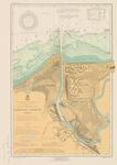
 - Fairport harbor, OH, 1917

 Maritime History of the Great Lakes
Page 1 of 1


