Results


Page 1 of 1
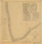
- South End of Lake Huron and Head of the St. Clair River, 1859
 "Survey of the Northern and North Western Lakes Made in obedience to acts of Congress and under the direction of The Bureau of Topographical Engineers of the War Department South End of Lake Huron and Head of the St. Clair River Projected from a Trigonometrical Survey, executed under the ...
  "Survey of the Northern and North Western Lakes Made in obedience to acts of Congress and under the direction of The Bureau of Topographical Engineers of the War Department South …Maritime History of the Great Lakes
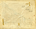
 - Head Township ca.1859


 Early surveyors, like William E. Logan, used Rochon micrometer telescopes and targets (disk on a calibrated pole) to measure distance. Each microscope had a different calibration and therefore a different range. The instruments were calibrated against a distance measured with a surveyors chain (also known as Gunter’s chain). One chain …

 Early surveyors, like William E. Logan, used Rochon micrometer telescopes and targets (disk on a calibrated pole) to measure distance. Each microscope had a different calibration and therefore a different …Head, Clara and Maria Public Library
Page 1 of 1


