Results


Page 1 of 1
- Map of East & West Oswego
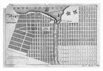
 Map of East & West Oswego This map is from a copperplate in possession of Geo. N. Burt, Oswego, N.Y. and represents the resservation as it existed about 1829.
  Map of East & West Oswego This map is from a copperplate in possession of Geo. N. Burt, Oswego, N.Y. and represents the resservation as it existed about 1829.Maritime History of the Great Lakes
Page 1 of 1


