Results
We found 11 matching items.


Page 1 of 1
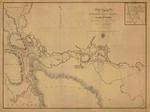
- St. Joseph's North Channel Lake Huron, 1822
 by Henry W. Bayfield, RN; inset with the Ship Neebish Rapid, published 1828
  by Henry W. Bayfield, RN; inset with the Ship Neebish Rapid, published 1828Maritime History of the Great Lakes
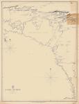
 - Lake Huron, 1822
 by H. W. Bayfield; North East corner with Manitoulin Island
  by H. W. Bayfield; North East corner with Manitoulin IslandMaritime History of the Great Lakes
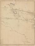
 - Lake Huron, 1822
 Northwest corner; Aids to Navigation corrected 1848
  Northwest corner; Aids to Navigation corrected 1848Maritime History of the Great Lakes
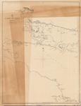
 - Lake Huron, 1822
 Northwest corner; Aids to Navigation corrected 1848
  Northwest corner; Aids to Navigation corrected 1848Maritime History of the Great Lakes
 - Lake Huron, 1822
 by Henry W. Bayfield, RN; Thunder Bay to Saginaw Bay, published 1828
  by Henry W. Bayfield, RN; Thunder Bay to Saginaw Bay, published 1828Maritime History of the Great Lakes
 - Lake Huron, 1822
 by Henry W. Bayfield, RN; Saginaw Bay to Chiefs Point, published 1828
  by Henry W. Bayfield, RN; Saginaw Bay to Chiefs Point, published 1828Maritime History of the Great Lakes
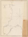
 - Lake Huron: Sheet II [1822]
 Coverage on the chart ranges from the Ducks in the northwest to Collins Inlet in the northeast to Chiefs Point on the Lake Huron side of the Bruce Peninsula and Lions Head on the Georgian Bay side
  Coverage on the chart ranges from the Ducks in the northwest to Collins Inlet in the northeast to Chiefs Point on the Lake Huron side of the Bruce Peninsula and …Maritime History of the Great Lakes
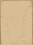
 - Lake Huron. Sheet IV [1822]
 Western shore of Lake Huron from roughly White Rock Point to Middle Island, including Saginaw Bay and Thunder Bay
  Western shore of Lake Huron from roughly White Rock Point to Middle Island, including Saginaw Bay and Thunder BayMaritime History of the Great Lakes
 - A Survey of St. Joseph's North Channel, Lake Huron [1822]
 Chart extends from Lake George and Sugar Island in the northwest, Neebish Island and Mud Lake in the south west, St. Joseph Island on the south and east to the bay that would eventually front Bruce Mines.
  Chart extends from Lake George and Sugar Island in the northwest, Neebish Island and Mud Lake in the south west, St. Joseph Island on the south and east to the …Maritime History of the Great Lakes
 - Lake Huron. Sheet V [1822]
 Chart of southern Lake Huron, from Point aux Barques in the center west, to Fort Gratiate [Gratiot] and Point Edward in the south to Chiefs Point in the northeast.
  Chart of southern Lake Huron, from Point aux Barques in the center west, to Fort Gratiate [Gratiot] and Point Edward in the south to Chiefs Point in the northeast.Maritime History of the Great Lakes
 - Lake Huron. Sheet III [Georgian Bay, 1822]
 Lake Huron. Sheet III The Soundings are in feet Surveyed by Capt'n H. W. Bayfield, R. N. 1822 London Published according to Act of Parliament at the Hydrographical Office of the Admiralty, 29th Sept. 1828. J. & C. Walker Sculpt
  Lake Huron. Sheet III The Soundings are in feet Surveyed by Capt'n H. W. Bayfield, R. N. 1822 London Published according to Act of Parliament at the Hydrographical Office of …Maritime History of the Great Lakes
Page 1 of 1

![Lake Huron: Sheet II [1822] Lake Huron: Sheet II [1822]](https://images.MaritimeHistoryoftheGreatLakes.ca/images/MHGL000122581t.jpg)
![Lake Huron. Sheet IV [1822] Lake Huron. Sheet IV [1822]](https://images.MaritimeHistoryoftheGreatLakes.ca/images/MHGL000122582t.jpg)
![A Survey of St. Joseph's North Channel, Lake Huron [1822] A Survey of St. Joseph's North Channel, Lake Huron [1822]](https://images.MaritimeHistoryoftheGreatLakes.ca/images/MHGL000122583t.jpg)
![Lake Huron. Sheet V [1822] Lake Huron. Sheet V [1822]](https://images.MaritimeHistoryoftheGreatLakes.ca/images/MHGL000122591t.jpg)
![Lake Huron. Sheet III [Georgian Bay, 1822] Lake Huron. Sheet III [Georgian Bay, 1822]](https://images.MaritimeHistoryoftheGreatLakes.ca/images/MHGL000122592t.jpg)
