Results


Page 1 of 1
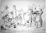
- Indian Warriors from Lake Erie
 Paper lithograph; "The North American Indian Warriors, from Lake Erie, of the Seneca, who were in London in 1818". "Beaver, I like her, Two Guns, Steep Back, Black Squirrel, Long Horns and Little Bear".
  Paper lithograph; "The North American Indian Warriors, from Lake Erie, of the Seneca, who were in London in 1818". "Beaver, I like her, Two Guns, Steep Back, Black Squirrel, Long …
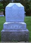
 - Frederick, Eleanor, Elizabeth, Mary Ann, and Charlotte Reeker
 This headstone is located in the Second Onondaga Baptist Church Cemetery which was established after the church was built in 1854. The Church and Cemetery are located on 330 Baptist Church Road, 0.3 km south of Mulligan Road. Location: 4-1
  This headstone is located in the Second Onondaga Baptist Church Cemetery which was established after the church was built in 1854. The Church and Cemetery are located on 330 Baptist …County of Brant Public Library
 - Lake Erie: Inner and Outer Bays of Long Point [1818]
 Lake Erie: Inner and Outer Bays of Long Point By Lieu't Henry W. Bayfield, R. N. in 1818 The Soundings are in Feet London Published according to Act of Parliament at the Hydrographical Office of the Admiralty 8th March 1828. J. & C. Walker Sculpt
  Lake Erie: Inner and Outer Bays of Long Point By Lieu't Henry W. Bayfield, R. N. in 1818 The Soundings are in Feet London Published according to Act of Parliament …Maritime History of the Great Lakes
 - Survey of Mohawk Bay, Lake Erie [1828]
 Survey of Mohawk Bay, Lake Erie by Lieut H. W. Bayfield R. N. NB The soundings are in feet. London Published according to Act of Parliament at the Hydrographical Office of the Admiralty, 29th March 1828. J. & C. Walker Sculpt
  Survey of Mohawk Bay, Lake Erie by Lieut H. W. Bayfield R. N. NB The soundings are in feet. London Published according to Act of Parliament at the Hydrographical Office …Maritime History of the Great Lakes
 - A survey of the River St. Lawrence from Lake Ontario to the Galop Rapids, in five sheets: sheet 1 [Kingston]
 A Survey of the River St. Lawrence From Lake Ontario to the Galop Rapids in Five Sheets by Captn W. F. W. Owen, R. N. 1818 Sheet 1 N.B. The soundings are in feet London: Published according to Act of Parliament at the Hydrographical Office of the Admiralty 16 July …
  A Survey of the River St. Lawrence From Lake Ontario to the Galop Rapids in Five Sheets by Captn W. F. W. Owen, R. N. 1818 Sheet 1 N.B. The …Maritime History of the Great Lakes
 - River St. Lawrence: sheet II [Howe/Grindstone Islands]
 River St. Lawrence Sheet II The soundings are in feet London: Published according to Act of Parliament at the Hydrographical Office of the Admiralty 12 Aug 1828.
  River St. Lawrence Sheet II The soundings are in feet London: Published according to Act of Parliament at the Hydrographical Office of the Admiralty 12 Aug 1828.Maritime History of the Great Lakes
 - River St. Lawrence: sheet III [Grindstone to Bathurst (Grenadier) Islands]
 River St. Lawrence Sheet III The soundings are in feet London: Published according to Act of Parliament at the Hydrographical Office of the Admiralty 22 Aug 1828.
  River St. Lawrence Sheet III The soundings are in feet London: Published according to Act of Parliament at the Hydrographical Office of the Admiralty 22 Aug 1828.Maritime History of the Great Lakes
 - River St. Lawrence: sheet IV [Bathurst (Grenadier) Island to Maitland]
 Chart is centered on Brockville, ON
  Chart is centered on Brockville, ONMaritime History of the Great Lakes
 - River St. Lawrence: sheet V [Maitland to Galop Rapids]
 Chart is centered on Prescott, ON, with notes for Fort Wellington New Jerusalem and Johnstown on the north shore and Ogdensburg on the south shore.
  Chart is centered on Prescott, ON, with notes for Fort Wellington New Jerusalem and Johnstown on the north shore and Ogdensburg on the south shore.Maritime History of the Great Lakes
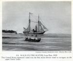
 - S. S. WALK-IN-THE-WATER, Lake Erie, 1818
 Courtesy Canada Steamship Lines' Marine Hist. Coll. S. S. WALK-IN-THE-WATER, Lake Erie, 1818 This United States registered vessel was the first steam-driven vessel to navigate on the upper Great Lakes.
  Courtesy Canada Steamship Lines' Marine Hist. Coll. S. S. WALK-IN-THE-WATER, Lake Erie, 1818 This United States registered vessel was the first steam-driven vessel to navigate on the upper Great Lakes.Maritime History of the Great Lakes
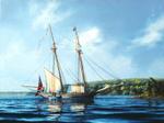
 - Tecumseth at anchor
 The naval schooner, the Tecumseth at anchor, drying her sails in the naval base at Penetanguishene. She was built too late to serve in the war.
  The naval schooner, the Tecumseth at anchor, drying her sails in the naval base at Penetanguishene. She was built too late to serve in the war.Association for Great Lakes Maritime History
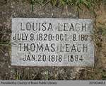
 - Leach Family Marker

 Range 1-10
 Range 1-10County of Brant Public Library
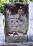
 - Almon Tapley?


 Tapley Cemetery is an inactive cemetery in Brant County, under the jurisdiction of the Corporation of the County of Brant. It is located at 92 Godby Rd, east of Burford. The stones have been moved from their original spot, and are now lined up in a row within an enclosed …

 Tapley Cemetery is an inactive cemetery in Brant County, under the jurisdiction of the Corporation of the County of Brant. It is located at 92 Godby Rd, east of Burford. …County of Brant Public Library
 - Charity (Phillips) Flanagin

 St. Abner's Cemetery is an inactive cemetery in Brant County, under the jurisdiction of the Corporation of the County of Brant. It is located at 77 Henderson Rd., North-East of Burford. The stones have been moved from their original spot, and are now lined up in a row. All but …
 St. Abner's Cemetery is an inactive cemetery in Brant County, under the jurisdiction of the Corporation of the County of Brant. It is located at 77 Henderson Rd., North-East of …County of Brant Public Library
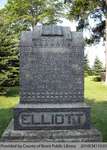
 - Elliott Family Headstone (Range 7-1)

 Range 7-1
 Range 7-1County of Brant Public Library
 - Mary Beemer Steinhoff

 Range 2-22
 Range 2-22County of Brant Public Library
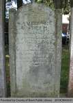
 - Ambrose Smith

 Range 2-38
 Range 2-38County of Brant Public Library
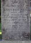
 - Elizabeth Brown McIntyre

 Range 1-37
 Range 1-37County of Brant Public Library
Page 1 of 1

![Lake Erie: Inner and Outer Bays of Long Point [1818] Lake Erie: Inner and Outer Bays of Long Point [1818]](https://images.MaritimeHistoryoftheGreatLakes.ca/images/MHGL000122580t.jpg)
![Survey of Mohawk Bay, Lake Erie [1828] Survey of Mohawk Bay, Lake Erie [1828]](https://images.MaritimeHistoryoftheGreatLakes.ca/images/MHGL000122597t.jpg)
![A survey of the River St. Lawrence from Lake Ontario to the Galop Rapids, in five sheets: sheet 1 [Kingston] A survey of the River St. Lawrence from Lake Ontario to the Galop Rapids, in five sheets: sheet 1 [Kingston]](https://images.MaritimeHistoryoftheGreatLakes.ca/images/MHGL000063737t.jpg)
![River St. Lawrence: sheet II [Howe/Grindstone Islands] River St. Lawrence: sheet II [Howe/Grindstone Islands]](https://images.MaritimeHistoryoftheGreatLakes.ca/images/MHGL063738t.jpg)
![River St. Lawrence: sheet III [Grindstone to Bathurst (Grenadier) Islands] River St. Lawrence: sheet III [Grindstone to Bathurst (Grenadier) Islands]](https://images.MaritimeHistoryoftheGreatLakes.ca/images/MHGL063739t.jpg)
![River St. Lawrence: sheet IV [Bathurst (Grenadier) Island to Maitland] River St. Lawrence: sheet IV [Bathurst (Grenadier) Island to Maitland]](https://images.MaritimeHistoryoftheGreatLakes.ca/images/MHGL063740t.jpg)
![River St. Lawrence: sheet V [Maitland to Galop Rapids] River St. Lawrence: sheet V [Maitland to Galop Rapids]](https://images.MaritimeHistoryoftheGreatLakes.ca/images/MHGL063741t.jpg)
