Results


Page 1 of 1
- Capture of Fort George
 Capture of Fort George. In the upper right hand corner it reads: "Porte Folio. July. 1817"
  Capture of Fort George. In the upper right hand corner it reads: "Porte Folio. July. 1817"
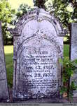
 - John, Fanny A., James Elmer, Jemima, Frances, Hanna, and Bertha Fawcett
 Located right next to the Salt Springs Church on the Grand River, the Salt Springs Cemetery has been in operation since 1822. The cemetery is still active under the management of the Salt Springs Cemetery Board of Trustees. There is a plaque on the property that tells the history of …
  Located right next to the Salt Springs Church on the Grand River, the Salt Springs Cemetery has been in operation since 1822. The cemetery is still active under the management …County of Brant Public Library
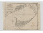
 - Plan of Toronto Harbour, Lake Ontario
 Plan of Toronto Harbour, Lake Ontario. Surveyed under the Direction of Capt'n W. F. W. Owen, R. N. By Lieu't now Commander H.W.Bayfield, R. N. Drawn by Geo. D. Cranfield, Lieu't 90th L't. Inf'y The Town is copied from a Plan in the Surveyor General's Office. --- London Published ...
  Plan of Toronto Harbour, Lake Ontario. Surveyed under the Direction of Capt'n W. F. W. Owen, R. N. By Lieu't now Commander H.W.Bayfield, R. N. Drawn by Geo. D. Cranfield, …Maritime History of the Great Lakes
 - Survey of the River Niagara [1817]
 Survey of the River Niagara. Made under the direction of Capt'n W'm Fiz W'm. Owen, in the Year 1817 The Soundings are laid down in Feet -- Inset -- Survey of the entrance of the River Niagara from Lake Erie by Lieu't H. W. Bayfield, R. N. -- London Published …
  Survey of the River Niagara. Made under the direction of Capt'n W'm Fiz W'm. Owen, in the Year 1817 The Soundings are laid down in Feet -- Inset -- Survey …Maritime History of the Great Lakes
 - Survey of Lake Erie [1817-18][manuscript]
 Copy of the original manuscript chart of Lake Erie surveyed by Henry W. Bayfield in 1817-18. There are different insets than in the published chart.
  Copy of the original manuscript chart of Lake Erie surveyed by Henry W. Bayfield in 1817-18. There are different insets than in the published chart.Maritime History of the Great Lakes
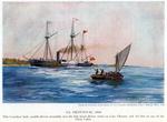
 - S.S. FRONTENAC, 1816
 Note: despite the title of this image, FRONTENAC did not move under steam until the spring of 1817.
  Note: despite the title of this image, FRONTENAC did not move under steam until the spring of 1817.Maritime History of the Great Lakes
 - HMS Tecumseth Rolling Home
 This purpose-built schooner was launched in 1815 near the Niagara River, served in Lake Erie for two years, then was transferred to Lake Huron. The war was over, peace was holding and she is seen running for home at Penetanguishene, where her remains are found today.
  This purpose-built schooner was launched in 1815 near the Niagara River, served in Lake Erie for two years, then was transferred to Lake Huron. The war was over, peace was …Association for Great Lakes Maritime History
 - Schooner Bee in a Squall
 Built in 1817, for the new upper lakes naval base in Penetanguishene, the Bee was one of the smaller, less labour intensive vessels that were used in the post-war era.
  Built in 1817, for the new upper lakes naval base in Penetanguishene, the Bee was one of the smaller, less labour intensive vessels that were used in the post-war era.Association for Great Lakes Maritime History
 - Looking n. from near Lighthouse, Centre Island; from Fort York on the left to foot of Trinity St. on the right
 Water colour
  Water colourAssociation for Great Lakes Maritime History
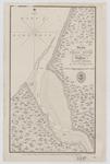
 - Sketch of a Small river Ten miles to the Westward of Buffalo, Lake Erie
 Bayfield would appear to have gotten his distances wrong, as this appears to be the mouth of Eighteen Mile Creek.
  Bayfield would appear to have gotten his distances wrong, as this appears to be the mouth of Eighteen Mile Creek.Maritime History of the Great Lakes
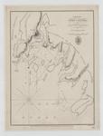
 - Lake Huron. Port Collier
 Lake Huron. Port Collier by Lieut H. W. Bayfield R. N. 1817 NB The Sounding are in feet London Published according to Act of Parliament at the Hydrographical Office of the Admiralty, 31th May 1828. J. & C. Walker Sculpt
  Lake Huron. Port Collier by Lieut H. W. Bayfield R. N. 1817 NB The Sounding are in feet London Published according to Act of Parliament at the Hydrographical Office of …Maritime History of the Great Lakes
 - Track Survey of the Lake & River St. Clair [1817]
 Added by 1861: Lighthouses at Windmill Point, mouth of the River Thames and Fort Gratiot
  Added by 1861: Lighthouses at Windmill Point, mouth of the River Thames and Fort GratiotMaritime History of the Great Lakes
 - A Survey of Lake Erie [1817-18]
 A Survey of Lake Erie; in the Years 1817 & 1818 By Lieu't Henry W. Bayfield, R. N. All Soundings are in feet N.B. The depth of water varies, according as the seasons are wet or dry; the maximum being from two to three feet. ---insets--- Survey of Put In …
  A Survey of Lake Erie; in the Years 1817 & 1818 By Lieu't Henry W. Bayfield, R. N. All Soundings are in feet N.B. The depth of water varies, according …Maritime History of the Great Lakes
 - Westbrook Cemetery

 Westbrook Cemetery is an inactive cemetery in Brant County, under the jurisdiction of the Corporation of the County of Brant. It is located at 30 Shaver St., off of Hwy 2/53 East. Most of the headstones have been placed in concrete in a row, and most are legible and in …
 Westbrook Cemetery is an inactive cemetery in Brant County, under the jurisdiction of the Corporation of the County of Brant. It is located at 30 Shaver St., off of Hwy …County of Brant Public Library
 - John W. Dickie


 St. Abner's Cemetery is an inactive cemetery in Brant County, under the jurisdiction of the Corporation of the County of Brant. It is located at 77 Henderson Rd., North-East of Burford. The stones have been moved from their original spot, and are now lined up in a row. All but …

 St. Abner's Cemetery is an inactive cemetery in Brant County, under the jurisdiction of the Corporation of the County of Brant. It is located at 77 Henderson Rd., North-East of …County of Brant Public Library
 - Clarissa, Rachel (Hopkins), Carrie, Mary, Nicholas, and O.J. Lee


 Papple Cemetery is an inactive cemetery in Brant County, under the jurisdiction of the Corporation of the County of Brant. It is located on Brant County Highway # 99, 2.5 kms east of the St George Road (Brant County Road # 13). Range 4-2

 Papple Cemetery is an inactive cemetery in Brant County, under the jurisdiction of the Corporation of the County of Brant. It is located on Brant County Highway # 99, 2.5 …County of Brant Public Library
 - Francis Fairchild

 Range 4-8
 Range 4-8County of Brant Public Library
 - William Merrill

 Contributed by Janet Hilliker. This article originally appeared on the County of Brant wiki at ourbrant.wikia.com. It has been included in this collection for ease of research.
 Contributed by Janet Hilliker. This article originally appeared on the County of Brant wiki at ourbrant.wikia.com. It has been included in this collection for ease of research.County of Brant Public Library
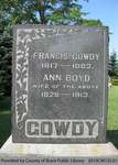
 - Gowdy Family Headstone (Range 9-1)

 Range 9-1
 Range 9-1County of Brant Public Library
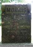
 - Morris Family Headstone (Range 2-2)

 Range 2-2
 Range 2-2County of Brant Public Library
Page 1 of 1


![Survey of the River Niagara [1817] Survey of the River Niagara [1817]](https://images.MaritimeHistoryoftheGreatLakes.ca/images/MHGL000122579t.jpg)
![Survey of Lake Erie [1817-18][manuscript] Survey of Lake Erie [1817-18][manuscript]](https://images.MaritimeHistoryoftheGreatLakes.ca/images/MHGL000122605t.jpg)



![Track Survey of the Lake & River St. Clair [1817] Track Survey of the Lake & River St. Clair [1817]](https://images.MaritimeHistoryoftheGreatLakes.ca/images/MHGL000122598t.jpg)
![A Survey of Lake Erie [1817-18] A Survey of Lake Erie [1817-18]](https://images.MaritimeHistoryoftheGreatLakes.ca/images/MHGL000122588t.jpg)
