Results
We found 3574 matching items.


- Springfield Pioneer Cemetery Headstone, Erected by the Springfield WI

 The stones in the Springfield Pioneer Cemetery were broken, so the Springfield WI had a new stone erected with all of the names inscribed. Springfield WI and other donors restored the cemetery in 1997.
 The stones in the Springfield Pioneer Cemetery were broken, so the Springfield WI had a new stone erected with all of the names inscribed. Springfield WI and other donors restored …Federated Women's Institutes of Ontario
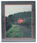
 - Framed Photograph of Unit 3076

 This engine and passenger train provided the town of Schreiber a bit of amusement when, in the summer of 1993 during Heritage Days, it was used to transport locals for a quick trip to Marathon, reminiscent of the time passenger trains were available in this area.
 This engine and passenger train provided the town of Schreiber a bit of amusement when, in the summer of 1993 during Heritage Days, it was used to transport locals for …Schreiber Heritage & Tourism Committee
 - Acton Fairview Cemetery, memorial to Fred Crewson
 – Acton Fairview Cemetery, memorial to Fred Crewson, 1962.
  – Acton Fairview Cemetery, memorial to Fred Crewson, 1962.Esquesing Historical Society
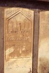
 - Worden Cemetary
 Worden Pioneer cemetery at corner of Highway 7 (27 Sideroad) and 5th line. Close-up of Elizabeth Worden gravestone wife of samuel Worden
  Worden Pioneer cemetery at corner of Highway 7 (27 Sideroad) and 5th line. Close-up of Elizabeth Worden gravestone wife of samuel WordenEsquesing Historical Society
 - Deux Rivières Boat Launch Ribbon

 A piece of the Red Ribbon from the Deux Rivières boat ramp opening ceremony.
 A piece of the Red Ribbon from the Deux Rivières boat ramp opening ceremony.Head, Clara and Maria Public Library
 - Churchill Community Church, built in 1843 for the Congregational Church, joining the United Church in 1926.
 Churchill Community Church, built in 1843 for the Congregational Church, joining the United Church in 1926. Photo by J. Mark Rowe. DATE: 2 April 1994 NEGATIVE: No PROVENENCE: EHS collection FORMAT: Colour 4”X6” print &
  Churchill Community Church, built in 1843 for the Congregational Church, joining the United Church in 1926. Photo by J. Mark Rowe. DATE: 2 April 1994 NEGATIVE: No PROVENENCE: EHS collection …Esquesing Historical Society
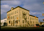
 - Waterloo Hotel
 The Bowman House was built in 1840 by Henry Bowman on the north-east corner of King and Erb Streets and was initially known as the Farmer's Hotel. In 1867, the directory lists William L. Bowman as the proprietor. In 1882, it was bought by Henry Zimmerman and eventually the name …
  The Bowman House was built in 1840 by Henry Bowman on the north-east corner of King and Erb Streets and was initially known as the Farmer's Hotel. In 1867, the …Waterloo Public Library
 - Waterloo Post Office, Waterloo, Ontario
 Construction on the clock began in 1911 and was completed in 1913. The clock and tower were removed in 1956, and the building ceased to be used as a Post Office in 1967. The tower was restored in 1991, followed by the clock in 2003.
  Construction on the clock began in 1911 and was completed in 1913. The clock and tower were removed in 1956, and the building ceased to be used as a Post …Waterloo Public Library
 - Joseph E. Seagram & Sons Distillery, Waterloo, Ontario
 In 1857 William Hespeler, a merchant, and George Randall, a contractor, built what was known as Granite Mills in Waterloo, Ontario. A subsidiary to the mill was a small distillery known as the Waterloo Distillery. The business also included a dry goods store near the corner of King and Erb …
  In 1857 William Hespeler, a merchant, and George Randall, a contractor, built what was known as Granite Mills in Waterloo, Ontario. A subsidiary to the mill was a small distillery …Waterloo Public Library
 - Church of the Holy Saviour, Waterloo, Ontario
 Church was built in 1897 and consecrated January 10, 1898.
  Church was built in 1897 and consecrated January 10, 1898.Waterloo Public Library
 - Wilfrid Laurier University Orientation Week, 1999
 Wilfrid Laurier University is located in Waterloo, Ontario. It began in 1911 as the Evangelical Lutheran Seminary of Canada. In 1924 Waterloo College was established, providing courses in post-secondary education. In 1960 Waterloo College became Waterloo Lutheran University, and in 1973 changed its name to Wilfrid Laurier University.
  Wilfrid Laurier University is located in Waterloo, Ontario. It began in 1911 as the Evangelical Lutheran Seminary of Canada. In 1924 Waterloo College was established, providing courses in post-secondary education. …Wilfrid Laurier University Library
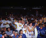
 - Shinerama 1999, Wilfrid Laurier University
 Canadian Cystic Fibrosis Foundation's Shinerama is Canada’s largest post-secondary fundraiser involving students at almost 60 university and college campuses across Canada. Shinerama originated at Waterloo Lutheran University in 1961, as an Orientation Week activity that raised money for local charities. Wilfrid Laurier University is located in Waterloo, Ontario. It began …
  Canadian Cystic Fibrosis Foundation's Shinerama is Canada’s largest post-secondary fundraiser involving students at almost 60 university and college campuses across Canada. Shinerama originated at Waterloo Lutheran University in 1961, as …Wilfrid Laurier University Library
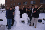
 - Students with snow sculpture, Wilfrid Laurier University Winter Carnival 1999
 Winter Carnival is an annual event organized by Wilfrid Laurier University students. The first Winter Carnival was held in 1961. Over the years the event has featured many different activities, including ice sculpture contests, musical concerts, outdoor sporting events, and the Miss Canadian University Queen Pageant. Wilfrid Laurier University is …
  Winter Carnival is an annual event organized by Wilfrid Laurier University students. The first Winter Carnival was held in 1961. Over the years the event has featured many different activities, …Wilfrid Laurier University Library
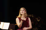
 - Jane Archibald in "Le Chien de Watteau"
 "Le Chien de Watteau" was a Laurier Opera production staged on November 20th and 21st, 1998 under the direction of Catherine Black. Wilfrid Laurier University is located in Waterloo, Ontario. It began in 1911 as the Evangelical Lutheran Seminary of Canada. In 1924 Waterloo College was established, providing courses in …
  "Le Chien de Watteau" was a Laurier Opera production staged on November 20th and 21st, 1998 under the direction of Catherine Black. Wilfrid Laurier University is located in Waterloo, Ontario. …Wilfrid Laurier University Library
 - Aerial View of Cochrane Street looking North, October 7, 1998
 A colour slide of an aerial view of Cochrane Street looking north in Whitby, Ontario.
  A colour slide of an aerial view of Cochrane Street looking north in Whitby, Ontario.Whitby Public Library
 - Aerial View of Cochrane Street looking North, October 7, 1998
 A colour slide of an aerial view of Cochrane Street looking north in Whitby, Ontario. This view is of Cochrane Street south of Bonacord Avenue.
  A colour slide of an aerial view of Cochrane Street looking north in Whitby, Ontario. This view is of Cochrane Street south of Bonacord Avenue.Whitby Public Library
 - Aerial View of Cochrane Street, October 7, 1998
 A colour slide of an aerial view of Cochrane Street looking north in Whitby, Ontario. This view is of Cochrane Street at Bonacord Avenue.
  A colour slide of an aerial view of Cochrane Street looking north in Whitby, Ontario. This view is of Cochrane Street at Bonacord Avenue.Whitby Public Library
 - Aerial View of Whitby Shores, October 7, 1998
 A colour slide of an aerial view of the subdivision of Whitby Shores under construction. Lynde Shores Conservation area is on the left side of the photograph.
  A colour slide of an aerial view of the subdivision of Whitby Shores under construction. Lynde Shores Conservation area is on the left side of the photograph.Whitby Public Library
 - Aerial View of Whitby looking North, October 7, 1998
 A colour slide of an aerial view of Whitby looking north. In this view the subdivision of West Lynde is in the foreground. Highway 2 (Dundas Street) is in the centre of the photograph.
  A colour slide of an aerial view of Whitby looking north. In this view the subdivision of West Lynde is in the foreground. Highway 2 (Dundas Street) is in the …Whitby Public Library
 - Aerial View of Whitby looking North, October 7, 1998
 A colour slide of an aerial view of Whitby looking north. In this view the intersection of Cochrane Street and Highway 2 (Dundas Street) is on the right side of the photograph.
  A colour slide of an aerial view of Whitby looking north. In this view the intersection of Cochrane Street and Highway 2 (Dundas Street) is on the right side of …Whitby Public Library


