- Map of Agnes Macphail locales in Grey County Part 1

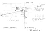
Hand drawn map of significant places relating to Agnes Macphail. The map identifies farms near the McPhail's, at Six Corners in Artemesia Township, as well as the location of Durham Rd. School which Agnes Macphail attended and two historical plaques erected in her honour.

Hand drawn map of significant places relating to Agnes Macphail. The map identifies farms near the McPhail's, at Six Corners in Artemesia Township, as well as the location of Durham …
South Grey Museum
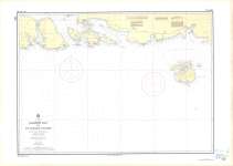
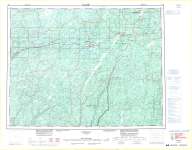
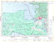
- Passage Island To/A Thunder Bay

Map housed at the Brodie Resource Library

Map housed at the Brodie Resource Library
Thunder Bay Public Library
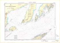
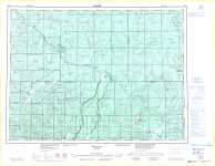
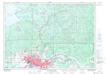
- Jackfish Bay to St. Ignace Island : Lake Superior

Map housed at the Brodie Resource Library

Map housed at the Brodie Resource Library
Thunder Bay Public Library
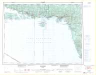
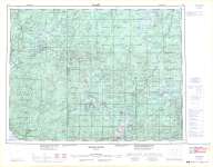
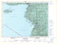
- Schreiber : Thunder Bay District

Map housed at the Brodie Resource Library

Map housed at the Brodie Resource Library
Thunder Bay Public Library
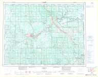
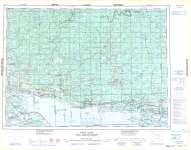
- Longlac

Map housed at the Brodie Resource Library

Map housed at the Brodie Resource Library
Thunder Bay Public Library
- Foleyet

Map housed at the Brodie Resource Library

Map housed at the Brodie Resource Library
Thunder Bay Public Library
- White River

Map housed at the Brodie Resource Library

Map housed at the Brodie Resource Library
Thunder Bay Public Library
- Timmins

Map housed at the Brodie Resource Library

Map housed at the Brodie Resource Library
Thunder Bay Public Library
- Sault Ste. Marie : Canada - United States of America

Map housed at the Brodie Resource Library

Map housed at the Brodie Resource Library
Thunder Bay Public Library
- Sault Ste. Marie

Map housed at the Brodie Resource Library

Map housed at the Brodie Resource Library
Thunder Bay Public Library
- Michipicoten

Map housed at the Brodie Resource Library

Map housed at the Brodie Resource Library
Thunder Bay Public Library
- Blind River

Map housed at the Brodie Resource Library

Map housed at the Brodie Resource Library
Thunder Bay Public Library
- Mainville Lake

Map housed at the Brodie Resource Library

Map housed at the Brodie Resource Library
Thunder Bay Public Library
- Mine Centre

Map housed at the Brodie Resource Library

Map housed at the Brodie Resource Library
Thunder Bay Public Library
- Manion Lake : Rainy River District

Map housed at the Brodie Resource Library

Map housed at the Brodie Resource Library
Thunder Bay Public Library
- Roseau : Canada - United States of America

Map housed at the Brodie Resource Library

Map housed at the Brodie Resource Library
Thunder Bay Public Library
- Kenora : Canada - United States of America

Map housed at the Brodie Resource Library

Map housed at the Brodie Resource Library
Thunder Bay Public Library
- Keewatin : Kenora District

Map housed at the Brodie Resource Library

Map housed at the Brodie Resource Library
Thunder Bay Public Library
- Kenora : Kenora District

Map housed at the Brodie Resource Library

Map housed at the Brodie Resource Library
Thunder Bay Public Library
- Dryden

Map housed at the Brodie Resource Library

Map housed at the Brodie Resource Library
Thunder Bay Public Library


 Hand drawn map of significant places relating to Agnes Macphail. The map identifies farms near the McPhail's, at Six Corners in Artemesia Township, as well as the location of Durham Rd. School which Agnes Macphail attended and two historical plaques erected in her honour.
  Hand drawn map of significant places relating to Agnes Macphail. The map identifies farms near the McPhail's, at Six Corners in Artemesia Township, as well as the location of Durham …South Grey Museum
 Map housed at the Brodie Resource Library
  Map housed at the Brodie Resource LibraryThunder Bay Public Library
 Map housed at the Brodie Resource Library
  Map housed at the Brodie Resource LibraryThunder Bay Public Library
 Map housed at the Brodie Resource Library
  Map housed at the Brodie Resource LibraryThunder Bay Public Library
 Map housed at the Brodie Resource Library
  Map housed at the Brodie Resource LibraryThunder Bay Public Library
 Map housed at the Brodie Resource Library
  Map housed at the Brodie Resource LibraryThunder Bay Public Library
 Map housed at the Brodie Resource Library
  Map housed at the Brodie Resource LibraryThunder Bay Public Library
 Map housed at the Brodie Resource Library
  Map housed at the Brodie Resource LibraryThunder Bay Public Library
 Map housed at the Brodie Resource Library
  Map housed at the Brodie Resource LibraryThunder Bay Public Library
 Map housed at the Brodie Resource Library
  Map housed at the Brodie Resource LibraryThunder Bay Public Library
 Map housed at the Brodie Resource Library
  Map housed at the Brodie Resource LibraryThunder Bay Public Library
 Map housed at the Brodie Resource Library
  Map housed at the Brodie Resource LibraryThunder Bay Public Library
 Map housed at the Brodie Resource Library
  Map housed at the Brodie Resource LibraryThunder Bay Public Library
 Map housed at the Brodie Resource Library
  Map housed at the Brodie Resource LibraryThunder Bay Public Library
 Map housed at the Brodie Resource Library
  Map housed at the Brodie Resource LibraryThunder Bay Public Library
 Map housed at the Brodie Resource Library
  Map housed at the Brodie Resource LibraryThunder Bay Public Library
 Map housed at the Brodie Resource Library
  Map housed at the Brodie Resource LibraryThunder Bay Public Library
 Map housed at the Brodie Resource Library
  Map housed at the Brodie Resource LibraryThunder Bay Public Library
 Map housed at the Brodie Resource Library
  Map housed at the Brodie Resource LibraryThunder Bay Public Library
 Map housed at the Brodie Resource Library
  Map housed at the Brodie Resource LibraryThunder Bay Public Library
