Results
We found 174 matching items.


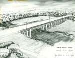
- Rebecca Street Bridge (William Anderson Bridge)
 Engineering drawing of the Rebecca Street Bridge.
  Engineering drawing of the Rebecca Street Bridge.
 - Sketch of Gas Station, South River, circa 1960
 This is a colour photograph of a sketching of a service station in South River. The sketching was done with black ink on white paper. The building is one floor. There is five large first floor windows, and a sign between two of them reads "BA." In front of the …
  This is a colour photograph of a sketching of a service station in South River. The sketching was done with black ink on white paper. The building is one floor. …South River - Machar Union PL
 - E.G. Schafer
 Dominion Life established in 1889 as Dominion Life Assurance Company. Bought by Manulife in 1985.
  Dominion Life established in 1889 as Dominion Life Assurance Company. Bought by Manulife in 1985.Waterloo Public Library
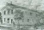
 - Oakville Town Hall
 Oakville’s first Town Hall and offices. Upstairs housed the community hall and the basement housed the local jail. It was built in 1862, but was destroyed by fire in 1913. The original building was located on Navy Street.
  Oakville’s first Town Hall and offices. Upstairs housed the community hall and the basement housed the local jail. It was built in 1862, but was destroyed by fire in 1913. …
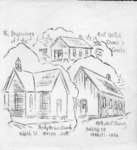
 - Sketch of Holy Cross Roman Catholic Church
 Sketch of Holy Cross Roman Catholic Church.
  Sketch of Holy Cross Roman Catholic Church.Esquesing Historical Society
 - Installation of Heaters at the Memorial Arena
 Georgetown Memorial Arena installation of heaters: Doug Vivvian (Manager).
  Georgetown Memorial Arena installation of heaters: Doug Vivvian (Manager).Esquesing Historical Society
 - Église unie du Canada / United Church of Canada
 Copie d'un document / Copy of a document
  Copie d'un document / Copy of a documentWest Nipissing Public Library
 - Calligraphy, Esther Demeny
 ...
...  ...Oakville Public Library
 - Caricature of "Art on the Green"
 ...
...  ...Oakville Public Library
 - Official opening card
 ...
...  ...Oakville Public Library
 - Port Arthur Public Library Proposed Addition : Sub-basement & Basement Plan
 Drawing housed at the Brodie Resource Library
  Drawing housed at the Brodie Resource LibraryThunder Bay Public Library
 - Reception Desk for the Fort William Public Library : Plan & Elevations
 Drawing housed at the Brodie Resource Library
  Drawing housed at the Brodie Resource LibraryThunder Bay Public Library
 - Reception Desk for the Fort William Public Library : Sections
 Drawing housed at the Brodie Resource Library
  Drawing housed at the Brodie Resource LibraryThunder Bay Public Library
 - Lighting Fixtures for F.W. Public Library
 Drawing housed at the Brodie Resource Library
  Drawing housed at the Brodie Resource LibraryThunder Bay Public Library
 - Public Library Building : Fort William
 Drawing housed at the Brodie Resource Library
  Drawing housed at the Brodie Resource LibraryThunder Bay Public Library
 - LHM058 Whitby and East Whitby Township
 Illustrated Historical Atlas of the County of Ontario, Ont. (Toronto, Ontario: J.H. Beers & Co., 1877), 1966 This is a 1966 reproduction of the 1867 map that was originally printed in the 1877 Historical Atlas for the County of Ontario.
  Illustrated Historical Atlas of the County of Ontario, Ont. (Toronto, Ontario: J.H. Beers & Co., 1877), 1966 This is a 1966 reproduction of the 1867 map that was originally printed in the 1877 Historical Atlas for the County of Ontario.Oshawa Public Libraries
 - LHM059 East Whitby Centennial Map
 Illustrated Historical Atlas of the County of Ontario, Ont. (Toronto, Ontario: J.H. Beers & Co., 1877), 1967 This is a 1967 Centennial reproduction based on the Ontario COunty Historical Atlas from 1877.
  Illustrated Historical Atlas of the County of Ontario, Ont. (Toronto, Ontario: J.H. Beers & Co., 1877), 1967 This is a 1967 Centennial reproduction based on the Ontario COunty Historical Atlas from 1877.Oshawa Public Libraries
 - LHM060 Wall Map of County of Ontario, North Portion
 Scale on map listed as 1" to 1 mile
  Scale on map listed as 1" to 1 mileOshawa Public Libraries
 - LHM073 Ajax (map)
 This is a map of the town of Ajax showing major streets, natural features, and Lake Ontario.
  This is a map of the town of Ajax showing major streets, natural features, and Lake Ontario.Oshawa Public Libraries
 - LHM074 Whitby (map)
 Information depicted current as of 1965, map printed in 1968.
  Information depicted current as of 1965, map printed in 1968.Oshawa Public Libraries

