Results


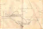
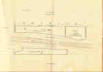
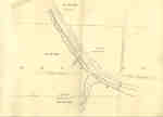
- Second Welland Canal - Book 1, Survey Map 1 - Entrance, Lock 1 and Port Dalhousie


 Survey map of the Second Welland Canal created by the Welland Canal Company showing the areas in and around Port Dalhousie and Grantham Township. Identified structures associated with the Canal include Lock 1, Lighthouse, Lighthouse Keeper's House, East and West Piers, Harbour, Waste Weir, Store House, Collector's Office, Collector Assistant …

 Survey map of the Second Welland Canal created by the Welland Canal Company showing the areas in and around Port Dalhousie and Grantham Township. Identified structures associated with the Canal …Brock University Archives
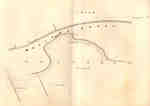
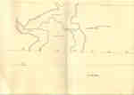
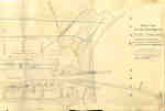
 - Second Welland Canal - Book 1, Survey Map 2 - Lock 1 and Port Dalhousie

 Survey map of the Second Welland Canal created by the Welland Canal Company showing the areas in and around Port Dalhousie and Grantham Township. Identified structures associated with the Canal include Lock 1, East and West Piers, Collector's Office, Lock Tender's House and the new towing path. The surveyors' measurements …
 Survey map of the Second Welland Canal created by the Welland Canal Company showing the areas in and around Port Dalhousie and Grantham Township. Identified structures associated with the Canal …Brock University Archives
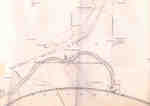
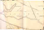
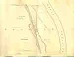
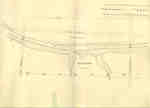
 - Second Welland Canal - Book 1, Survey Map 4 - Through Grantham Township

 Survey map of the Second Welland Canal created by the Welland Canal Company showing a portion of the Grantham Township. Identified structures associated with the Canal include the floating tow path and the canal itself. The surveyors' measurements and notes can be seen in red and black ink and pencil. …
 Survey map of the Second Welland Canal created by the Welland Canal Company showing a portion of the Grantham Township. Identified structures associated with the Canal include the floating tow …Brock University Archives
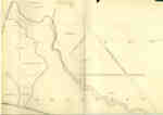
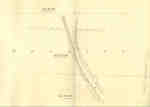
 - Second Welland Canal - Book 1, Survey Map 6 - Through Grantham and Louth Townships

 Survey map of the Second Welland Canal created by the Welland Canal Company showing the area between the Townships of Grantham and Louth. Identified structures associated with the Canal include the floating tow path. The surveyors' measurements and notes can be seen in red and black ink and pencil. Features …
 Survey map of the Second Welland Canal created by the Welland Canal Company showing the area between the Townships of Grantham and Louth. Identified structures associated with the Canal include …Brock University Archives
 - Second Welland Canal - Book 1, Survey Map 8 - Through Grantham and Louth Townships

 Survey map of the Second Welland Canal created by the Welland Canal Company showing the area between the Townships of Louth and Grantham. Identified structures associated with the Canal include the floating tow path. It is not labelled, but runs along the bottom of the map. The surveyors' measurements and …
 Survey map of the Second Welland Canal created by the Welland Canal Company showing the area between the Townships of Louth and Grantham. Identified structures associated with the Canal include …Brock University Archives
 - Second Welland Canal - Book 1, Survey Map 7 - Through Grantham Township

 Survey map of the Second Welland Canal created by the Welland Canal Company showing a portion of the Grantham Township. Identified structures associated with the Canal include the floating tow path. The surveyors' measurements and notes can be seen in red and black ink and pencil. Local area landmarks are …
 Survey map of the Second Welland Canal created by the Welland Canal Company showing a portion of the Grantham Township. Identified structures associated with the Canal include the floating tow …Brock University Archives
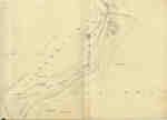
 - Second Welland Canal - Book 1, Survey Map 10 - St. Catharines


 Survey map of the Second Welland Canal created by the Welland Canal Company along the western edge of the Town of St. Catharines. Although not labelled, the Second Welland Canal can be seen running through the map along with its tow path, which is located on the southwestern edge of …

 Survey map of the Second Welland Canal created by the Welland Canal Company along the western edge of the Town of St. Catharines. Although not labelled, the Second Welland Canal …Brock University Archives
 - Trial of Dr. William H. King

 Dr. William King was the only criminal to be executed in Northumberland and was a well-known doctor of Brighton. He became infatuated with Melinda Vandervoort and began to feed his wife small doses of arsenic. After a hard-fought trial he was convicted of murder and on June 9, 1859 he …
 Dr. William King was the only criminal to be executed in Northumberland and was a well-known doctor of Brighton. He became infatuated with Melinda Vandervoort and began to feed his …Cobourg Public Library
 - Cover of historical booklet on the King murder case
 Dr. William King was the only criminal to be executed in Northumberland and was a well-known doctor of Brighton. He became infatuated with Melinda Vandervoort and began to feed his wife small doses of arsenic. After a hard-fought trial he was convicted of murder and on June 9, 1959 he …
  Dr. William King was the only criminal to be executed in Northumberland and was a well-known doctor of Brighton. He became infatuated with Melinda Vandervoort and began to feed his …Cobourg Public Library
 - Globe Hotel
 From "View of Cobourg, C.W." facsimile p.viii, Angle American magazine vol II Jan-June 1853
  From "View of Cobourg, C.W." facsimile p.viii, Angle American magazine vol II Jan-June 1853Cobourg Public Library
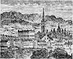
 - View of Cobourg from Weller's (Factory) Hill
 This picture from the mouth of Factory Creek is not totally accurate, but is important for its representation of the Globe Hotel (in the centre near the Church of England). The Globe Hotel stood on the northeast corner of King and McGill streets. It was destroyed by fire in 1864 …
  This picture from the mouth of Factory Creek is not totally accurate, but is important for its representation of the Globe Hotel (in the centre near the Church of England). …Cobourg Public Library
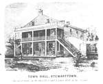
 - Town Hall
 A sketch of the “Town Hall”, built in 1849. It did not become the Esquesing Council Chambers until 1925. This sketch is copied from the Tremaine Map.
  A sketch of the “Town Hall”, built in 1849. It did not become the Esquesing Council Chambers until 1925. This sketch is copied from the Tremaine Map.Esquesing Historical Society
 - Oliver's Ferry c.1850
 A drawing of Oliver's Ferry c.1850 by Edwin Whitefield. The ferry was named after John Oliver but later his son William took over operation. William was shot by a neighbor in 1843 after an altracation.
  A drawing of Oliver's Ferry c.1850 by Edwin Whitefield. The ferry was named after John Oliver but later his son William took over operation. William was shot by a neighbor …Rideau Lakes Public Library
 - Second Welland Canal - Book 2, Survey Map 16 - Deep Cut in Thorold

 Survey map of the Second Welland Canal created by the Welland Canal Company showing the canal in the Thorold Township between Allanburg and Port Robinson. Identified structures and features associated with the Canal include the Deep Cut and the towing path. The surveyors' measurements and notes can be seen in …
 Survey map of the Second Welland Canal created by the Welland Canal Company showing the canal in the Thorold Township between Allanburg and Port Robinson. Identified structures and features associated …Brock University Archives
 - Second Welland Canal - Book 3, Survey Map 4 - Back Water in Thorold

 Survey map of the Second Welland Canal created by the Welland Canal Company showing the Back Water from the canal in Thorold Township near Port Robinson. The surveyors' measurements and notes can be seen in red and black ink and pencil. Local area landmarks are also identified and include the …
 Survey map of the Second Welland Canal created by the Welland Canal Company showing the Back Water from the canal in Thorold Township near Port Robinson. The surveyors' measurements and …Brock University Archives
 - Second Welland Canal - Book 3, Survey Map 6 - Canal along Chippewa Creek in Thorold

 Survey map of the Second Welland Canal created by the Welland Canal Company showing the canal along Chippewa Creek in Thorold Township. Identified structures and features associated with the Canal include the towing path, the back ditch, and the waterway itself. The surveyors' measurements and notes can be seen in …
 Survey map of the Second Welland Canal created by the Welland Canal Company showing the canal along Chippewa Creek in Thorold Township. Identified structures and features associated with the Canal …Brock University Archives
 - Second Welland Canal - Book 3, Survey Map 7 - Through Thorold

 Survey map of the Second Welland Canal created by the Welland Canal Company showing the canal in the Thorold Township between Port Robinson and Welland. Identified structures and features associated with the Canal include the towing path, a ditch, and the waterway itself. The surveyors' measurements and notes can be …
 Survey map of the Second Welland Canal created by the Welland Canal Company showing the canal in the Thorold Township between Port Robinson and Welland. Identified structures and features associated …Brock University Archives
 - Second Welland Canal - Book 3, Survey Map 8 - Quaker Bridge in Thorold


 Survey map of the Second Welland Canal created by the Welland Canal Company showing the canal in the Thorold Township between Port Robinson and Welland. Identified structures and features associated with the Canal include the towing path, back ditch, and the waterway itself. The surveyors' measurements and notes can be …

 Survey map of the Second Welland Canal created by the Welland Canal Company showing the canal in the Thorold Township between Port Robinson and Welland. Identified structures and features associated …Brock University Archives
 - Second Welland Canal - Book 3, Survey Map 21 - Village of Port Colborne


 Survey map of the Second Welland Canal created by the Welland Canal Company showing the areas in and around Port Colborne. Identified structures associated with the Canal include Lighthouse, Pier Light, Old Lock House, Collector's Office, Harbour Master's House, Canal Boundary, Back Ditch, Reserved Back Ditch, Basin, Light-Keeper's House and …

 Survey map of the Second Welland Canal created by the Welland Canal Company showing the areas in and around Port Colborne. Identified structures associated with the Canal include Lighthouse, Pier …Brock University Archives
 - Second Welland Canal - Book 3, Survey Map 9 - Canal along Chippewa Creek in Thorold


 Survey map of the Second Welland Canal created by the Welland Canal Company showing the canal in the Thorold Township between Port Robinson and Welland. Identified structures and features associated with the Canal include the towing path, back ditches, and the waterway itself. The surveyors' measurements and notes can be …

 Survey map of the Second Welland Canal created by the Welland Canal Company showing the canal in the Thorold Township between Port Robinson and Welland. Identified structures and features associated …Brock University Archives


