Results
We found 28 matching items.


- Second Welland Canal - Book 3, Survey Map 17 - Through Humberstone

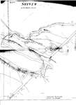
 Survey map of the Second Welland Canal created by the Welland Canal Company showing the area through Humberstone. Identified structures associated with the Canal include Spoil Banks, Towing Path, Back Ditches and Culvert. Surveyor measurements and notes can be seen in red and black ink and pencil. Local area landmarks …
 Survey map of the Second Welland Canal created by the Welland Canal Company showing the area through Humberstone. Identified structures associated with the Canal include Spoil Banks, Towing Path, Back …Brock University Archives
 - Second Welland Canal - Book 3, Survey Map 19 - Petersburgh and Humberstone

 Survey map of the Second Welland Canal created by the Welland Canal Company showing the areas in and around Petersburg and Humberstone. Identified structures associated with the Canal include North and South Back Ditches, Bridge Tender's Building, Towing Path, Old Back Ditch, and Covered Drain. Features of the First Welland …
 Survey map of the Second Welland Canal created by the Welland Canal Company showing the areas in and around Petersburg and Humberstone. Identified structures associated with the Canal include North …Brock University Archives
 - Sheriff Henry Ruttan
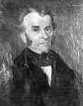
 Henry Rutttan served as Lieutenant in the War of 1812. Distinguished conducted at Lundry's Lane where he was wounded. Henry was married to Mary Jones, the daughter of Elias Jones, one of Cobourg's first settlers. By 1820 he became a member of the Legislative Assembly. In 1827 he became the …
  Henry Rutttan served as Lieutenant in the War of 1812. Distinguished conducted at Lundry's Lane where he was wounded. Henry was married to Mary Jones, the daughter of Elias Jones, …Cobourg Public Library
 - Survey of the Sixteen Mile Creek Hollow, 1847
 A cleaned up version of the map is also included in this record, courtesy of Mr. David Hobden. Click on "select" under the title above here. You can move the image around with your mouse to focus on certain parts of the photograph, or use the slider to zoom out …
  A cleaned up version of the map is also included in this record, courtesy of Mr. David Hobden. Click on "select" under the title above here. You can move the …Trafalgar Township Historical Society
 - Steamboat EMPIRE, 1844, Capt. D. Howe
 Some evidence suggests that this was published in a contemporary Detroit newspaper.
  Some evidence suggests that this was published in a contemporary Detroit newspaper.Maritime History of the Great Lakes
 - Sidewheeler Peytonia
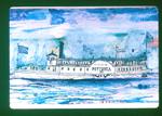
 The Peytonia, considered to be the second steamer in the passenger trade on Lake Winnebago, was built about 1847; 150 feet long, 30 feet wide. It carried many thousands of early settlers into the Fox river valley before the railroads came. It was wrecked by ice, April, 1858, while on …
  The Peytonia, considered to be the second steamer in the passenger trade on Lake Winnebago, was built about 1847; 150 feet long, 30 feet wide. It carried many thousands of …Maritime History of the Great Lakes
 - Barque NEW BRUNSWICK

 Maritime History of the Great Lakes
 - Brockville (Ontario), Looking down the St. Lawrence River
 Pencil on bristol board, with ruled border of pencil
  Pencil on bristol board, with ruled border of pencilAssociation for Great Lakes Maritime History
 - Brockville (Ontario)
 Photograph of pencil drawing
  Photograph of pencil drawingAssociation for Great Lakes Maritime History
 - Kingston, from Barriefield (Ontario)
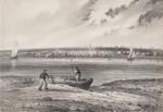
 Pencil on bristol board, with ruled border of pencil
  Pencil on bristol board, with ruled border of pencilAssociation for Great Lakes Maritime History
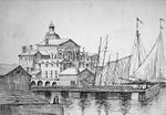
 - View looking n.e. across Helliwell's wharf to rear of City Hall.
 Pen & ink drawing, after a pencil drawing.
  Pen & ink drawing, after a pencil drawing.Association for Great Lakes Maritime History
 - Toronto from the Island
 Pencil on wove paper
  Pencil on wove paperAssociation for Great Lakes Maritime History
 - Toronto Harbour 1847, looking east from Queen's Wharf, foot of Bathurst St., Toronto, Ont.
 Pen & ink drawing.
  Pen & ink drawing.Association for Great Lakes Maritime History
 - Ermatinger's Grist Mill, Canadian Shore, Sault Ste. Marie
 Graphite on paper
  Graphite on paperAssociation for Great Lakes Maritime History
 - Manitowaning Village Seen from Fanny Island
 Graphite on paper
  Graphite on paperAssociation for Great Lakes Maritime History
 - The Second Horse Boat (Toronto, 1845?)
 Pen and black ink over traces of moderate greenish blue pencil on wove paper. Laid down on album page
  Pen and black ink over traces of moderate greenish blue pencil on wove paper. Laid down on album pageAssociation for Great Lakes Maritime History
 - The Milwaukie
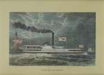
 The MILWAUKIE was chartered to the Upper Canadian administration in 1838-39 and operated as the SIR JOHN COLBORNE.
  The MILWAUKIE was chartered to the Upper Canadian administration in 1838-39 and operated as the SIR JOHN COLBORNE.Maritime History of the Great Lakes
 - Propeller Phoenix, Capt. B. G. Sweet, 1845
 PHOENIX was destroyed by fire off Sheboygan, WI, Lake Michigan, on 21 November 1847.
  PHOENIX was destroyed by fire off Sheboygan, WI, Lake Michigan, on 21 November 1847.Maritime History of the Great Lakes
 - S. S. VANDALIA, Passing Through the Old Welland Canal
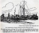
 Courtesy Canada Steamship Lines' Marine Hist. Coll. S. S. VANDALIA, Passing Through the Old Welland Canal This vessel was built at Oswego, N.Y., in 1841, and was propelled with the Ericsson Patent Screw Propeller. She was the first commercially operated propeller vessel in the world, and first on ...
  Courtesy Canada Steamship Lines' Marine Hist. Coll. S. S. VANDALIA, Passing Through the Old Welland Canal This vessel was built at Oswego, N.Y., in 1841, and was propelled with the …Maritime History of the Great Lakes
 - Kelley's and Bass Islands, 1849
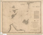
 "Kelley's and Bass Islands Showing the Harbors of Refuge in their vicinity being an extract from the Survey of the West End of Lake Erie made under the direction of the Bureau of Topographical Engineers, War Department in obedience to Acts of Congress requiring the Survey of the Northern ...
  "Kelley's and Bass Islands Showing the Harbors of Refuge in their vicinity being an extract from the Survey of the West End of Lake Erie made under the direction of …Maritime History of the Great Lakes


