Results


Page 1 of 1
- Plan of the Township of Grantham and Louth 1814
 A copy of a map from the National Archives.
  A copy of a map from the National Archives.St. Catharines Museum
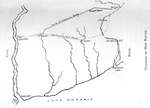
 - Diagram of Laura Secord's Route
 Sketched map with text depicting Laura Secord's projected route from Thorold to Queenston.
  Sketched map with text depicting Laura Secord's projected route from Thorold to Queenston.
 - Plan of the American Forts and Possessions in the Environs of the Head of Lake Erie [1811]
 Watermark on the paper is 1811. This map was made before 1814 when LeBreton was Deputy Quarter Master General
  Watermark on the paper is 1811. This map was made before 1814 when LeBreton was Deputy Quarter Master GeneralMaritime History of the Great Lakes
 - Map of Detroit River and Adjacent Country [1813]
 From LAC: It appears that the bottom imprint line was cut off. It should read "Enter as the act directs, Philadelphia Published by John Melish, Chestnut street, 26 August 1813."
  From LAC: It appears that the bottom imprint line was cut off. It should read "Enter as the act directs, Philadelphia Published by John Melish, Chestnut street, 26 August 1813."Maritime History of the Great Lakes
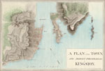
 - A Plan of the Town and Adjacent Fortifications of Kingston
 A Plan of the Town and Adjacent Fortifications of Kingston Surveyed and Drawn in August 1816, by Lieut E. A.Smith, 70th Reg't
  A Plan of the Town and Adjacent Fortifications of Kingston Surveyed and Drawn in August 1816, by Lieut E. A.Smith, 70th Reg'tMaritime History of the Great Lakes
Page 1 of 1


![Plan of the American Forts and Possessions in the Environs of the Head of Lake Erie [1811] Plan of the American Forts and Possessions in the Environs of the Head of Lake Erie [1811]](https://images.MaritimeHistoryoftheGreatLakes.ca/images/MHGL000122573t.jpg)
![Map of Detroit River and Adjacent Country [1813] Map of Detroit River and Adjacent Country [1813]](https://images.MaritimeHistoryoftheGreatLakes.ca/images/MHGL000122574t.jpg)

