Results
We found 3 matching items.


Page 1 of 1
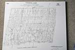
- A map of the land purchased from the Mississaugas in 1806
 A map of the land purchased from the Mississaugas in 1806
  A map of the land purchased from the Mississaugas in 1806Oakville Public Library
 - 1806 Trafalgar Township Map


 This copy of the Wilmot survey map of Trafalgar Township was photographed from a wonderful display copy. It looks like Mr. Wilmot signed his name, "Sam L. Wilmot", but it is actually "Sam S. Wilmot".

 This copy of the Wilmot survey map of Trafalgar Township was photographed from a wonderful display copy. It looks like Mr. Wilmot signed his name, "Sam L. Wilmot", but it …Trafalgar Township Historical Society
 - Sketch of Land Purchase from the Mississauga Indians 1805
 In 1787-88 the Toronto Purchase was made in absence of legal documents between Sir John Johnson and the Mississaugas, because of the former absence of legal documents the agreements was confirmed in 1805 with the Mississauga Indians at the River Credit reaffirming the old boundaries of 1787-88.
  In 1787-88 the Toronto Purchase was made in absence of legal documents between Sir John Johnson and the Mississaugas, because of the former absence of legal documents the agreements was …Oakville Public Library
Page 1 of 1


