Results


Page 1 of 1
- Lands of the Giant
 Wojciechowski, Barry, Lake Superior Magazine, Jul 2013 Full text available at the Brodie Resource Library
  Wojciechowski, Barry, Lake Superior Magazine, Jul 2013 Full text available at the Brodie Resource LibraryThunder Bay Public Library
 - Salem Lutheran Cemetery

 Alternate Cemetery Name: Pass Lake Cemetery County/District/Region: Thunder Bay District Historical Township: Sibley Current Municipality: Sibley Historical Municipality: Pass Lake Lot: 2 Part Concession: 5 Location address: East side of Hwy 587, about 100 m south of junction with Community Hall Road Denomination: Lutheran Cemetery Status: Active Transcription Status: Transcribed …
 Alternate Cemetery Name: Pass Lake Cemetery County/District/Region: Thunder Bay District Historical Township: Sibley Current Municipality: Sibley Historical Municipality: Pass Lake Lot: 2 Part Concession: 5 Location address: East side of …
 - Silver Islet Community Cemetery

 County/District/Region: Thunder Bay District Historical Township: Sibley Current Municipality: Sibley Historical Municipality: Silver Islet location address: Former Silver Islet mine on Thunder Cape, about 100 m. north of the main village street, and just west of the creek, behind private property Cemetery Status: Closed to further burials Transcription Status: Transcribed …
 County/District/Region: Thunder Bay District Historical Township: Sibley Current Municipality: Sibley Historical Municipality: Silver Islet location address: Former Silver Islet mine on Thunder Cape, about 100 m. north of the main …
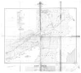
 - Loon Sheet : Thunder Bay District
 Map housed at the Brodie Resource Library
  Map housed at the Brodie Resource LibraryThunder Bay Public Library
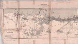
 - Sketch map of the Thunder Bay mining region of Lake Superior
 Map housed at the Brodie Resource Library
  Map housed at the Brodie Resource LibraryThunder Bay Public Library
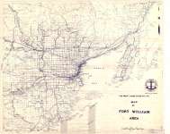
 - Map of Fort William Area
 Map housed at the Brodie Resource Library
  Map housed at the Brodie Resource LibraryThunder Bay Public Library
Page 1 of 1


