- Welland Canal Survey of Lands Welland Canal Company Land in Thorold, 1834

Survey map of the lands of the Welland Canal Company in Thorold. Created by The Welland Canal Company. Noteable features include; Company's land, reservoir, channel of canal, bridge, Pine street, Mullen street, lot divisions. The plan is titled "Plan of Lands belonging to the Welland Canal Company being the West …

Survey map of the lands of the Welland Canal Company in Thorold. Created by The Welland Canal Company. Noteable features include; Company's land, reservoir, channel of canal, bridge, Pine street, …
Brock University Archives
- Welland Canal Survey of Lands Peter Vanevery, 1827

Survey map and description of Peter Vanevery's land created by The Welland Canal Company. Included is a written description of the land along with a drawing of the land. Noteable features include; lines between lots, L. Carrol's and E. Bouke's land. The land totals 100 acres. Deed from Jacob Stule …

Survey map and description of Peter Vanevery's land created by The Welland Canal Company. Included is a written description of the land along with a drawing of the land. Noteable …
Brock University Archives
- Welland Canal Survey of Lands William McLellan

Survey map and description of William McLellan's land created by The Welland Canal Company. Included is a written description of the land along with a drawing of the land. Noteable features include; line between lots, canal. Surveyor notes are seen in pencil on the map.

Survey map and description of William McLellan's land created by The Welland Canal Company. Included is a written description of the land along with a drawing of the land. Noteable …
Brock University Archives
- Welland Canal Survey of Lands Samuel Swayze, 1827

Survey map and description of Samuel Swayze's land created by The Welland Canal Company. Included is a written description of the land along with a drawing of the land. Noteable features include; lot division. The land totals 65 acres and 12 perches. The deed from Hall Davis to the Welland …

Survey map and description of Samuel Swayze's land created by The Welland Canal Company. Included is a written description of the land along with a drawing of the land. Noteable …
Brock University Archives
- Welland Canal Survey of Lands Garrett Vanderburgh, 1826

Survey map and description of Garret Vanderburgh's land created by The Welland Canal Company. Included is a written description of the land along with a drawing of the land. Noteable features include; division between Swayze and Carl's land. The deed for the land is dated November 9th, 1826. The land …

Survey map and description of Garret Vanderburgh's land created by The Welland Canal Company. Included is a written description of the land along with a drawing of the land. Noteable …
Brock University Archives
- Welland Canal Survey of Lands John Brown, 1827

Survey map and description of John Brown's land created by The Welland Canal Company. Included is a written description of the land along with a drawing of the land. Noteable features include; Welland river, towpath, canal, lock, side line between Broan and Carl. The land totals 6 acres, 3 roads …

Survey map and description of John Brown's land created by The Welland Canal Company. Included is a written description of the land along with a drawing of the land. Noteable …
Brock University Archives
- Welland Canal Survey of Lands John Watson, 1831

Survey map and description of John Watson's land created by The Welland Canal Company. Included is a written description of the land along with a drawing of the land. The land totals 2 acres, 1 road, and 21 perches. The land was surveyed on September 5th, 1831.

Survey map and description of John Watson's land created by The Welland Canal Company. Included is a written description of the land along with a drawing of the land. The …
Brock University Archives
- Welland Canal Survey of Lands Widow McAlpine

Survey map and description of Widow McAlpine's land created by The Welland Canal Company. Included is a written description of the land along with a drawing of the land. Noteable features include; line between Carl and Widow McAlpine, line between McAlpine and D. Thompson Esq. The land totals 15 acres …

Survey map and description of Widow McAlpine's land created by The Welland Canal Company. Included is a written description of the land along with a drawing of the land. Noteable …
Brock University Archives
- Welland Canal Survey of Lands David Thompson Esquire

Survey map and description of David Thompson's land created by The Welland Canal Company. Included is a written description of the land along with a drawing of the land. Noteable features include; line between Widow McAlpine and Thompson's land. The land contains 9 acres, 3 roads, 11 perches and 2 …

Survey map and description of David Thompson's land created by The Welland Canal Company. Included is a written description of the land along with a drawing of the land. Noteable …
Brock University Archives
- Welland Canal Survey of Lands Elijah Shotwell, 1834

See also page 138.

See also page 138.
Brock University Archives
- Welland Canal Survey of Lands Jonathan Silverthorn, 1834

See also page 138.

See also page 138.
Brock University Archives
- Welland Canal Survey of Lands Joseph Burger, n.d.

Survey map and description of Joseph Burger's land created by The Welland Canal Company. Included is a written description of the land along with a drawing of the land. Noteable features include; line between Silverthorn and Burger's land, line between Burger and Shotwell's land. The land totals 15 acres, 1 …

Survey map and description of Joseph Burger's land created by The Welland Canal Company. Included is a written description of the land along with a drawing of the land. Noteable …
Brock University Archives
- Welland Canal Survey of Lands Smith Shotwell, 1834

Survey map and description of Smith Shotwell's land created by The Welland Canal Company. Included is a written description of the land along with a drawing of the land. Noteable features include; the Welland River, road. The deed for the land is dated October 14, 1834. The land totals 10 …

Survey map and description of Smith Shotwell's land created by The Welland Canal Company. Included is a written description of the land along with a drawing of the land. Noteable …
Brock University Archives
- Welland Canal Survey of Lands Michael and Jacob Silverthorn, 1834

Survey map and description of Michael and Jacob Silverthorn's land created by The Welland Canal Company. Included is a written description of the land along with a drawing of the land. Noteable features include; line between Burger and Silverthorn's land, reservoir, wood land, road leading to Quaker settlement, line between …

Survey map and description of Michael and Jacob Silverthorn's land created by The Welland Canal Company. Included is a written description of the land along with a drawing of the …
Brock University Archives
- The Beaverdams Methodist Church

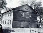
Slide File Number: 04.67-C-2 Beaverdams Methodist Church was constructed in 1832 and is Ontario's oldest standing Methodist church. Regular services were discontinued in 1890 but the building served as a Sunday School until the 1970's. The building was designated under the Ontario Heritage Act in 1994, which includes an adjacent …

Slide File Number: 04.67-C-2 Beaverdams Methodist Church was constructed in 1832 and is Ontario's oldest standing Methodist church. Regular services were discontinued in 1890 but the building served as a …
St. Catharines Public Library
- The Beaverdams Methodist Church

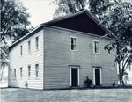
Slide File Number: 04.67-C-3 Beaverdams Methodist Church was constructed in 1832 and is Ontario's oldest standing Methodist church. Regular services were discontinued in 1890 but the building served as a Sunday School until the 1970's. The building was designated under the Ontario Heritage Act in 1994, which includes an adjacent …

Slide File Number: 04.67-C-3 Beaverdams Methodist Church was constructed in 1832 and is Ontario's oldest standing Methodist church. Regular services were discontinued in 1890 but the building served as a …
St. Catharines Public Library
- Trinity United Church

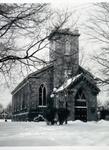
Slide File Number: 04.73-E-3

Slide File Number: 04.73-E-3
St. Catharines Public Library
- Our Lady of the Holy Rosary Roman Catholic Church

Slide File Number: 04.72-B-1

Slide File Number: 04.72-B-1
St. Catharines Public Library
- St. Mary's Ukrainian Catholic Church

Slide File Number: 04.71-A-1

Slide File Number: 04.71-A-1
St. Catharines Public Library
- Aerial View of the Welland Canal

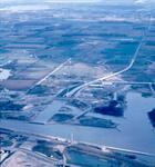
Slide File Number: 08.20-C-1

Slide File Number: 08.20-C-1
St. Catharines Public Library


 Survey map of the lands of the Welland Canal Company in Thorold. Created by The Welland Canal Company. Noteable features include; Company's land, reservoir, channel of canal, bridge, Pine street, Mullen street, lot divisions. The plan is titled "Plan of Lands belonging to the Welland Canal Company being the West …
  Survey map of the lands of the Welland Canal Company in Thorold. Created by The Welland Canal Company. Noteable features include; Company's land, reservoir, channel of canal, bridge, Pine street, …Brock University Archives
 Survey map and description of Peter Vanevery's land created by The Welland Canal Company. Included is a written description of the land along with a drawing of the land. Noteable features include; lines between lots, L. Carrol's and E. Bouke's land. The land totals 100 acres. Deed from Jacob Stule …
  Survey map and description of Peter Vanevery's land created by The Welland Canal Company. Included is a written description of the land along with a drawing of the land. Noteable …Brock University Archives
 Survey map and description of William McLellan's land created by The Welland Canal Company. Included is a written description of the land along with a drawing of the land. Noteable features include; line between lots, canal. Surveyor notes are seen in pencil on the map.
  Survey map and description of William McLellan's land created by The Welland Canal Company. Included is a written description of the land along with a drawing of the land. Noteable …Brock University Archives
 Survey map and description of Samuel Swayze's land created by The Welland Canal Company. Included is a written description of the land along with a drawing of the land. Noteable features include; lot division. The land totals 65 acres and 12 perches. The deed from Hall Davis to the Welland …
  Survey map and description of Samuel Swayze's land created by The Welland Canal Company. Included is a written description of the land along with a drawing of the land. Noteable …Brock University Archives
 Survey map and description of Garret Vanderburgh's land created by The Welland Canal Company. Included is a written description of the land along with a drawing of the land. Noteable features include; division between Swayze and Carl's land. The deed for the land is dated November 9th, 1826. The land …
  Survey map and description of Garret Vanderburgh's land created by The Welland Canal Company. Included is a written description of the land along with a drawing of the land. Noteable …Brock University Archives
 Survey map and description of John Brown's land created by The Welland Canal Company. Included is a written description of the land along with a drawing of the land. Noteable features include; Welland river, towpath, canal, lock, side line between Broan and Carl. The land totals 6 acres, 3 roads …
  Survey map and description of John Brown's land created by The Welland Canal Company. Included is a written description of the land along with a drawing of the land. Noteable …Brock University Archives
 Survey map and description of John Watson's land created by The Welland Canal Company. Included is a written description of the land along with a drawing of the land. The land totals 2 acres, 1 road, and 21 perches. The land was surveyed on September 5th, 1831.
  Survey map and description of John Watson's land created by The Welland Canal Company. Included is a written description of the land along with a drawing of the land. The …Brock University Archives
 Survey map and description of Widow McAlpine's land created by The Welland Canal Company. Included is a written description of the land along with a drawing of the land. Noteable features include; line between Carl and Widow McAlpine, line between McAlpine and D. Thompson Esq. The land totals 15 acres …
  Survey map and description of Widow McAlpine's land created by The Welland Canal Company. Included is a written description of the land along with a drawing of the land. Noteable …Brock University Archives
 Survey map and description of David Thompson's land created by The Welland Canal Company. Included is a written description of the land along with a drawing of the land. Noteable features include; line between Widow McAlpine and Thompson's land. The land contains 9 acres, 3 roads, 11 perches and 2 …
  Survey map and description of David Thompson's land created by The Welland Canal Company. Included is a written description of the land along with a drawing of the land. Noteable …Brock University Archives
 See also page 138.
  See also page 138.Brock University Archives
 See also page 138.
  See also page 138.Brock University Archives
 Survey map and description of Joseph Burger's land created by The Welland Canal Company. Included is a written description of the land along with a drawing of the land. Noteable features include; line between Silverthorn and Burger's land, line between Burger and Shotwell's land. The land totals 15 acres, 1 …
  Survey map and description of Joseph Burger's land created by The Welland Canal Company. Included is a written description of the land along with a drawing of the land. Noteable …Brock University Archives
 Survey map and description of Smith Shotwell's land created by The Welland Canal Company. Included is a written description of the land along with a drawing of the land. Noteable features include; the Welland River, road. The deed for the land is dated October 14, 1834. The land totals 10 …
  Survey map and description of Smith Shotwell's land created by The Welland Canal Company. Included is a written description of the land along with a drawing of the land. Noteable …Brock University Archives
 Survey map and description of Michael and Jacob Silverthorn's land created by The Welland Canal Company. Included is a written description of the land along with a drawing of the land. Noteable features include; line between Burger and Silverthorn's land, reservoir, wood land, road leading to Quaker settlement, line between …
  Survey map and description of Michael and Jacob Silverthorn's land created by The Welland Canal Company. Included is a written description of the land along with a drawing of the …Brock University Archives
 Slide File Number: 04.67-C-2 Beaverdams Methodist Church was constructed in 1832 and is Ontario's oldest standing Methodist church. Regular services were discontinued in 1890 but the building served as a Sunday School until the 1970's. The building was designated under the Ontario Heritage Act in 1994, which includes an adjacent …
  Slide File Number: 04.67-C-2 Beaverdams Methodist Church was constructed in 1832 and is Ontario's oldest standing Methodist church. Regular services were discontinued in 1890 but the building served as a …St. Catharines Public Library
 Slide File Number: 04.67-C-3 Beaverdams Methodist Church was constructed in 1832 and is Ontario's oldest standing Methodist church. Regular services were discontinued in 1890 but the building served as a Sunday School until the 1970's. The building was designated under the Ontario Heritage Act in 1994, which includes an adjacent …
  Slide File Number: 04.67-C-3 Beaverdams Methodist Church was constructed in 1832 and is Ontario's oldest standing Methodist church. Regular services were discontinued in 1890 but the building served as a …St. Catharines Public Library
 Slide File Number: 04.73-E-3
  Slide File Number: 04.73-E-3St. Catharines Public Library
 Slide File Number: 04.72-B-1
  Slide File Number: 04.72-B-1St. Catharines Public Library
 Slide File Number: 04.71-A-1
  Slide File Number: 04.71-A-1St. Catharines Public Library
 Slide File Number: 08.20-C-1
  Slide File Number: 08.20-C-1St. Catharines Public Library


