Results


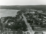
- Aerial Photograph of Main Street and Highway 11, Sundridge, circa 1960

 Black and white aerial photograph of Sundridge and Lake Bernard. In the middle is the Main Street and Highway 11.
 Black and white aerial photograph of Sundridge and Lake Bernard. In the middle is the Main Street and Highway 11.Sundridge - Strong Union PL
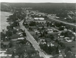
 - Aerial Photograph of Main Street and Highway 11, Sundridge, circa 1960

 Black and white aerial photograph of Sundridge Ontario during the 1960s. Lake Bernard is on the left of the photograph. In the middle of the image is the Main Street and Highway 11 is on the right side of the photograph.
 Black and white aerial photograph of Sundridge Ontario during the 1960s. Lake Bernard is on the left of the photograph. In the middle of the image is the Main Street …Sundridge - Strong Union PL
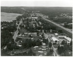
 - Aerial Photograph of Sundridge, circa 1960

 Black and white aerial photograph of Sundridge Ontario during the 1960s. A small portion of Lake Bernard can be seen in the upper left hand portion of the image. Hwy 11 can be seen on the right hand side of the photograph.
 Black and white aerial photograph of Sundridge Ontario during the 1960s. A small portion of Lake Bernard can be seen in the upper left hand portion of the image. Hwy …Sundridge - Strong Union PL
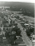
 - Aerial Photograph of Main Street and Highway 11, Sundridge, ON, circa 1960

 Black and white aerial photograph of Sundridge during the 1960s. Highway 11 is on the right side of the image, and the main street of Sundridge is the prominent road on the left side of the photograph.
 Black and white aerial photograph of Sundridge during the 1960s. Highway 11 is on the right side of the image, and the main street of Sundridge is the prominent road …Sundridge - Strong Union PL
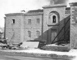
 - Demolition of Ontario County Jail, 1960
 he Ontario County Jail was built in 1853 at the south-east corner of King and Gilbert Streets and demolished in February 1960. It was replaced by the new jail on Victoria Street in 1958.
  he Ontario County Jail was built in 1853 at the south-east corner of King and Gilbert Streets and demolished in February 1960. It was replaced by the new jail on …Whitby Public Library
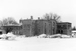
 - Demolition of Ontario County Jail, 1960
 The Ontario County Jail was built in 1853 at the south-east corner of King and Gilbert Streets and demolished in February 1960. It was replaced by the new jail on Victoria Street in 1958.
  The Ontario County Jail was built in 1853 at the south-east corner of King and Gilbert Streets and demolished in February 1960. It was replaced by the new jail on …Whitby Public Library
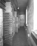
 - Ontario County Jail Cell Block
 The Ontario County Jail was built in 1853 at the south-east corner of King and Gilbert Streets and demolished in February 1960. It was replaced by the new jail on Victoria Street in 1958.
  The Ontario County Jail was built in 1853 at the south-east corner of King and Gilbert Streets and demolished in February 1960. It was replaced by the new jail on …Whitby Public Library
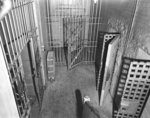
 - Ontario County Jail Cells
 The Ontario County Jail was built in 1853 at the south-east corner of King and Gilbert Streets and demolished in February 1960. It was replaced by the new jail on Victoria Street in 1958.
  The Ontario County Jail was built in 1853 at the south-east corner of King and Gilbert Streets and demolished in February 1960. It was replaced by the new jail on …Whitby Public Library
 - The Evangelical Lutheran Church of the Good Shepherd, Toronto, Ontario
 There are lines drawn in ink on the photograph. Eastern Synod of the Evangelical Lutheran Church in Canada is one of five synods of the Evangelical Lutheran Church in Canada, consisting of more than 200 member congregations and 78,000 baptized members. The territory of the Eastern Synod runs from Sault …
  There are lines drawn in ink on the photograph. Eastern Synod of the Evangelical Lutheran Church in Canada is one of five synods of the Evangelical Lutheran Church in Canada, …Wilfrid Laurier University Library
 - Schoolhouse, School Section #1, Lount Township, circa 1960
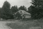
 Black and white photograph of a schoolhouse, School Section #1, Lount Township, circa 1960. The photo shows the front of the schoolhouse, which is a one floor building, with four windows on the side visible. There's a covered porch at the entrance, and the exterior's dark. There are evergreen trees …
  Black and white photograph of a schoolhouse, School Section #1, Lount Township, circa 1960. The photo shows the front of the schoolhouse, which is a one floor building, with four …South River - Machar Union PL
 - Schoolhouse, School Section #2, Lount Township, circa 1960
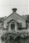
 Black and white photograph of a schoolhouse, School Section # 2, Lount, circa 1960. The building has one floor, with a covered porch at the entrance. There are three windows along its side. The exterior's dark, and a chimney can be seen in the middle of the roof. The yard …
  Black and white photograph of a schoolhouse, School Section # 2, Lount, circa 1960. The building has one floor, with a covered porch at the entrance. There are three windows …South River - Machar Union PL
 - The Brennan School, South River Area, circa 1960

 This is a black and white photograph of the Brennan School, South River Area, circa 1960. The picture's showing the entrance to the former school. The building has one floor, with the exterior wood siding painted light on the top, with a darker part on the bottom few feet. The …
 This is a black and white photograph of the Brennan School, South River Area, circa 1960. The picture's showing the entrance to the former school. The building has one floor, …South River - Machar Union PL
 - Group Photo Outside a House

 Black and white photograph of a group of people posing outside of a house. There's a couple in the front row. The second row has four women and a man in it. The third row has three men, they're leaning. The Back row has five men, they are standing. The …
 Black and white photograph of a group of people posing outside of a house. There's a couple in the front row. The second row has four women and a man …South River - Machar Union PL
 - Gord Maeck's Barber Shop Ottawa Street, South River
 Gordon Maeck operated a barber shop in South River on Ottawa Street from 1944 until 1980.
  Gordon Maeck operated a barber shop in South River on Ottawa Street from 1944 until 1980.South River - Machar Union PL
 - Charter membership, Trinity Evangelical Lutheran Church, St. John's, Newfoundland
 On Sunday, June 5, 1960 Trinity Evangelical Lutheran Church, the first Lutheran congregation in Newfoudland, was organized under the Pastorate of William Kurschinski. The organization service was held in the Prince of Wales Annez, LeMarchant Road. Eastern Synod of the Evangelical Lutheran Church in Canada is one of five synods …
  On Sunday, June 5, 1960 Trinity Evangelical Lutheran Church, the first Lutheran congregation in Newfoudland, was organized under the Pastorate of William Kurschinski. The organization service was held in the …Wilfrid Laurier University Library
 - Tom McLennan Farm House, Thessalon, circa 1960
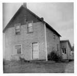
 The frame house replaced the original log home that stood on the property when Mr. and Mrs. McLennan took possession of the property in 1898. The frame house was built in 1910 and was still in use as of 1960. This photo can be found in the Tweedsmuir History created …
  The frame house replaced the original log home that stood on the property when Mr. and Mrs. McLennan took possession of the property in 1898. The frame house was built …Thessalon Union Public Library
 - Robert Allen Baling Hay, Thessalon, circa 1970

 The ink notation below this photo states "Robert Allen Stooking baled hay in the 1960's." This photo can be found in the Tweedsmuir History created by the Princess Elizabeth Women's Institute.
 The ink notation below this photo states "Robert Allen Stooking baled hay in the 1960's." This photo can be found in the Tweedsmuir History created by the Princess Elizabeth Women's …Thessalon Union Public Library
 - Leach Home, Thessalon, circa 1960
 This photo can be found in the Tweedsmuir History created by the Princess Elizabeth Women's Institute.
  This photo can be found in the Tweedsmuir History created by the Princess Elizabeth Women's Institute.Thessalon Union Public Library
 - Pine Ridge Farm Barn, Thessalon, circa 1921
 This photo can be found in the Tweedsmuir History created by the Princess Elizabeth Women's Institute.
  This photo can be found in the Tweedsmuir History created by the Princess Elizabeth Women's Institute.Thessalon Union Public Library
 - Hastings Steele
 (Condition: Good.)
  (Condition: Good.)Rideau Lakes Public Library

