Results


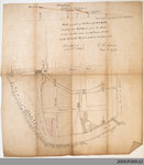
- Plan of Paris showing the Nith River Area, 1869
 This item was digitized on November 14th, 2009, during a Digitization Days event at the Paris Branch of the County of Brant Public Library.
  This item was digitized on November 14th, 2009, during a Digitization Days event at the Paris Branch of the County of Brant Public Library.County of Brant Public Library
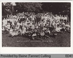
 - Baptist Picnic, Burt's Grove, June 19 1909
 This photograph shows a church picnic in Burt's Grove, a mile north of Paris. At one time, a trolley line ran through this area. The area was popular for church picnics. Members of the Crouse family are likely in this image. Ted Wallace has provided information on the location of …
  This photograph shows a church picnic in Burt's Grove, a mile north of Paris. At one time, a trolley line ran through this area. The area was popular for church …County of Brant Public Library
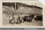
 - Workers building Highway 24 near Perry German's Farm

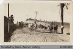
 This photograph shows a group of construction workers building Highway 24 in the 1920s. The photos in this set were taken near Perry German's farm. Charles Alvin Truckle can be seen sitting on the right. This photograph was provided by Elaine (Tanner) Culling during a Digitization Day event held by …
 This photograph shows a group of construction workers building Highway 24 in the 1920s. The photos in this set were taken near Perry German's farm. Charles Alvin Truckle can be …County of Brant Public Library
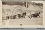
 - Workers building Highway 24 near Perry German's Farm

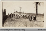
 This photograph shows a group of construction workers building Highway 24 in the 1920s. The photos in this set were taken near Perry German's farm. Charles Alvin Truckle can be seen in many photos. This photograph was provided by Elaine (Tanner) Culling during a Digitization Day event held by the …
 This photograph shows a group of construction workers building Highway 24 in the 1920s. The photos in this set were taken near Perry German's farm. Charles Alvin Truckle can be …County of Brant Public Library
 - Workers building Highway 24 near Perry German's Farm

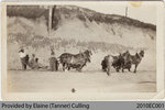
 This photograph shows a group of construction workers building Highway 24 in the 1920s. The photos in this set were taken near Perry German's farm. Charles Alvin Truckle can be seen in many photos, and is probably on the white horse to the left. This photograph was provided by Elaine …
 This photograph shows a group of construction workers building Highway 24 in the 1920s. The photos in this set were taken near Perry German's farm. Charles Alvin Truckle can be …County of Brant Public Library
 - Workers building Highway 24 near Perry German's Farm

 This photograph shows a group of construction workers building Highway 24 in the 1920s. The photos in this set were taken near Perry German's farm. Charles Alvin Truckle can be seen in many photos. This photograph was provided by Elaine (Tanner) Culling during a Digitization Day event held by the …
 This photograph shows a group of construction workers building Highway 24 in the 1920s. The photos in this set were taken near Perry German's farm. Charles Alvin Truckle can be …County of Brant Public Library
 - Workers building Highway 24 near Perry German's Farm

 This photograph shows a group of construction workers building Highway 24 in the 1920s. The photos in this set were taken near Perry German's farm. Charles Alvin Truckle can be seen in many photos. This photograph was provided by Elaine (Tanner) Culling during a Digitization Day event held by the …
 This photograph shows a group of construction workers building Highway 24 in the 1920s. The photos in this set were taken near Perry German's farm. Charles Alvin Truckle can be …County of Brant Public Library
 - Thomas and Mary Jane Hutchinson Lockyer, 1920
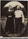
 This 1920 photograph shows Thomas Lockyer and his wife Mary Jane Hutchinson Lockyer on their farm in New Durham at Townline. Thomas was born March 13, 1854 in Devonshire, England; as an adult he worked as a tanner there before emigrating to Canada to become a farmer. He died April …
  This 1920 photograph shows Thomas Lockyer and his wife Mary Jane Hutchinson Lockyer on their farm in New Durham at Townline. Thomas was born March 13, 1854 in Devonshire, England; …County of Brant Public Library
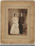
 - Ethel Lockyer and Robert Penny

 This photograph shows Ethel Lockyer (b. Oct 21 1882, d. Apr 11, 1967) and her husband Robert Penny in their wedding portrait. Robert was a farmer at the Norwich Gore. The wedding was performed in 1905 at the Lockyer home in New Durham by Rev. Ottewell. Ethel was born in …
 This photograph shows Ethel Lockyer (b. Oct 21 1882, d. Apr 11, 1967) and her husband Robert Penny in their wedding portrait. Robert was a farmer at the Norwich Gore. …County of Brant Public Library
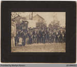
 - UNKNOWN IMAGE: Misidentified Image Donated During Burford Digitization Day


 This photo was provided by Marilyn Kovacs during the September 18th, 2010 Digitization Day held in Burford, Ontario by the County of Brant Public Library. Its donor identified this image as a unidentified group of men outside the Burford Armoury. However, due to comments this photo has been positively identified …

 This photo was provided by Marilyn Kovacs during the September 18th, 2010 Digitization Day held in Burford, Ontario by the County of Brant Public Library. Its donor identified this image …County of Brant Public Library
 - Heydenshore Park, c.1910
 Heydenshore Park was a summer resort established around 1900 east of Whitby Harbour. A number of cottages were built there starting in 1900 and were demolished in 1965 when the private park was sold to the Whitby Public Utilities Commission. In 1971 Heydenshore Park was sold to the Town of …
  Heydenshore Park was a summer resort established around 1900 east of Whitby Harbour. A number of cottages were built there starting in 1900 and were demolished in 1965 when the …Whitby Public Library
 - 401 Colborne Street West, c.1950s
 This house was built for Andrew M. Ross, a Whitby merchant, in 1879. He was Mayor of Whitby from 1900 to 1902. His daughter, Marcia Ross, lived in the house until her death in 1979.
  This house was built for Andrew M. Ross, a Whitby merchant, in 1879. He was Mayor of Whitby from 1900 to 1902. His daughter, Marcia Ross, lived in the house …Whitby Public Library
 - 401 Colborne Street West, 1979
 This house was built for Andrew M. Ross, a Whitby merchant, in 1879. He was Mayor of Whitby from 1900 to 1902. His daughter, Marcia Ross, lived in the house until her death in 1979.
  This house was built for Andrew M. Ross, a Whitby merchant, in 1879. He was Mayor of Whitby from 1900 to 1902. His daughter, Marcia Ross, lived in the house …Whitby Public Library
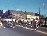
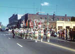
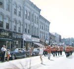
 - Confederation Centennial Parade, 1967
 Colour photograph showing a pipe band marching south on Brock Street South during the Confederation Centennial parade.
  Colour photograph showing a pipe band marching south on Brock Street South during the Confederation Centennial parade.Whitby Public Library
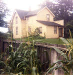
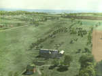
 - Residence of Earl Carr, 1958
 Hand-coloured photograph showing the residence of the Carr family located at 819 Dundas Street West. Dundas Street runs along the bottom of the photograph and Annes Street is visible along the left side. The Clarence McCullough subdivision between Henry and Annes Street is under construction in the background. This house …
  Hand-coloured photograph showing the residence of the Carr family located at 819 Dundas Street West. Dundas Street runs along the bottom of the photograph and Annes Street is visible along …Whitby Public Library
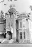
 - Residence of Samuel Trees, 1958

 The Samuel Trees residence was built for lawyer George Young Smith in 1877 and sold to Samuel Trees in 1912. The house was demolished in August 1958 to built Whitby's new municipal building.
 The Samuel Trees residence was built for lawyer George Young Smith in 1877 and sold to Samuel Trees in 1912. The house was demolished in August 1958 to built Whitby's …Whitby Public Library
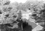
 - Visser Residence, 1958
 Black and white photograph showing the Visser residence located at 117 King Street. View looking east from the top of the Samuel Trees residence (401 Dundas Street West). The Visser residence is now a law firm.
  Black and white photograph showing the Visser residence located at 117 King Street. View looking east from the top of the Samuel Trees residence (401 Dundas Street West). The Visser …Whitby Public Library
 - Centennial Parade, 1967
 Colour photograph showing a marching band proceeding south on Brock Street South during the Centennial parade.
  Colour photograph showing a marching band proceeding south on Brock Street South during the Centennial parade.Whitby Public Library
 - Centennial Parade, 1967
 Colour photograph showing a marching band proceeding north on Brock Street South just south of Dundas during the Centennial parade.
  Colour photograph showing a marching band proceeding north on Brock Street South just south of Dundas during the Centennial parade.Whitby Public Library
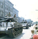
 - Centennial Parade, 1967
 Colour photograph showing tanks rolling up Brock Street South during the Centennial parade. The tanks are proceeding north.
  Colour photograph showing tanks rolling up Brock Street South during the Centennial parade. The tanks are proceeding north.Whitby Public Library

